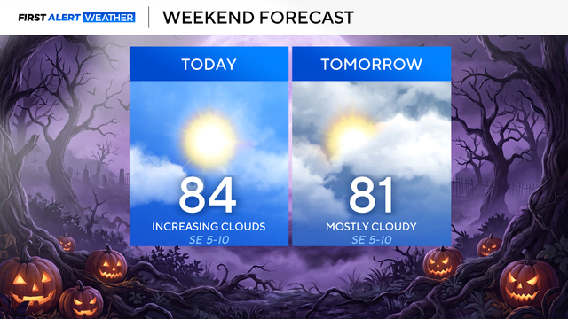
Mostly sunny skies as temperatures hit mid-90s across North Texas
Most of North Texas will stay dry, but a few spotty showers will be possible along the Red River Valley Saturday afternoon.
Watch CBS News
Most of North Texas will stay dry, but a few spotty showers will be possible along the Red River Valley Saturday afternoon.

Temperatures will be a bit warmer Friday afternoon, topping out near 94 degrees.

Another pleasant summer day is ahead in North Texas with a few spotty showers possible in the afternoon hours.
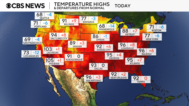
A brutal heat wave across the eastern United States trapped millions of people in sweltering air this week with record-high temperatures.

A lucky few will get some rain and a brief drop in temperatures with the additional cloud cover, keeping afternoon highs a little cooler.

An isolated shower is possible each day during peak heating in the afternoon, especially for the southeast areas.

Summertime heat is here.

Feel-like temperatures will hover in the low 100s all week.

The actual temperature is seasonably hot.

Temperatures this afternoon will top out near 96 degrees, with feels like temperatures around 102-105, making it a great day to spend at the pool.

Temperatures are sticking in the mid to upper 90s for a stretch, but feels-like temperatures are even hotter, thanks to high humidity.

After undergoing rapid intensification, Erick made landfall on Mexico's Pacific coast on Thursday as a Category 3 hurricane.

A cold front will move into North Texas Wednesday night, bringing the risk of severe weather and brief downpours.
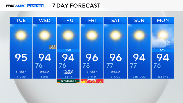
Highs in the mid-90s, lows in the upper 70s, and sunshine will be expected over the next several days.

Low rain chances return overnight Wednesday into Thursday.
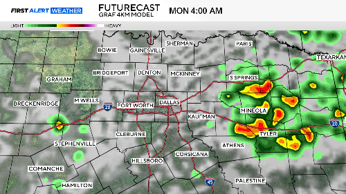
For DFW, the chance for storms will likely be around lunchtime, which will unfortunately impact any grilling plans and outdoor activities.

The North Texas region will have storm chances on Saturday and Sunday.

Friday will be a great pool day with "feels-like" temperatures near 100 degrees.

After a morning of storms across North Texas, skies are clearing up and rain chances remain isolated.

Flash flooding is possible with these storms.

The First Alert Weather Team has been tracking a complex of storms to the west on Tuesday morning as they move into the area.

Some residents woke to damage from Sunday night's storms that had winds up to 80 mph.

Environmental factors are extremely favorable for storm development.

The afternoon heat index on Sunday will reach the as high as 106.

Some rain might pop up along the I-35 corridor as storms head east through the morning.