Mild and dry conditions expected to continue into the weekend
Expect widespread frost this morning thanks to clear skies and light winds in place.
Watch CBS News
Expect widespread frost this morning thanks to clear skies and light winds in place.
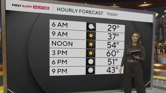
Get the latest weather forecast from KDKA-TV First Alert Meteorologist Mary Ours!
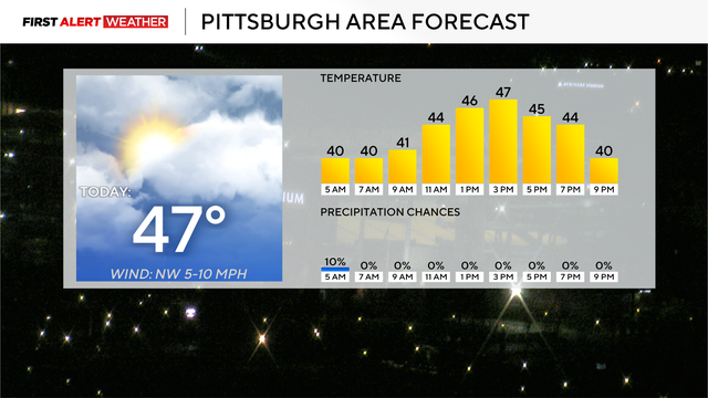
The next rain chance for the area will come on Sunday.
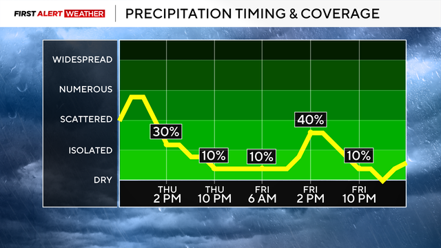
The most widespread rain is expected from the morning through 2 p.m. Thursday.
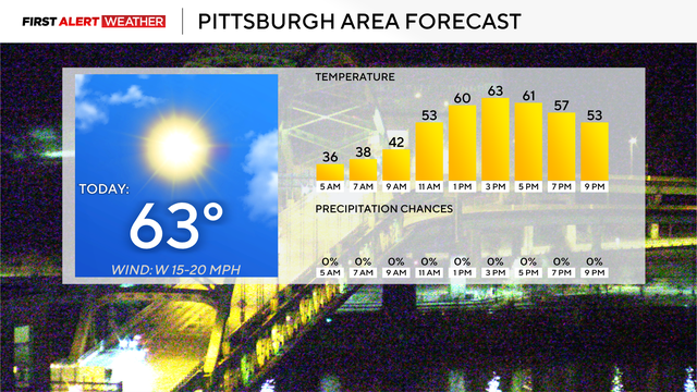
Measurable snow is expected for the highest elevations of the area late Friday into Saturday morning.
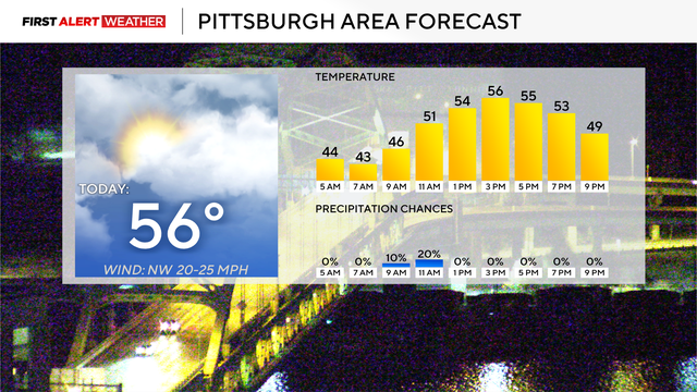
Parts of the area could see a wintry mix this weekend.
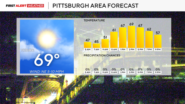
Yesterday was the tenth day in a row with no measurable precipitation.
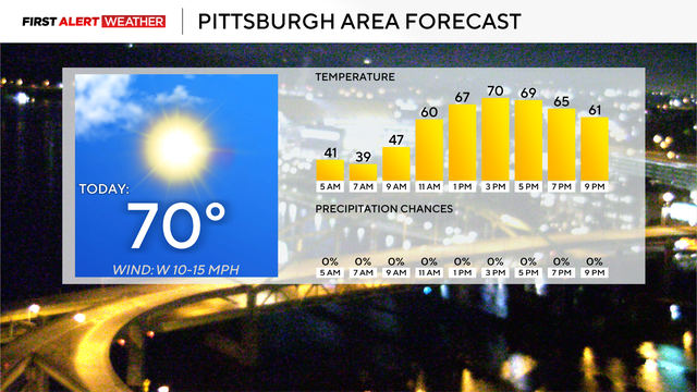
The weather forecast for Halloween isn't looking very scary.
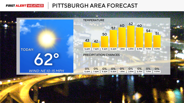
Skies will be sunny for today, making it five in a row.
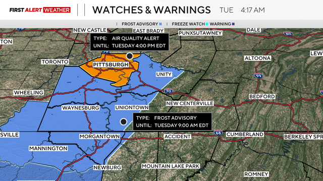
The Mon Valley in southern Allegheny County is usually the area most impacted by poor air quality.
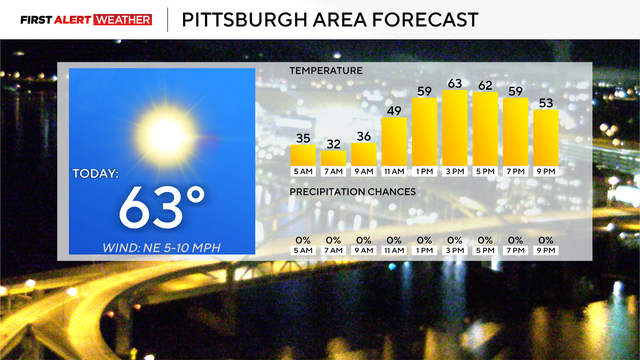
We will likely be completely dry through at least next Sunday.
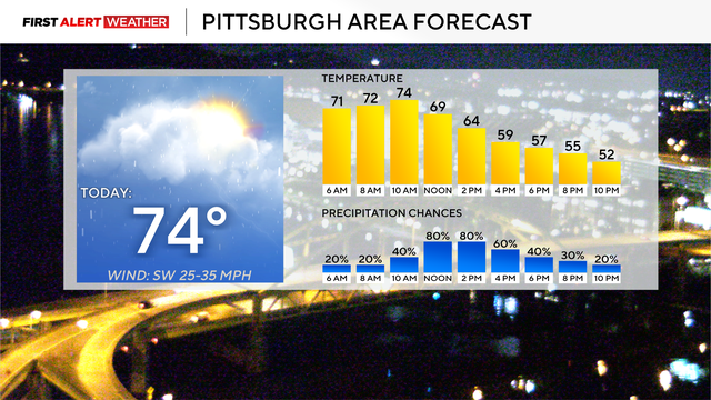
Temperatures will drop throughout the region this weekend.
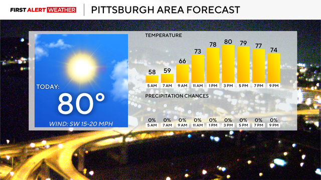
Today could be the final time this year that we hit 80 degrees.
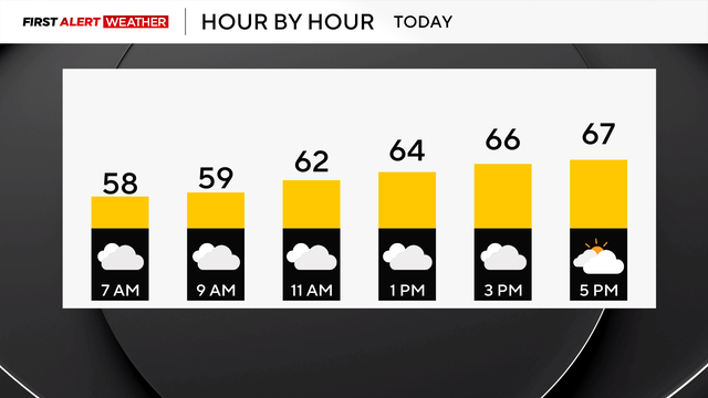
It's going to be a seasonable day with cloudy skies and drizzle.
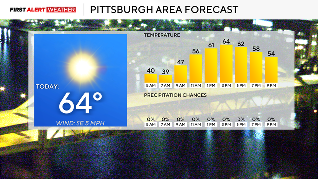
Temperatures will likely be just a degree or two cooler than yesterday.
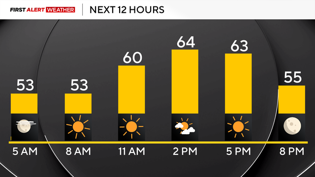
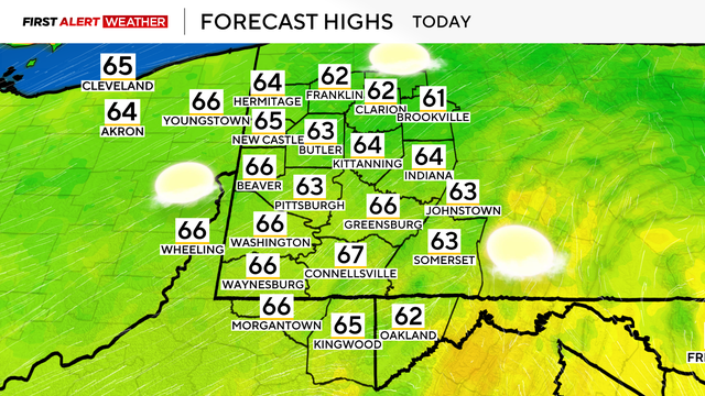
High temperatures today will be in the mid-to-upper 60s.
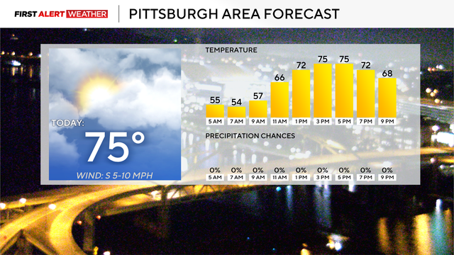
High temperatures will be in the mid-70s.
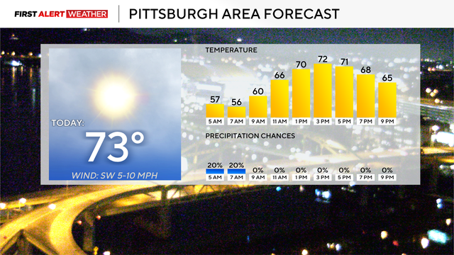
High temperatures for the region will be in the low 70s today.
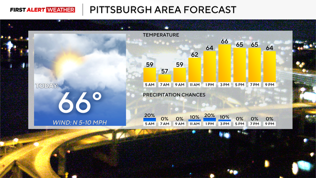
The cloudy conditions for the region are happening because of the storm hitting the East Coast.
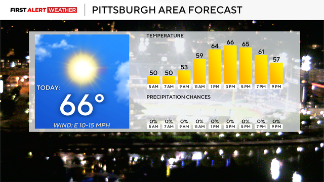
The afternoon is expected to be sunny and pleasant today.
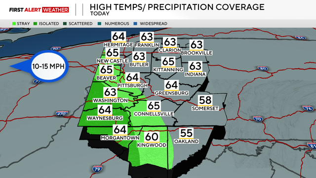
High temperatures today will be in the low 60s.
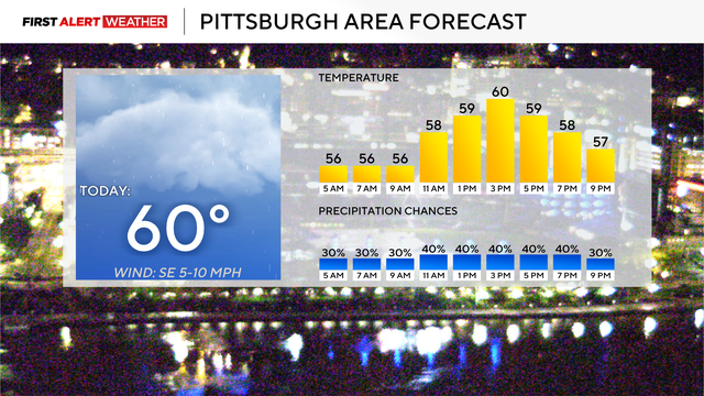
Highs today will be near 60 degrees with no big warm-up.
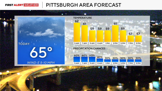
Today is a First Alert Weather Day due to morning flood risk.
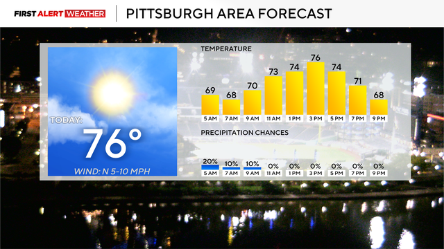
Our rainy weather pattern is set to return either late Saturday or early Sunday
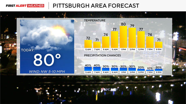
The start of fall is less than a week away, and the weather is going to increasingly feel very fall-like.