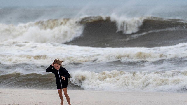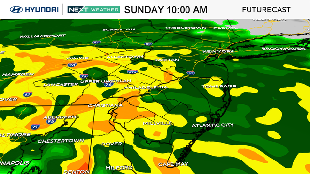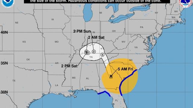
Maps show Helene's path as it batters Florida and Southeast
Maps show the areas impacted by storm surge, rainfall levels and more as Helene, once a major hurricane and now a tropical storm, moves inland from Florida's Gulf Coast over Georgia.
Watch CBS News
Maps show the areas impacted by storm surge, rainfall levels and more as Helene, once a major hurricane and now a tropical storm, moves inland from Florida's Gulf Coast over Georgia.
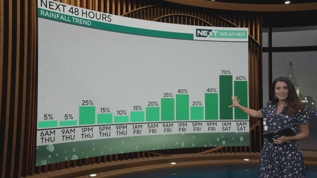
Expect some minor rain in the Philadelphia area, with more possible Friday into Saturday morning as Helene breaks up inland.
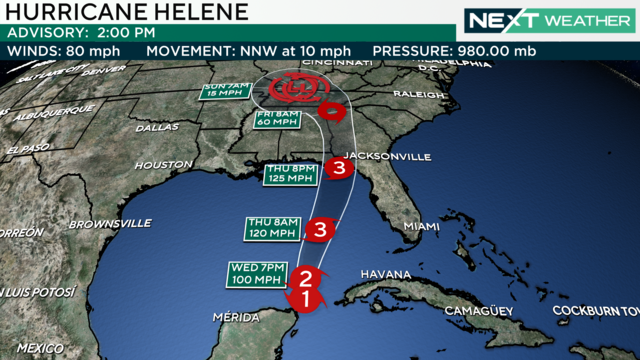
The Philadelphia region will get some much-needed rain on Wednesday and potentially even more this weekend as Helene breaks up inland.
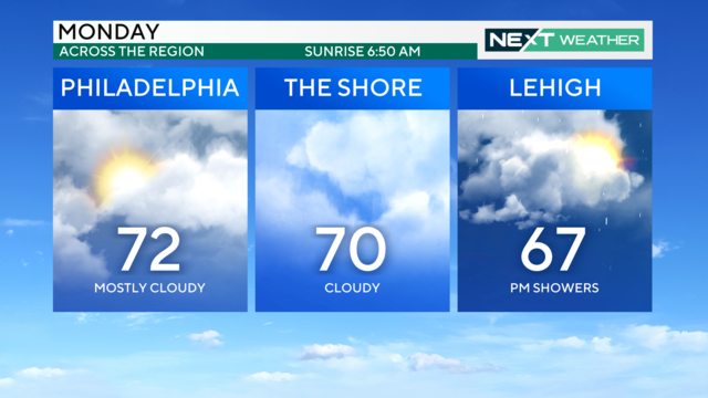
Mother Nature will make it look and feel like autumn, with highs in low the 70s over the next few days, and morning temperatures in the 50s and 60.
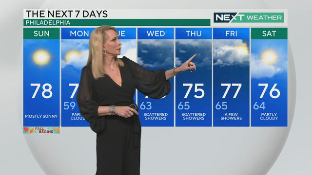
The first day of fall in Philadelphia will start out cloudy but turn sunnier as we head into the afternoon. Much-needed rain is also in the forecast for this week.
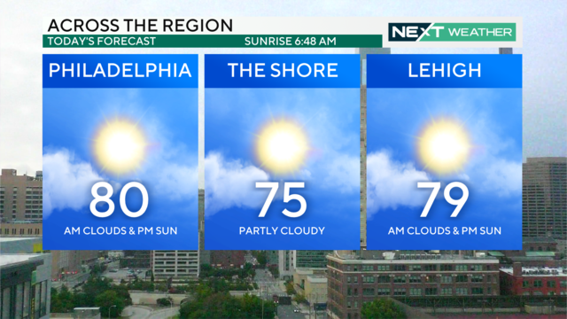
It'll be a very nice last day of summer across the area on Saturday with high temperatures in the low 80s followed by scattered showers and cloud coverage this evening.
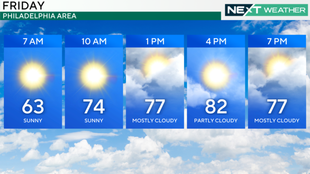
The Philadelphia region can expect mostly dry weather this weekend with some chances for light rain.
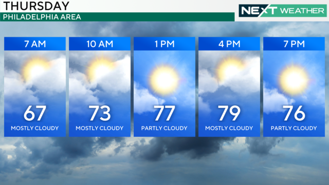
The region will see on-and-off cloud cover Thursday morning before the sun breaks through in the afternoon. Showers look to stay away Friday and into the weekend.
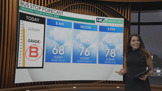
After a sunny stretch we're entering an overcast week in the Delaware Valley, with showers and even a few rumbles of thunder returning to the forecast.
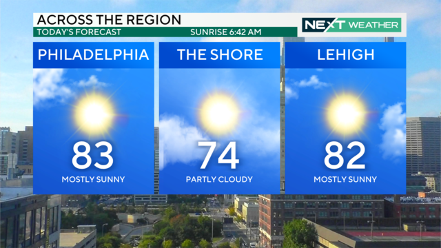
Once some patchy morning fog clears out, the Delaware Valley will have mostly sunny skies with high temperatures in the low 80s.
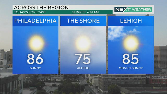
Philadelphia's weekend is headlined by warm and sunny days with comfortable nights. There was dense fog across South Jersey and Delaware this morning but the skies are cleared and temperatures are rising.
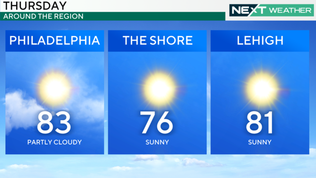
After periods of locally dense and patchy fog across much of Delaware, South Jersey and parts of Bucks and Delaware counties, sunny and dry weather returns to region.
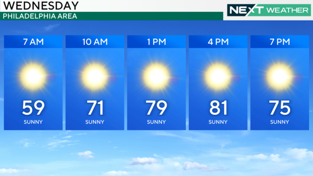
Wednesday starts out nice and cool but warms up to the upper 70s and low 80s, a dry, comfortable trend weather trend that continues the rest of the week in Philadelphia.
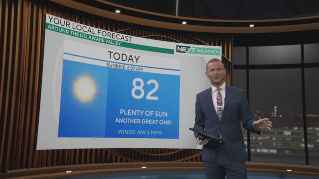
After another relatively chilly start, Tuesday will feature plenty of sunshine as temperatures make their way back into the low 80s in Philadelphia.
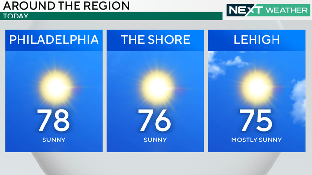
After a chilly weekend across the region, the sunshine will remain in full effect today as temperatures climb back into the upper 70s.
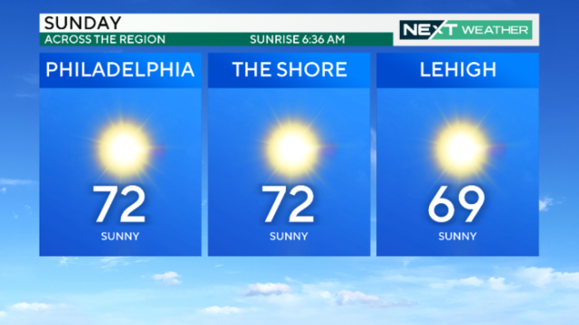
Temperatures over the next few days and nights may be the chilliest since last May, and highs Sunday only reach reach the low 70s in Philadelphia.
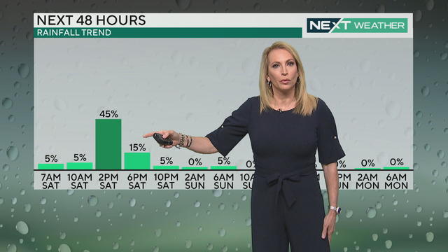
Grab your umbrella before heading out in the Philadelphia area on Saturday; there's rain in the forecast.
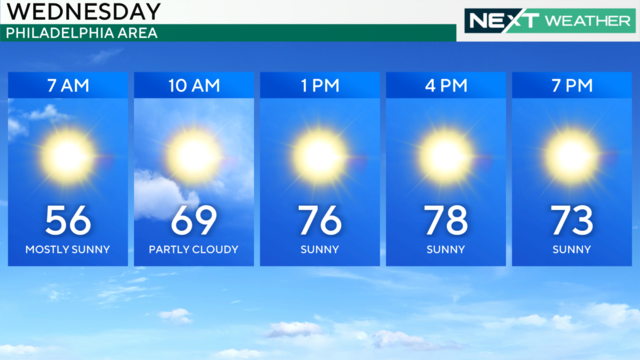
Wednesday will feature another cool and crisp morning with a sunny and mild afternoon in the Philadelphia region.
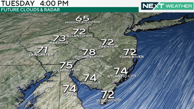
Sunshine will warm up the Philadelphia region to high temperatures in the 70s after a cool morning.
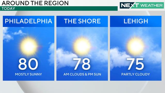
On Labor Day, the Philadelphia region should expect mostly sunny skies and comfortable conditions.
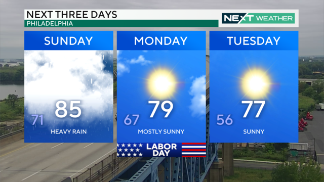
Sunday will be mostly cloudy, muggy and warm, with a few showers and rumbles of thunder. Labor Day is shaping up to be clear and sunny with highs in the 70s.
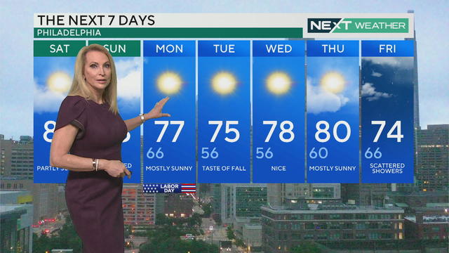
There are two pleasant weather days and one stinker on Labor Day Weekend around Pennsylvania, New Jersey and Delaware.
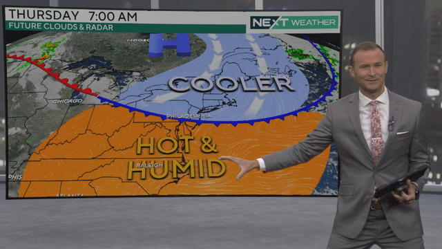
We could see showers on Friday, Saturday and Sunday in the weather forecast around Philadelphia, but Labor Day looks clear.

Rising temperatures are having impacts on the classroom. Our NEXT Weather Meteorologist Grant Gilmore explains how climate change is affecting learning.
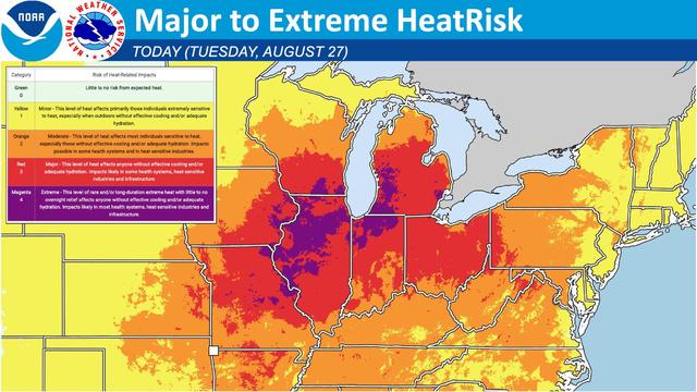
More than 60 million people were under heat alerts Tuesday as a scorching heat wave blanketed the Midwest.