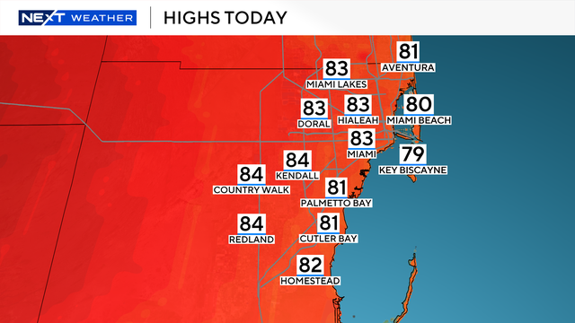
South Florida kicks off May with dry, breezy conditions
Expect warmer and wetter weather over the weekend and into the beginning of next week.
Watch CBS News
Expect warmer and wetter weather over the weekend and into the beginning of next week.

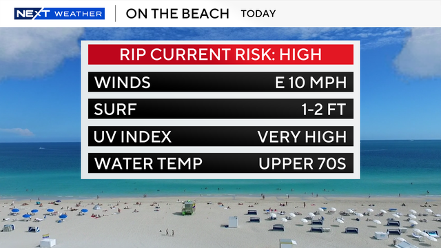
There's a high risk of rip currents at South Florida's beaches.

Keep the umbrella close on Tuesday.

Monday afternoon highs will be in the mid-80s under mostly sunny skies.
There's a 30% chance of rain this week.
There are no marine alerts for boaters in the Atlantic Waters and Florida Keys.

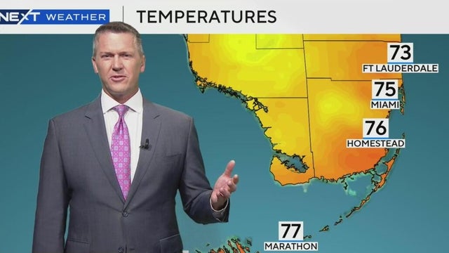
CBS News Miami's NEXT meteorologist Shane Hinton weather outlook for South Florida.
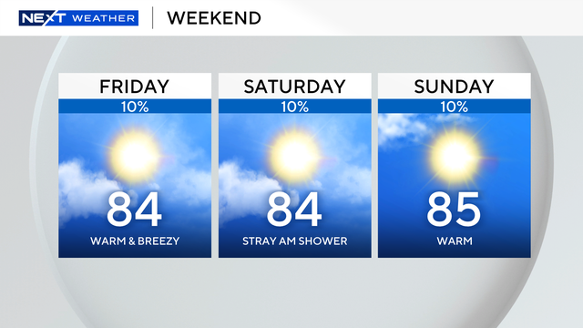
A few brief isolated showers are possible.

The high risk of rip currents at South Florida's beaches continues through Friday evening.

Highs will climb to the low to mid-80s Wednesday afternoon. South Florida will stay dry with plenty of sunshine.

There is a high risk of rip currents along the Atlantic beaches due through Friday due to the easterly wind.

There is a dangerous high risk of rip currents along the Atlantic beaches until 8 p.m. Monday.
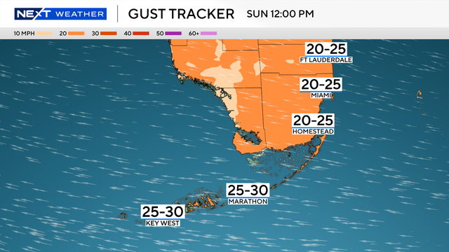
Easter Sunday will see a gusty breeze throughout much of the day. The wind will be coming right off the ocean and pushing through the metro areas and the Keys with gusts near 30 mph.

Breezy conditions linger not only throughout the day, but into the beginning of the upcoming work week

The breeze will build throughout the day out of the east at 10 to 15 miles per hour with gusts up to 25 miles per hour.

The breeze will build out of the east, gusts could reach 15 to 20 miles per hour.

Wednesday's high temperature will reach 86 degrees with mostly sunny skies.

Tuesday morning across South Florida began slightly cooler, with temperatures in the mid-to-upper 60s.

South Florida will warm up the next few days ahead of the next cold front moving in midweek.

Next Weather Meteorologist Shane Hinton has the latest weekend forecast.

Sunday morning is expected to bring "sweater weather" to the region.

Highs will climb to the low 80s in the afternoon under mostly sunny skies.

Spotty showers will be possible Thursday as the breeze increases out of the northeast.

Two low-end weather threats, damaging winds and flash flooding, are forecast to develop as a cold front moves across the region.

Gusty downpours will be possible on Tuesday.