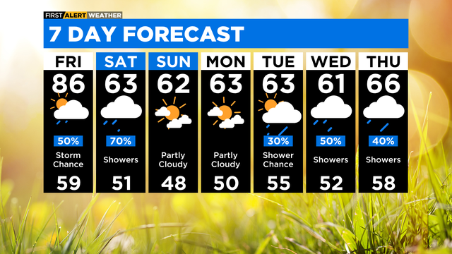
Chicago First Alert Weather: Thunderstorms Friday afternoon and evening
Storm chances are on the way.
Watch CBS News
Storm chances are on the way.
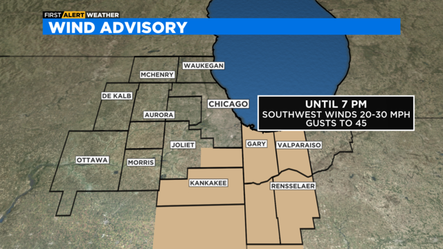
Windy & warm this evening with a very small chance of an isolated storm well south of I-80.
Other than an isolated chance for a shower, we'll be just warm and breezy overnight.
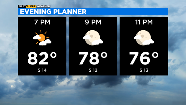
Windy & warm this evening with a very small chance of an isolated storm well south of I-80.
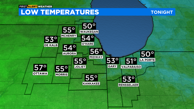
Partly cloudy skies tonight, but low clouds and fog will be likely along lakeside locations through Thursday morning.
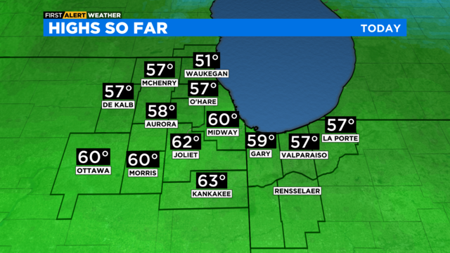
Light rain through the day with highs in the 50s in most places.
Overcast tonight with areas of light rain and sprinkles.
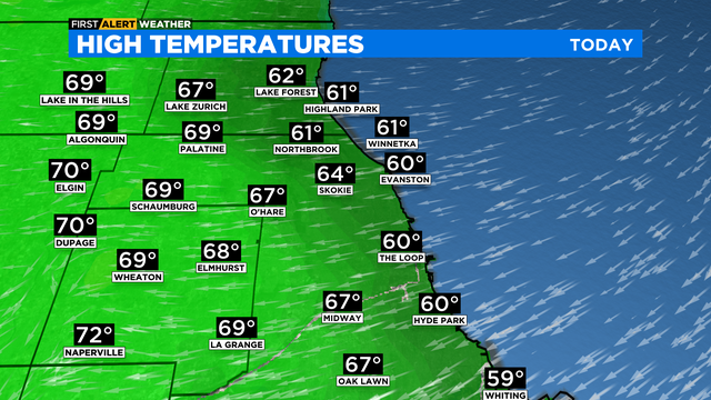
Temperatures will be cooler, in the 60s.
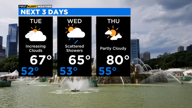
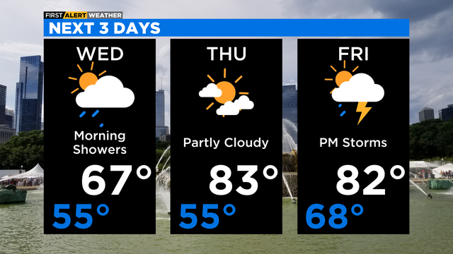
There are rain chances Tuesday through Saturday, with a chance for strong storms on Friday.
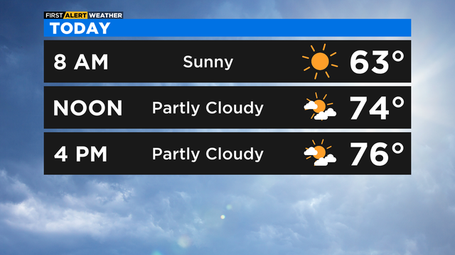
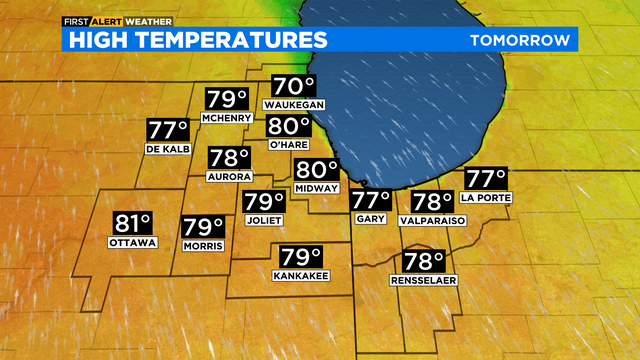
A few nice Spring days are ahead.
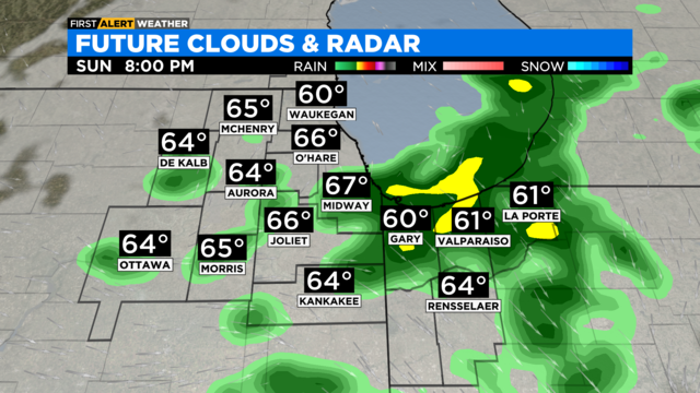
Scattered showers continue through the late evening hours, then a clearing sky is expected overnight. Lows will be in the mid-50s.
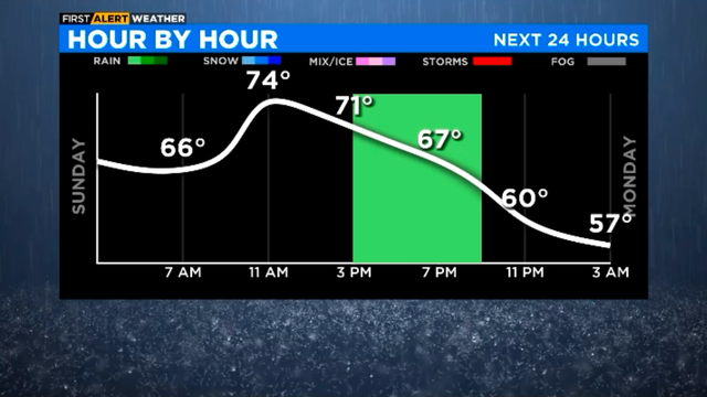
A cooler day with rain on the way.
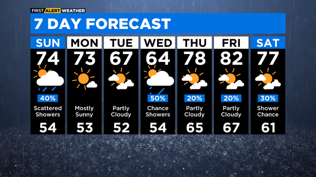
Sunday starts off dry aside from a random shower.
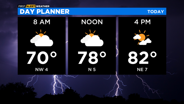
A pair of cold fronts help bring unsettled weather to the Chicago area and, eventually, cooler temperatures.
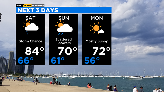
An isolated strong storm cannot be ruled out Saturday afternoon, but the chances remain small at this time.
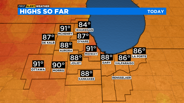
Temperatures are still climbing this afternoon, nearing the record high for May 13, which is 89 degrees.
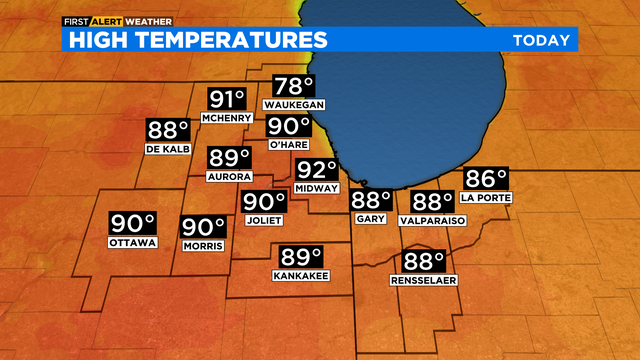
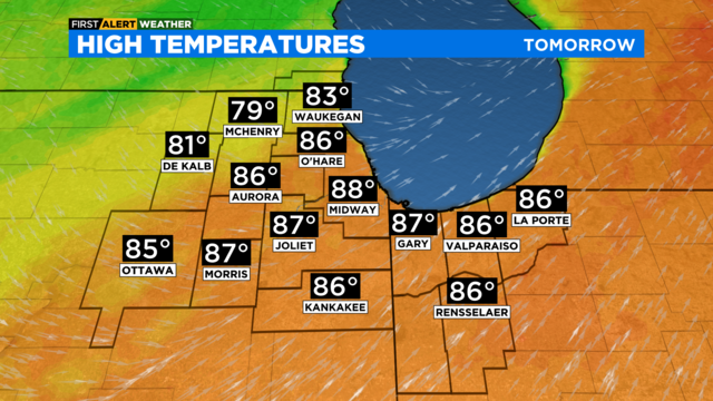
Another hot day is ahead.
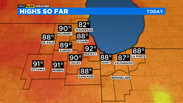
No significant lakefront cooling today.
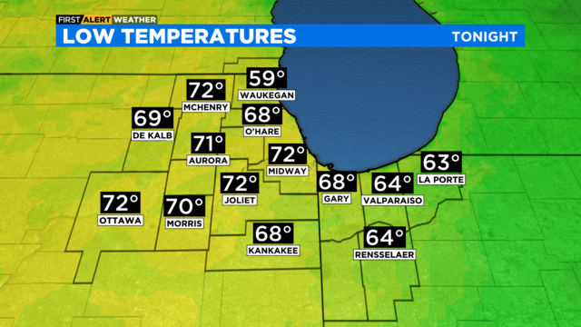
High temperatures today reached the low 90s for the first time this year in several locations.
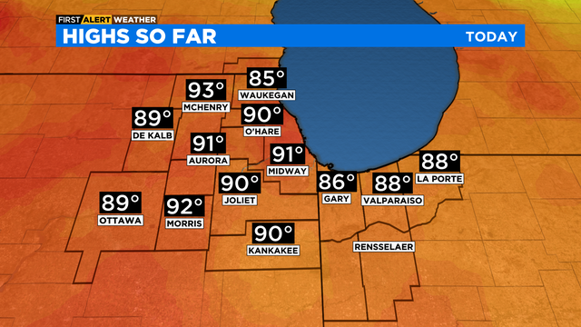
The temperature breaks the previous May 11 record high of 89 degrees set in 1982, when Jane Byrne was mayor.
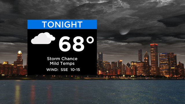
If storms do take shape, they have the potential to bring damaging winds and hail overnight.
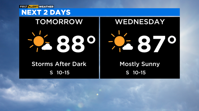
On Monday night, the low is 65 with partly cloudy and mild conditions.
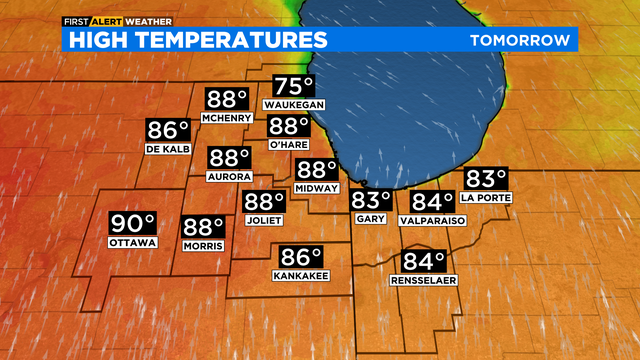
Heat index values will be in the low 90s. Scattered showers and storms are in the forecast for Tuesday evening. An isolated strong storm is possible.
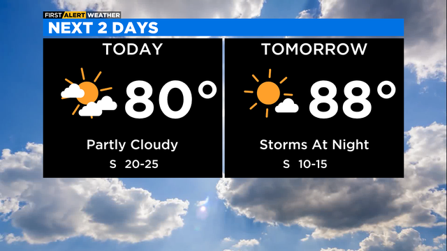
The summerlike warmth starts today!
It's almost here -- the best weather of the year!