Chicago First Alert Weather: Sunny and dry weekend, possible storm on Saturday night
According to CBS 2 meteorologist Mary Kay Kleist, high pressure keeps things dry Saturday. On Sunday, the high drifts away and the next system moves into our area.
Watch CBS News
According to CBS 2 meteorologist Mary Kay Kleist, high pressure keeps things dry Saturday. On Sunday, the high drifts away and the next system moves into our area.

A warmer day in the middle 80s.

Dense Fog advisory in effect this morning until 9 a.m.

There is also a slight chance for storms on Sunday and Monday.

Another day of sunshine and pleasant temperatures.

Heat and humidity build into the weekend.

Nothing impressive as far as organized storm chances for the next week.

Sprinkles will come to an end, but patchy fog may linger Tuesday morning.

A few areas of northern Cook, Lake (IL) and McHenry counties may deal with additional heavy rain Sunday afternoon and evening.

Rain begins early and lasts through the day.

On Sunday night, look for increasing clouds and a low of 62.

First half of the weekend looks great.

Mostly sunny skies for much of Saturday, then partly cloudy by late in the day. Highs in the low to mid 80s.

According to CBS 2 meteorologist Mary Kay Kleist, the next system brings rain on Sunday.

Rain chances will remain low for much of Saturday, but shower chances increase Saturday night.
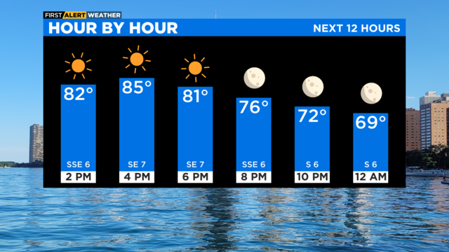
We can expect it to be clear and quiet tonight.

Portions of Indiana are under a Dense Fog Advisory Thursday.

Pockets of fog will be possible, but mainly for areas south of I-80.
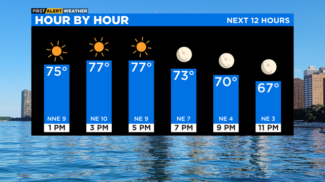
According to CBS 2 meteorologist Mary Kay Kleist, some patchy fog may drop visibility well inland overnight.

Increasing sunshine is expected throughout the day.

Lows will be in the upper 50s and low 60s.

A warmup is on the way.

Lows Monday night will range from upper 50s in the western suburbs, to upper 60s in Chicago.
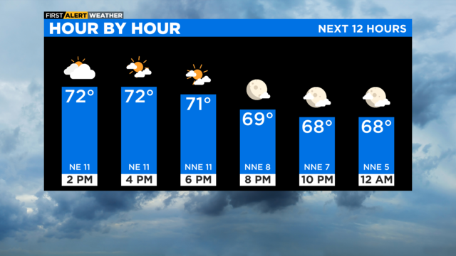
There's enough instability around for a few spotty sprinkles.

Labor Day starts off gloomy, but the clouds clear out by afternoon.