Above average temperatures for North Texas most of the week before scattered rain chances
Well above average temperatures most of the week, with scattered rain chances midweek, and better rain chances into the start of the weekend.
Watch CBS News
Well above average temperatures most of the week, with scattered rain chances midweek, and better rain chances into the start of the weekend.
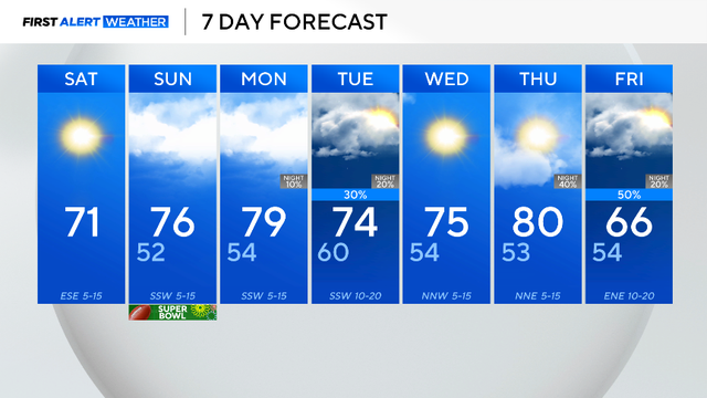
The high will top out in the 70s with winds coming from the southeast around 5 mph.

After today there are no more mornings in the 30s for at least another seven to ten days.
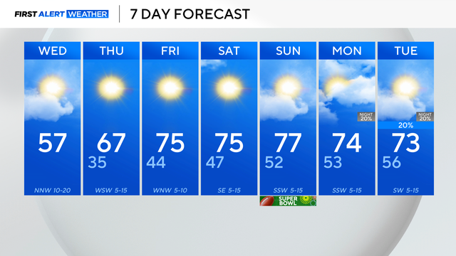
There is a small chance for a few sprinkles across portions of North Texas, as a weak disturbance pushes south, but most will just see clouds.
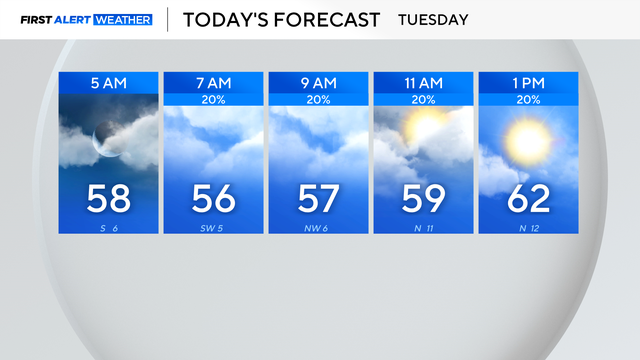
A cold front moving into the region will bring clouds and a chance for a few showers along and east of I-35 on Tuesday morning and into the afternoon.
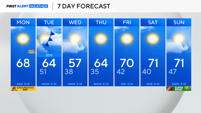
Following a cold weekend in North Texas, we kicked off the workweek on a warmer note, with highs near 70 for much of the metroplex.
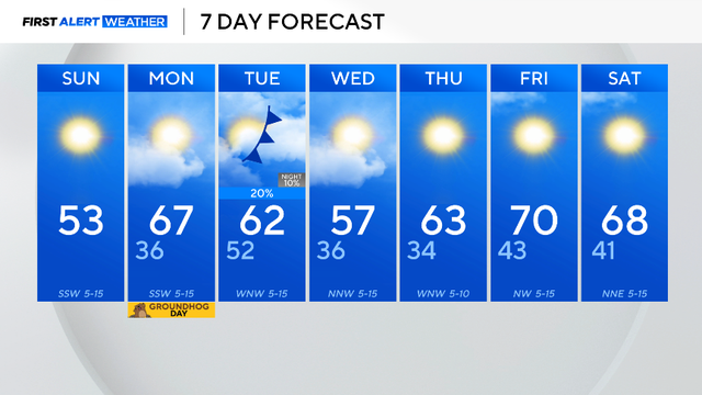
The last month was interesting. January was considered average climatology-wise, but the month was riddled with temperature extremes.

Each Groundhog Day, Punxsutawney Phil makes his prediction about a late end to winter weather or early start to spring temperatures. Here's how accurate his forecasts have been over the years.
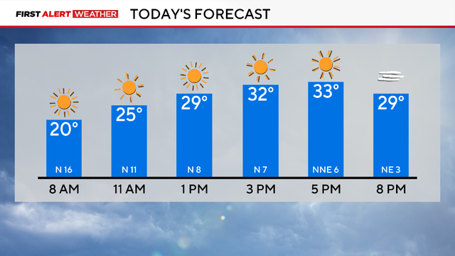
Bundle up! It will be cold all day long.
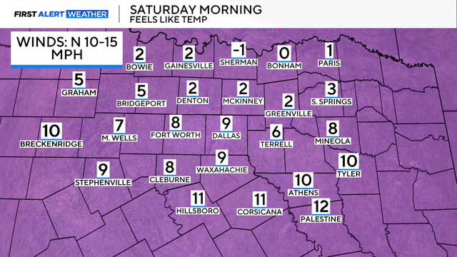
Feels-like temperatures on Saturday morning will be as cold as 0.
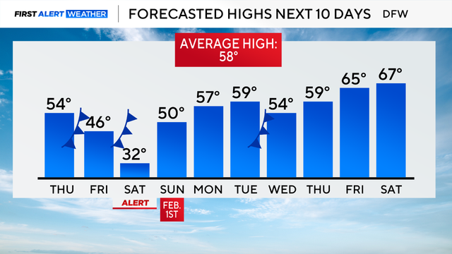
A First Alert Weather Day is in effect for Saturday due to extreme cold, with wind chills ranging from -5 to 15.
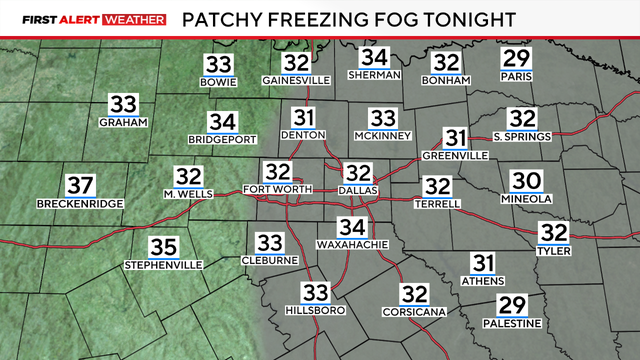
A First Alert Weather Day is in place due to the freezing fog advisory, which is in effect through 11 a.m. Wednesday, visibility will be under three miles.
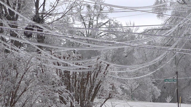
Deaths and power outages were reported across numerous states due to a monster storm across much of the country.

A First Alert Weather Day is in effect for Wednesday morning due to the chance for freezing fog.
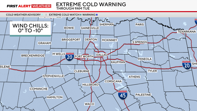
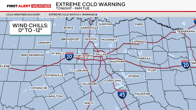
An extreme cold warning is in effect through Tuesday morning due to wind chills from 0 to -10 degrees covering the region.
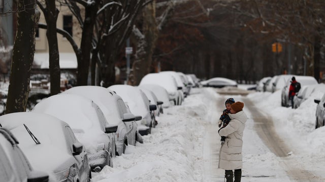
The winter storm bringing harsh weather to much of the U.S. dumped snowfall totals higher than 20 inches in some states. How much snow did we get?
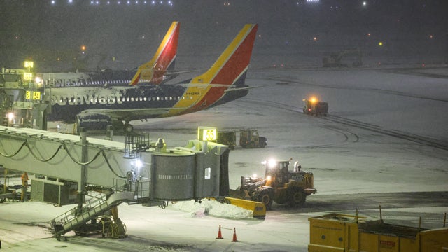
Flight cancellations are continuing to mount as the U.S. is being hit with dangerous winter weather from a storm moving across the country.
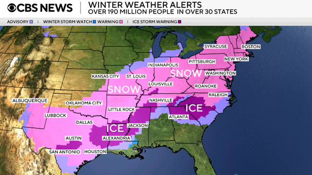
As millions of Americans hunker down for the winter storm, at least 23 states and Washington, D.C., have declared states of emergency.
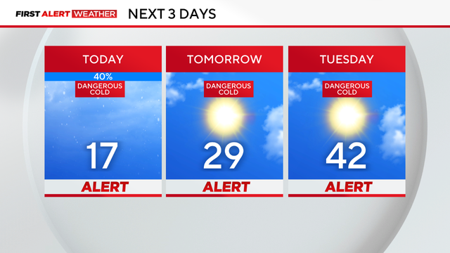
Weather Alerts are in place through Tuesday due to dangerously cold temperatures and icy roads at times.
Saturday began with rain, sleet and snow in parts of North Texas, with temperatures falling into the low 30s by 3 a.m.
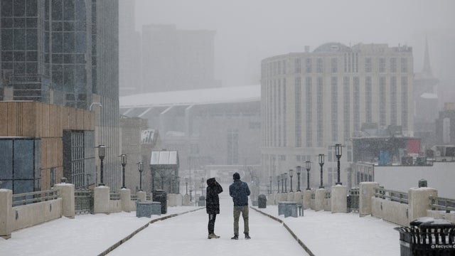
More than 230 million people are under winter storm threats as officials brace for power outages and travel difficulties.

Ahead of a major weekend winter storm, many airlines are dropping change fees so travelers can rebook their flights.
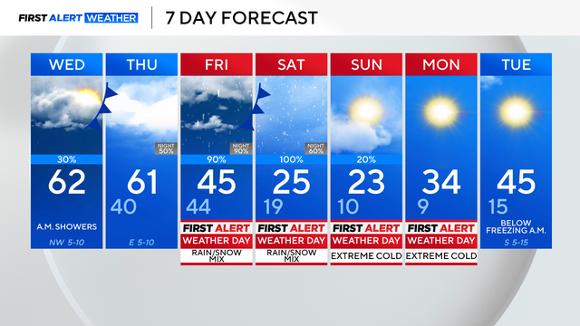
After Wednesday, all eyes are on our winter system.
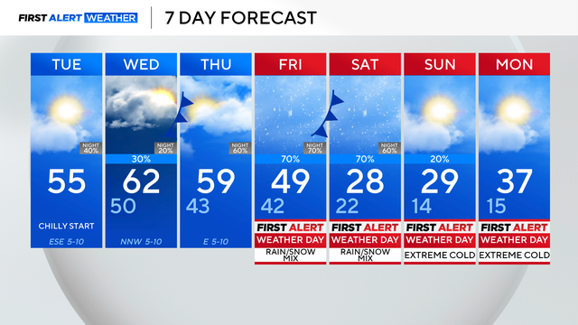
Even though it's still too early to discuss rain, sleet and ice totals, here's a current outlook of the next system.
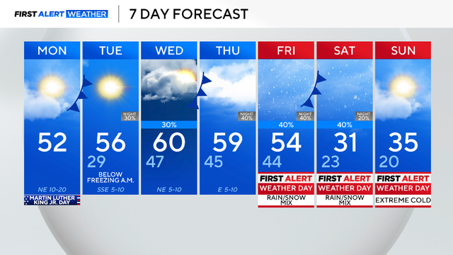
An arctic air mass is set to bring dangerously cold air and wintry precipitation to North Texas this weekend. We have issued First Alert Weather Days for Friday through Sunday for all of this.