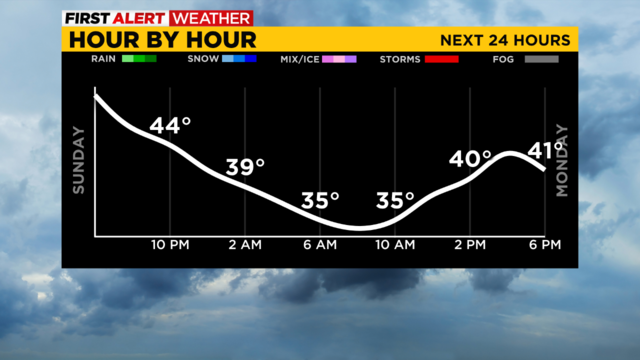
Pittsburgh Weather: Weekend closes out with few isolated showers
Skies are growing cloudier as a little bit of wet weather lingers around.
Watch CBS News
Skies are growing cloudier as a little bit of wet weather lingers around.
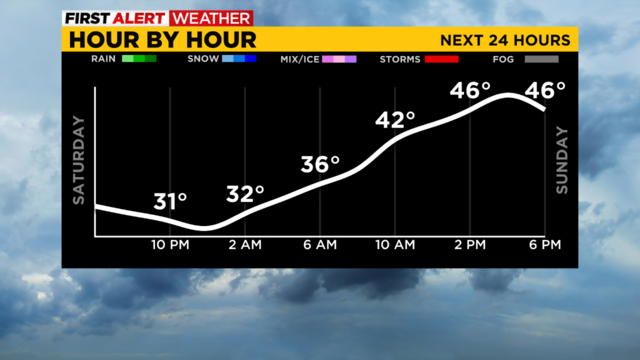
After starting Saturday with single-digit lows and sub-zero wind chills, temperatures have warmed into the 30s, and we're not stopping there!
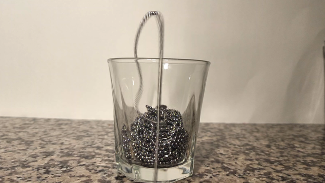
In physics, sometimes, the reaction you get is not the reaction you expected. Meteorologist Ray Petelin explains with a cool experiment.
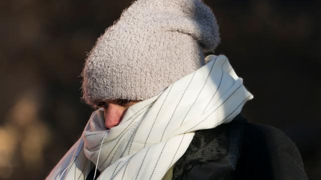
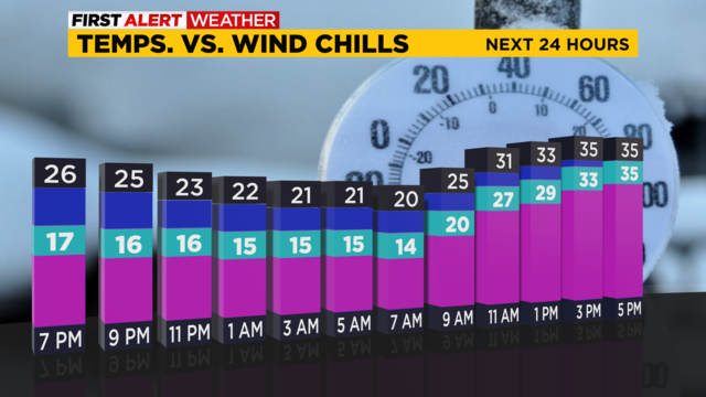
We're in for some bitter cold today so here's how you can stay warm.
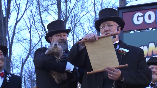
For the 108th time, Phil saw his shadow.
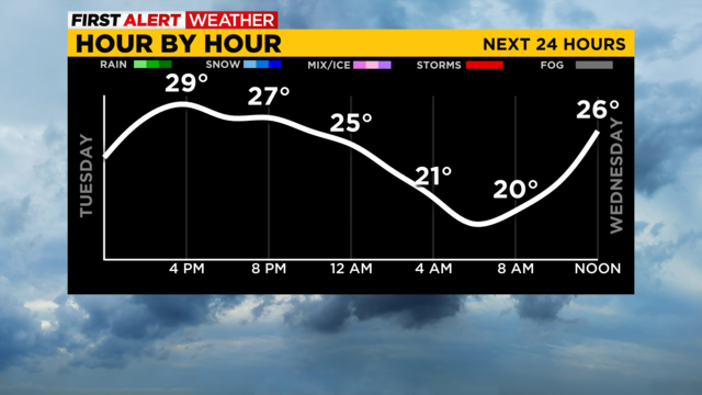
Snow showers are slowly tapering off to the south.
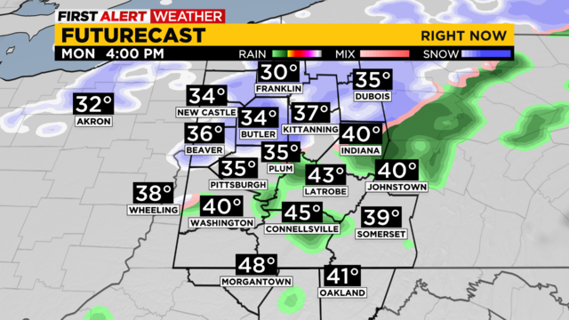
Light pockets of drizzle are expected to stick around through the morning hours today.
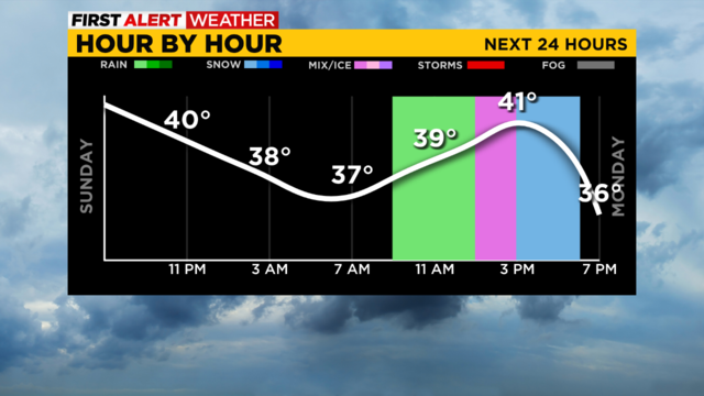
Drizzle will stick around overnight with highs Monday hitting the lower 40s and a touch of rain showers mixing with snow showers (to the north) at times.
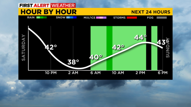
Temperatures will be a little warmer through the weekend but another chill is on the way.

Ray Petelin is here to tell you all about "cross-quarter days" and Groundhog Day!
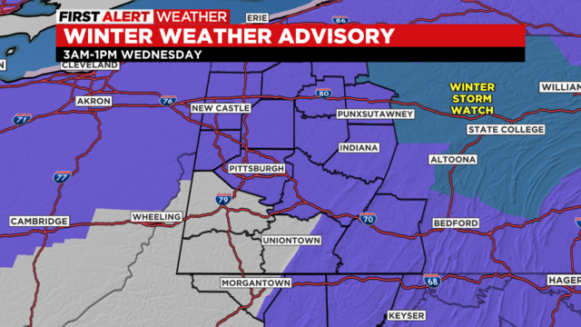
It's going to be a sleep-in-and-you'll-miss-it event with three-to-five inches of snow in some parts of our area.
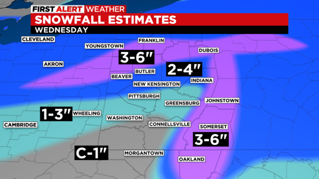
A winter storm system is set to impact the region by daybreak Wednesday.
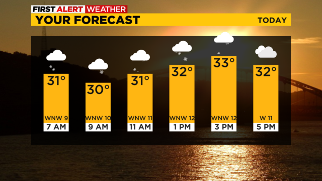
The best chance for snow is happening this morning and will last through Noon today.
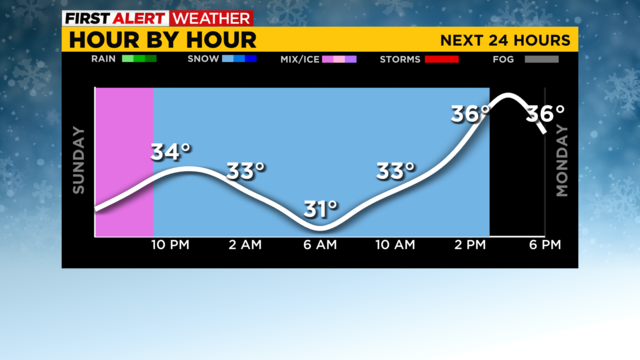
The change from rain to snow will occur tonight.
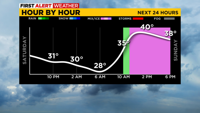
A chilly weekend will bring us grey skies but seasonable temperatures. A rain/snow mix is on the way for Sunday.

Potholes make your commute this time of year a brought one, but what causes them?
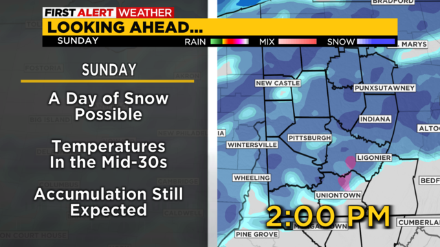
Snow is possible all weekend long and that could start today.
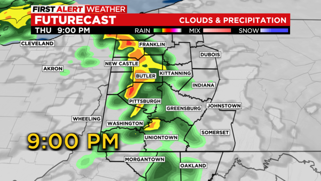
The chance for some severe weather will be around Thursday evening.
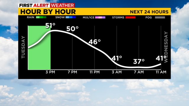
Our Tuesday will be mainly dreary and grey but not that chilly!
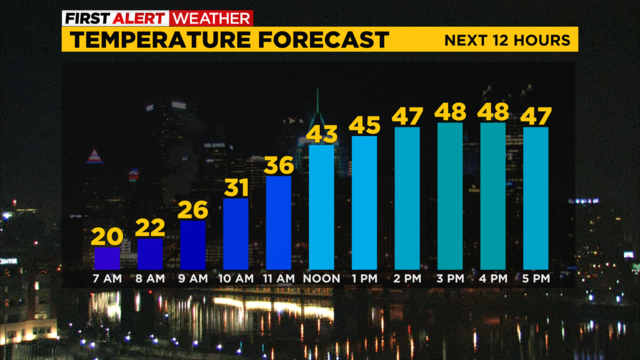
It's going to be warmer today with highs in the upper 40s expected.
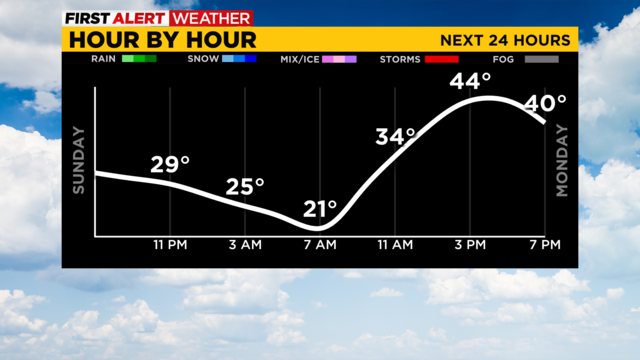
After a sunny Sunday, clouds will come to shield the sun on Monday before rain returns Monday night.
More rain is on the way.
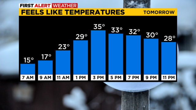
The day begins with snow and clouds but they decrease throughout the day.
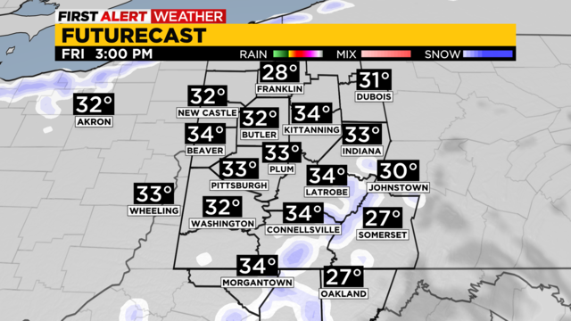
Early snow showers turn into colder temperatures this weekend.
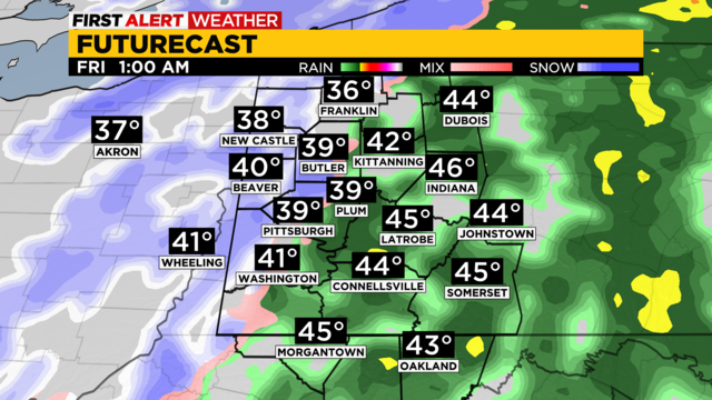
If you're heading out this afternoon, make sure you have an umbrella with you!