Birds migrating south for winter light up the Pittsburgh radar
More than 19,000 birds are predicted to migrate per 1/2 mile of land.
Watch CBS News
More than 19,000 birds are predicted to migrate per 1/2 mile of land.
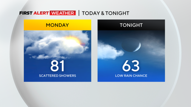
High temperatures will be in the low 80's with mostly cloudy skies.
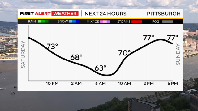
The weekend has started off on a pleasant, sunny note this afternoon and clear skies are the rule overnight with lows in the lower 60s.

Get the latest weather updates with First Alert Meteorologist Ray Petelin's forecast!

Although we had a lot of rain yesterday, we're not done yet.
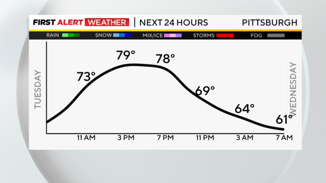
While we are on the edge, the powerful ridge of high pressure anchored in the center of the United States continues to be our main weather player here in Western Pennsylvania.
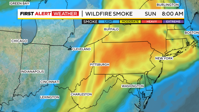
Wildfire smoke is back and will leave the sky looking hazy this Sunday morning and afternoon.
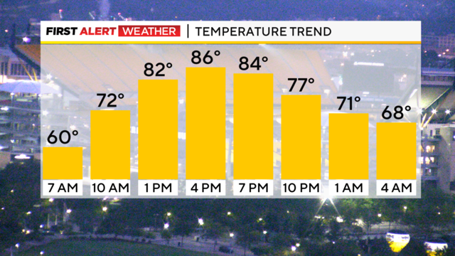
After a cool, clear, crisp morning, the summer heat returns for the last weekend before school starts!

Places along and south of I-70 have by far the highest chance for severe weather.

Get the latest weather updates from KDKA First Alert Meteorologist Ron Smiley!

After a quiet Sunday, we turn our attention to the potential for more strong to severe storms later Monday. Because of that, Monday is a First Alert Weather Day.

Severe storms with hail and wind and even a tornado are possible today.

Get the latest weather updates with First Alert Meteorologist Kristin Emery's forecast!

Much of the region is under a 'slight risk' (2 out of 5) meaning isolated strong to severe storms are possible with frequent lightning, hail and damaging winds.

Heavy rains, lightning, hail, and damaging winds are all possible.

Get the latest weather updates with First Alert Meteorologist Kristin Emery's forecast!

Severe storms are possible on Sunday and Monday, and a First Alert Weather Day has already been issued for Monday, with the possibility of Sunday being added.

Pleasant weather will remain in place for the first day of August, with highs today near 80 degrees.

Highs today will hit the upper 70s with morning temps dipping down to the 50s in most communities.

Rain chances dwindle late tonight, and lows will hover near 60, with some patchy fog possible again in valleys and low-lying areas.

Our intense heat and humidity have broken!

Temperatures are set to soar, with morning lows in the 60s.

What has all the makings of being one of the hottest stretches of weather for the year could be 'cooled' by rain chances.

This is a sneaky busy weather week with a couple of things to talk about.

July will end on a hot, humid note as temperatures this week begin to creep back into the mid to upper 80s and will end near or at 90 by late week.