Sunny, slightly cooler in Philadelphia Monday, another chance to see northern lights
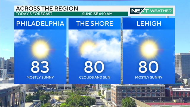
Today will be an extension of our beautiful weekend with mostly sunny skies and comfortable temperatures in the low 80s in the Philadelphia region.
Watch CBS News
Today will be an extension of our beautiful weekend with mostly sunny skies and comfortable temperatures in the low 80s in the Philadelphia region.
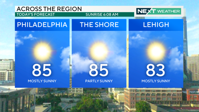
Only one other weekend this summer has been fully dry — get out and enjoy this great weather in Pennsylvania, New Jersey and Delaware!
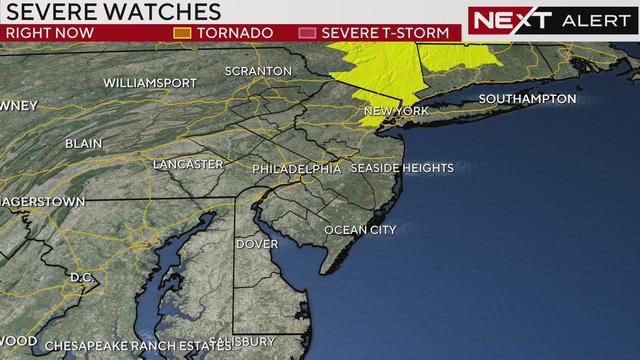
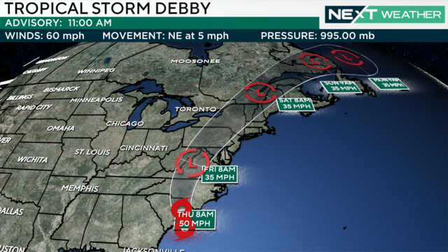
The National Weather Service canceled a tornado watch that was previously in effect for parts of the Philadelphia region until 10 p.m. as the remnants of Debby head north of our region.
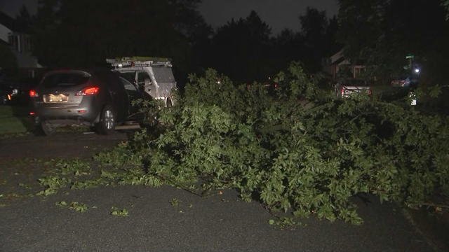
The National Weather Service confirmed a tornado occurred Thursday night near Marshallton, Delaware, which is just west of Wilmington.

The remnants of Debby should make its biggest impact on the Philadelphia area on Friday afternoon, dropping multiple inches of rain.
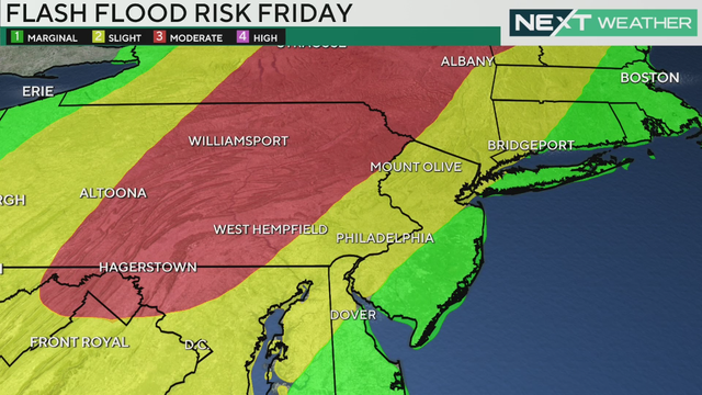
Friday is a NEXT Weather Alert day as Tropical Storm Debby brings heavy rain and strong winds to the Philadelphia region.
Wednesday's storms in the Philadelphia region won't be as intense as Tuesday's storms, which brought more than 7 inches of rain to some areas.
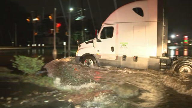
Parts of the Delaware Valley were slammed with storms and heavy downpours Tuesday night, and some areas in South Jersey got more than five inches of rain in a matter of hours.
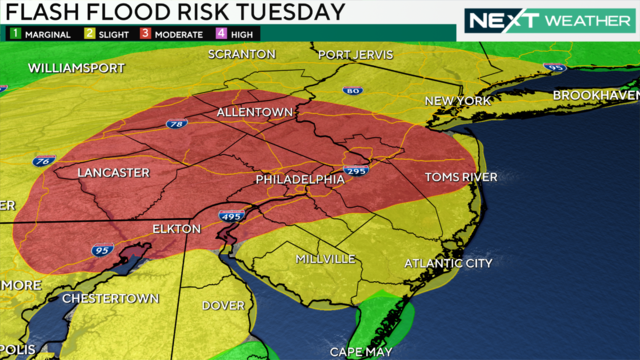
Two weather systems we're tracking this week each have the threat to bring heavy rain that could cause flooding in the Philadelphia region. The first one arrives Tuesday.
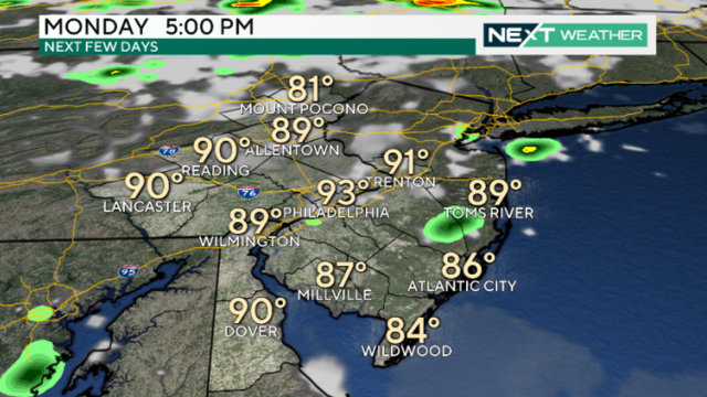
Monday in Philadelphia will be the driest day with sun and highs back in the 90s. The remainder of this week will be unsettled with a chance of showers and storms each day, prompting NEXT Weather Alert days.
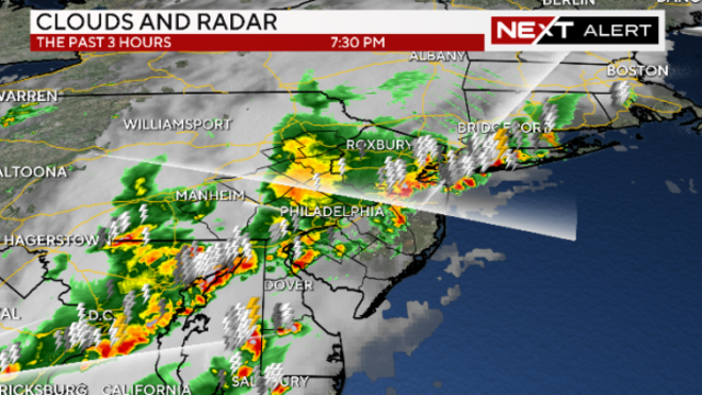
With potential rain and storms bringing flood risks to the Philadelphia area, in addition to a heat advisory, Saturday is a NEXT Weather Alert Day.
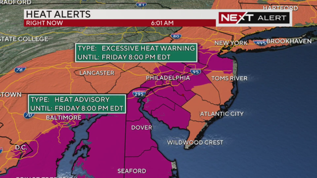
High humidity will combine with heat for feels-like temperatures in the triple digits today, and we're expecting afternoon storms each day through the weekend.
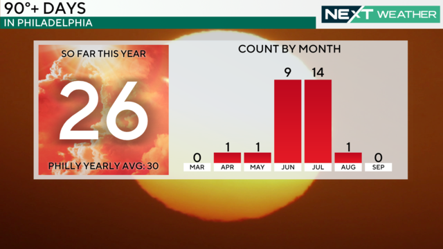
Meteorologist Tammie Souza explains just how hot this summer has been and what to expect in August and September.
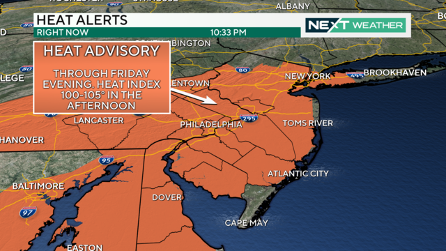
Thursday and Friday look even hotter than Wednesday, and the humidity may make those days feel near 100 degrees.
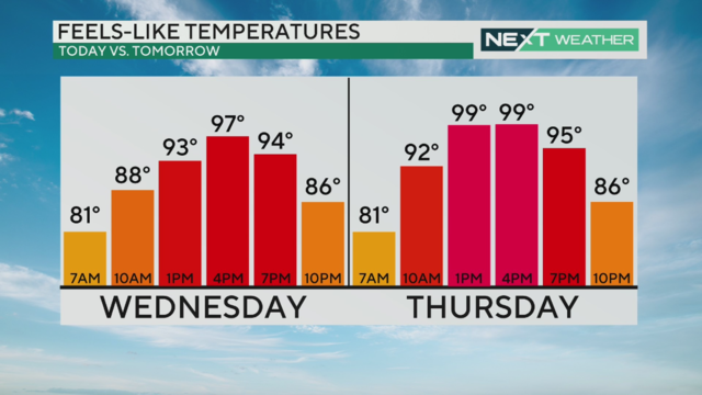
After some morning rain gives way to sunshine in the afternoon, Wednesday kicks off another heat wave in the Philadelphia region.
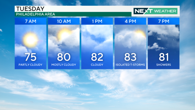
Temperatures will hover near or below average through Wednesday but edge upwards to the 90s by Thursday and beyond.
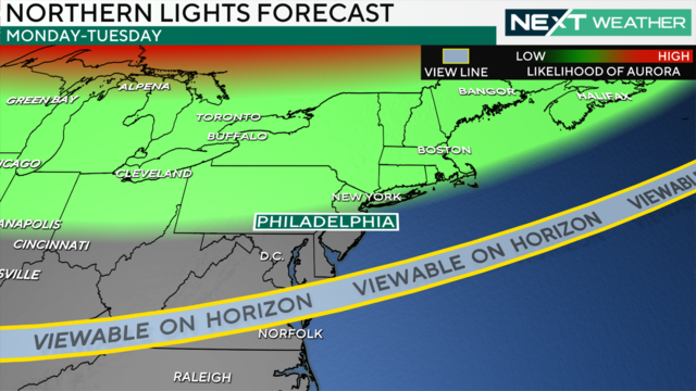
Could Philadelphia have another chance to see the northern lights this year? Here's what our NEXT Weather meteorologists say.
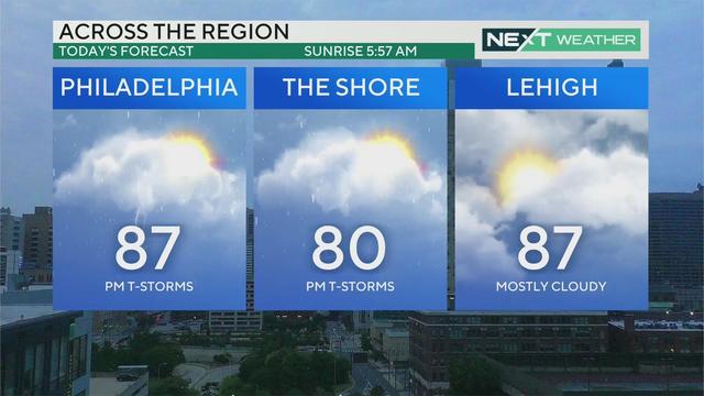
After a rain-free weekend, heat and humidity are building this week, with increased chances for showers and storms each day through Wednesday.
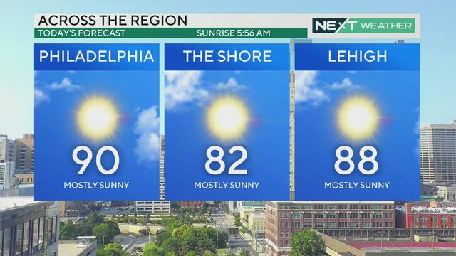
Sunday will be mostly sunny and very warm with a high of 89 degrees and some late-day clouds.
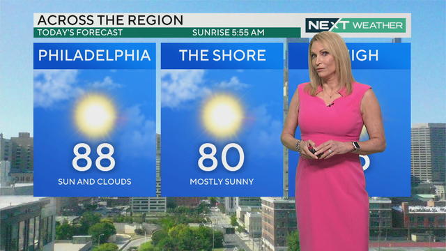
The last time we had rain-free weekend weather in the Philadelphia area was before Memorial Day.
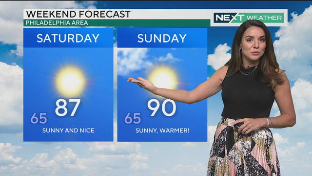
After an excessively muggy stretch, the Philadelphia region will be rewarded with sunshine, low humidity, and seasonably mild temperatures on Friday.
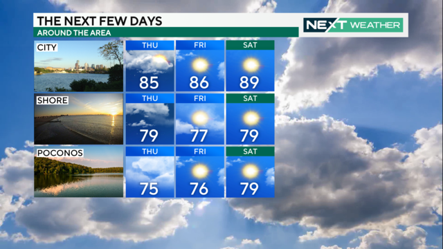
After a muggy and wet day on Wednesday (in spots), the pattern continues on Thursday with a greater chance for storms during the evening.
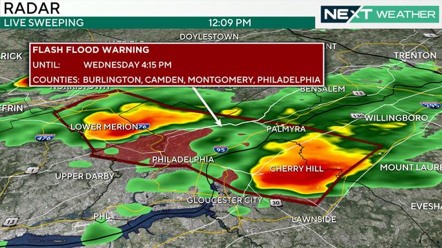
The muggy air and unsettled weather pattern kicks up a bit on Wednesday with mostly cloudy skies, temps in the 80s and showers.
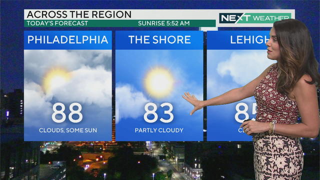
Tuesday will be sunny and cloudy with a stray shower or thunderstorm in the Philadelphia region as an unsettled pattern this week continues.
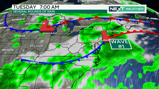
The chance for scattered showers and thunderstorms will increase Monday afternoon with periods of heavy rain possible.