Another hot and humid Sunday in store for South Florida

The NEXT Weather Team is tracking heat and the tropics on this Sunday morning.
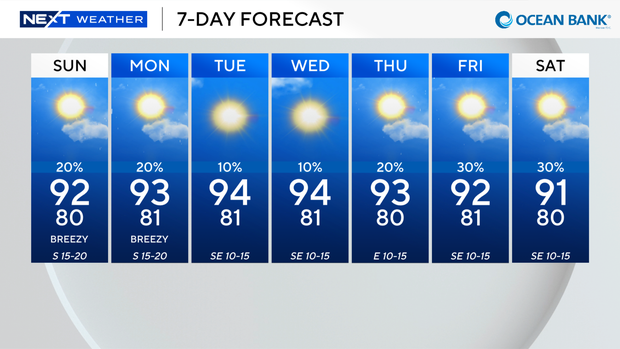
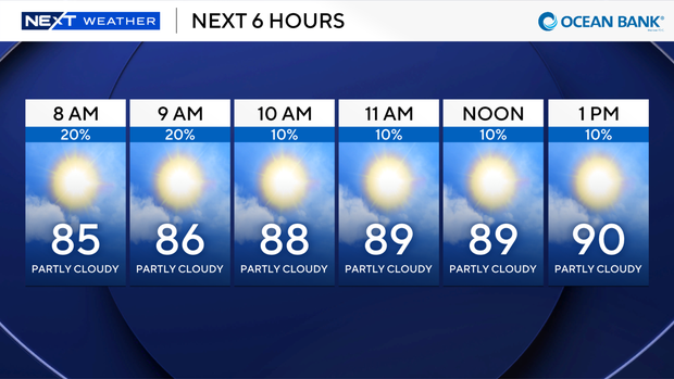
We'll see another hot, humid day across South Florida. Feels-like temperatures will hit the triple digits from Fort Lauderdale to Key West. There will be little to no relief from the heat due to rain.
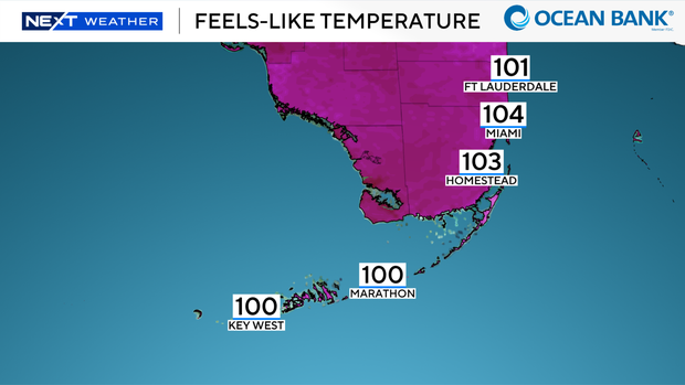
We're not expecting any significant rainfall. Also, we do not have a heat advisory today because we'll fall just under the threshold, but we'll all need to stay hydrated and stay in the AC as much as possible today.
Tracking the Tropics
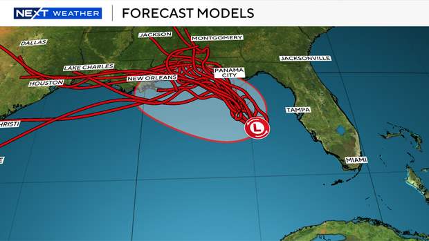
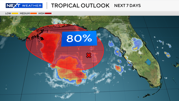
The National Hurricane Center expected a Tropical Depression to develop in the Gulf either Sunday or Monday. Around 1 p.m. Eastern time, the National Weather Service issued a Tropical Storm Watch for residents living along the Ochlockonee River to the border shared by Florida and Alabama, confirming a tropical depression had formed.
The center of the depression was located in the Gulf Coast, heading north-northwest, moving near 1 mph. It's expected to continue this slow movement along the northern Gulf Coast during the next several days.
Maximum sustained winds are near 30 mp with higher gusts, and the NWS expects the depression to gradually strengthen. The NWS expects the depression to become a tropical storm either Sunday night or on Monday.
Hurricane Hunter aircraft will fly through the system later this afternoon for further confirmation.
The most immediate impacts to be seen along the coastline, from Indian Pass to Chassahowitzka, will be up to three feet of flooding caused by the storm surge and tide. The deepest water, per the NWS, will occur along the immediate coast.
The storm could produce up to four inches of rainfall, with locally higher totals around eight inches through Thursday along the eastern and central Gulf Coast spanning from western Florida to the southern portions of Alabama, Mississippi, and Louisiana. Flash flooding may happen, particularly in urban areas.