Saturday morning showers in South Florida set to give way to hazy skies

The NEXT Weather Team is monitoring the potential for scattered showers and storms, summerlike heat, and Saharan dust for the weekend.
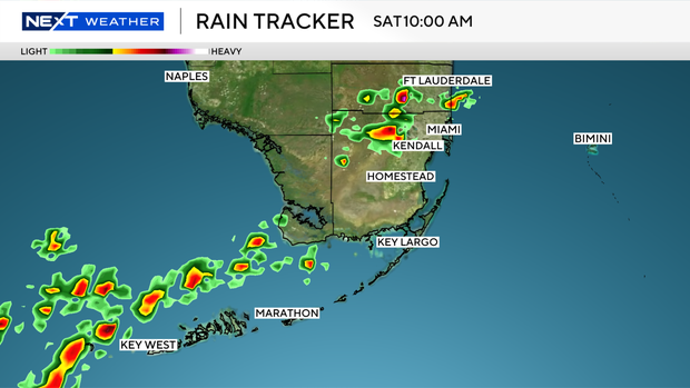
Saturday morning will feature scattered showers and storms possible along the coastlines of Broward and Miami-Dade in addition to the Keys. Heading into the afternoon, showers and storms will focus further inland. Isolated strong storms could develop over the interior and push toward our far western metro areas, but most should remain dry for the back half of Saturday.
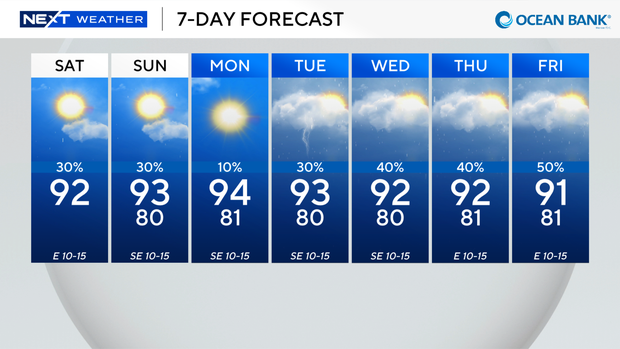
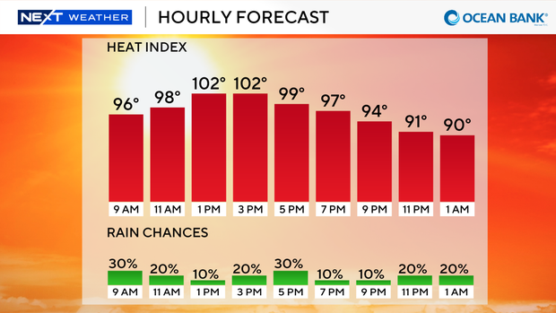
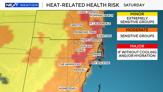
Highs climb to the lower 90s, but "feels like" temperatures will still climb to around 105, leading to major heat risk concerns across South Florida. A similar weather pattern will stick around for Sunday.
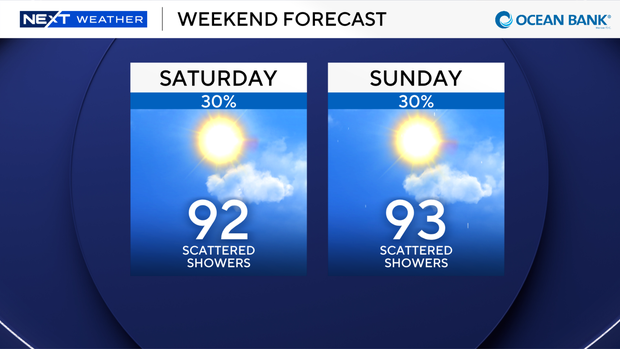
A moderate rip current risk is present at the beach with an "extreme" UV index rating and no alerts for boaters.
Hazy skies will also be featured in the forecast as Saharan dust moves in off the Atlantic. While this could lead to slightly reduced air quality, the main impacts will be hazy appearances on the skyline and drier air arriving by the end of the weekend and beginning of the upcoming workweek. Rain chances drop to 10% on Monday before a wetter weather pattern returns to South Florida for the middle of the upcoming workweek.
Tracking tropical developments
The NEXT Weather Team will also be monitoring the low-end potential for a tropical disturbance to form off the Southeast U.S. coastline toward the beginning of next week. As of the Saturday 8 a.m. update from the National Hurricane Center, there is a 20% chance for tropical development over the next 7 days.
An area of low pressure is expected to form offshore along a front that will be moving through the Southeast. There is still a lot of uncertainty surrounding this area, so our team will continue to monitor it closely.
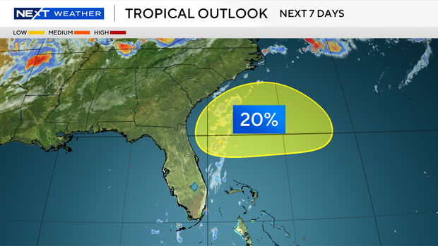
Long-range forecast models currently show this area of low pressure bringing elevated amounts of moisture to parts of Florida, including parts of South Florida, later next week. This will help to elevate rain chances for the middle of the week.
If this area were to become a named system, it would be called Bertha. The NEXT Weather Team will continue to monitor this area closely over the coming days and will provide updates on air and online.