Toasty day in store across South Florida as heat advisory is in effect and rain chances increase to end the week

The NEXT Weather Team is tracking another day of toasty temperatures, but rain chances will also return to South Florida.
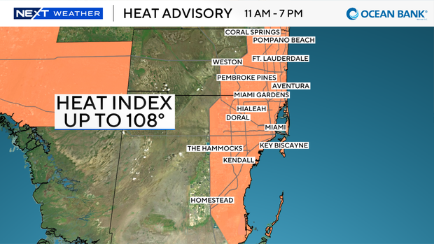
A Heat Advisory will be in effect from 11 a.m. until 7 p.m. for metro Broward and Miami-Dade on Thursday, as "feels-like" temperatures could peak at 108.
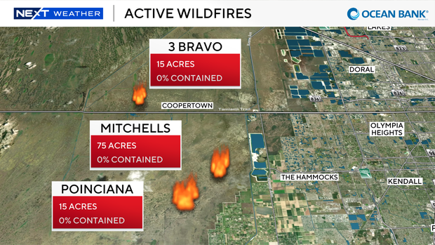
In addition to the heat, the team is tracking at least three active wildfires in Miami-Dade in the Everglades just west of The Hammocks. Each fire ranges from 15 to 75 acres and is at 0% containment. Moderate impacts on air quality are possible due to smoke.
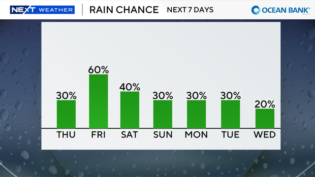
Rain chances are on the rise Thursday as scattered showers and storms gradually return to the forecast. There is a 30% chance of scattered storms on Thursday afternoon, favoring the western edge of the metro areas between 2 p.m. and 7 p.m.
Rain chances trend even higher on Friday with a 60% chance for rain throughout the afternoon and early evening.
Scattered chances of rain will continue for the weekend, but neither day is expected to be a complete washout.
The rain and cloud coverage will also help to make the heat more manageable as afternoon highs dip slightly into the lower to mid-90s for the weekend. "Feels-like" temperatures will still hover in the lower triple digits.
Tracking the tropics
The NEXT Weather Team is monitoring two areas of potential tropical development as of Thursday morning.
The National Hurricane Center highlighted an area ranging from the Northeastern Gulf to the Southeast U.S. coast with a 20% chance for tropical development over the next seven days.
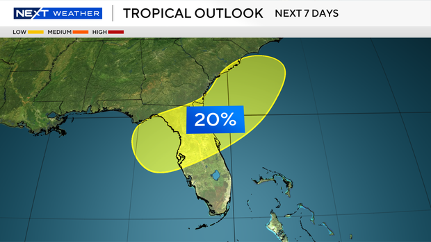
Chances for development are low as forecast models continue to disagree on whether an area of low pressure will be able to develop Friday into the weekend.
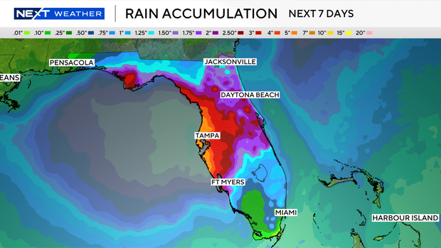
Regardless of whether or not it becomes an official tropical system, areas of Central and Northern Florida can expect higher rain chances with some forecast totals over the next seven days ranging from 5-7".
Locally, there are no direct impacts from this low pressure in South Florida. Rain chances will be increasing due to more moisture moving into the region as Saharan dust moves out.
The second area being monitored is just off the west coast of Africa and only has a 10% chance of tropical development. Long-range forecast models do not see this area as posing a threat to the United States.
If one of these were to become a named system, it would be called Bertha.
The NEXT Weather Team will continue to monitor all updates from the National Hurricane Center and provide consistent updates on air and online.