Scattered showers, storms possible as heat index could reach 110 degrees for parts of South Florida

The NEXT Weather Team is tracking the potential for scattered to widespread showers and storms as the workweek ends and the weekend kicks off.
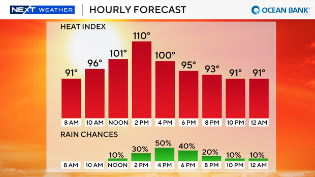
After a week that has been mostly dry, hot, and hazy, there is a return of significant rain chances across South Florida for Friday afternoon. The forecast calls for a 50-60% chance of showers and storms between 2-7 p.m. for Broward and Miami-Dade.
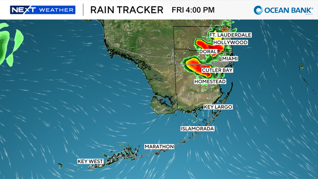
Isolated strong storms could be embedded within the showers and could contain strong winds, heavy downpours and lightning.
Ahead of the rain, the weather team will be tracking triple-digit heat, with another Heat Advisory across metro Broward and Miami-Dade between 11 a.m. and 7 p.m. "Feels-like" temperatures could climb to 110 in some areas ahead of the afternoon showers.
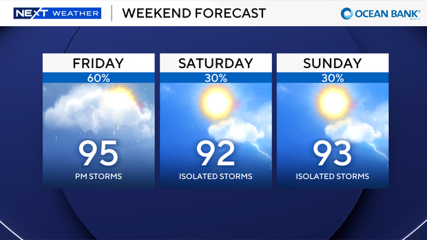
While about a 30% chance of scattered showers and storms will linger for Saturday and Sunday, a washout isn't anticipated for the weekend. Afternoon highs will still climb to the lower to mid-90s, with heat index values remaining in the triple digits.
In addition to the heat and rain chances, there's an active wildfire in Broward County just west of US-27. Reports as of early Friday morning show 3,600 acres have burned with 0% containment. Southwesterly wind could push smoke into northern portions of Broward County and South Palm Beach County throughout the day.
The NEXT Weather Team is also keeping an eye on the Northeastern Gulf, as the National Hurricane Center continues to highlight an area of potential tropical development. Chances are still on the lower end at 20% over the next seven days.
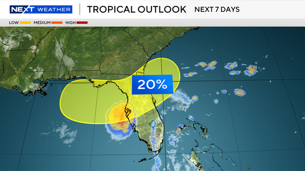
Direct impacts aren't expected in South Florida, but expect a wetter weather pattern for parts of Central and North Florida over the weekend through the beginning of next week.