Increasing showers and storms this weekend in the Florida Peninsula

Showers and storms increase over the weekend as tropical moisture returns to the Florida Peninsula. Storms will develop along the sea breeze and slowly work through the metro areas throughout the morning and early afternoon. Slow-moving storms may lead to brief minor flooding around the heaviest downpours and in areas with poor drainage. The storms will gradually begin to taper off later this afternoon and evening.
Slow-moving storms that impact an area will stabilize the atmosphere for a while, so if you have a downpour in your area, once it ends, the rain will hold off for the next few hours. If sunshine returns, it may trigger a few storms later in the day.
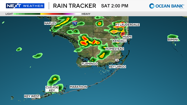
The pattern changes slightly over the next few days as a west wind develops. With this pattern, storms develop later in the day and linger longer over the East Coast metro areas. Given that the storms take longer to develop, they typically contain stronger winds and heavier rain. There is a minor flooding risk in northern Miami-Dade and Broward Counties on Sunday.
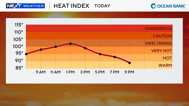
Afternoon storms will remain in the forecast throughout the next week. Storms will cool temperatures down briefly. Highs will still be above 90 degrees, with heat index values above 100 degrees, each day before these storms trigger.
The tropics remain quiet with no activity expected over the next seven days. Plumes of Saharan dust continue to push away from Africa and linger over the main development area in the Atlantic.