Hot and humid Friday for South Florida with scattered afternoon storms
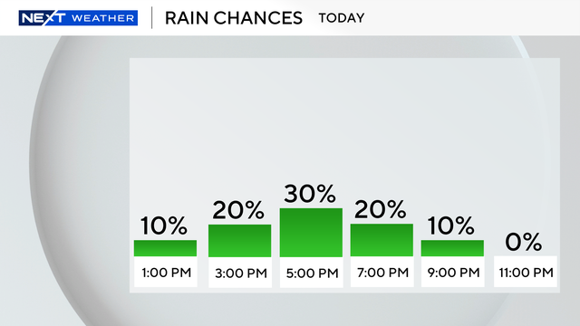
The NEXT Weather Team is tracking another hot and humid day across South Florida with the potential for a few scattered afternoon storms to end the workweek.
Watch CBS News
The NEXT Weather Team is tracking another hot and humid day across South Florida with the potential for a few scattered afternoon storms to end the workweek.
While nothing severe is expected, you'll want to keep an umbrella nearby as scattered showers will continue through the midday hours, said NEXT Weather Meteorologist Shane Hinton.
NEXT Weather Meteorologist Shane Hinton said these showers will be hit-or-miss through the morning as temperatures begin in the lower 80s.
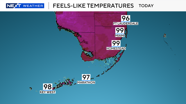
Scattered showers and dangerous heat are in the forecast for South Florida this week, with rain chances increasing into the weekend.

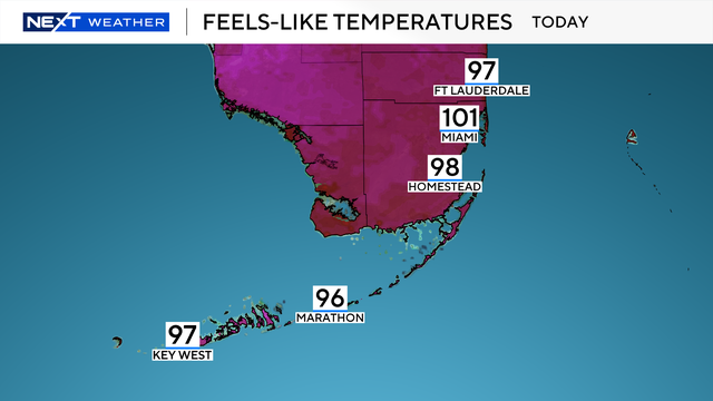
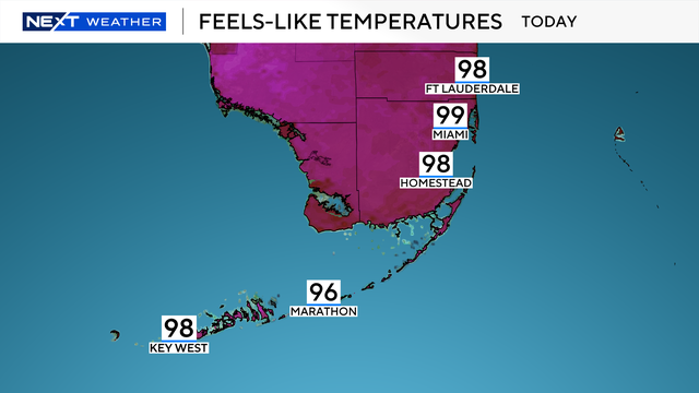
Highs will climb to the upper 80s and low 90s. But it will feel like the upper 90s and 100s when you factor in the humidity.

For Memorial Day on Monday, a lighter breeze will allow showers and storms to linger longer along the east coast through the morning before pushing back inland.
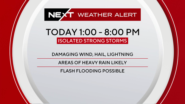
South Florida faces a new storm threat Saturday with damaging winds and hail possible in Broward and Miami-Dade.
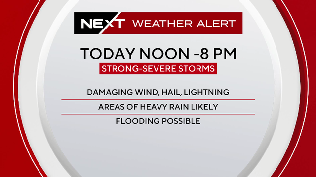
The most active period for storm activity will be from noon through 8 p.m.
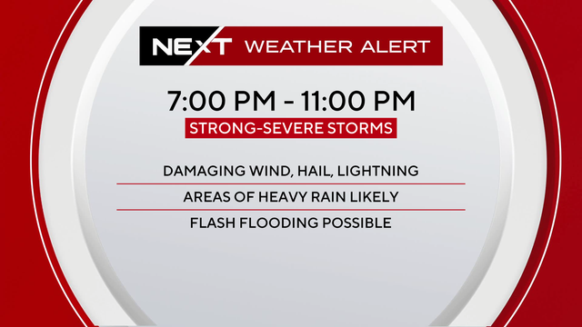
The main threats will be storms capable of producing damaging wind gusts and hail.
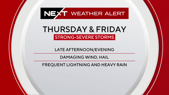
The main threats will be storms capable of producing damaging wind gusts and hail.

Most of South Florida is under a moderate heat health risk.

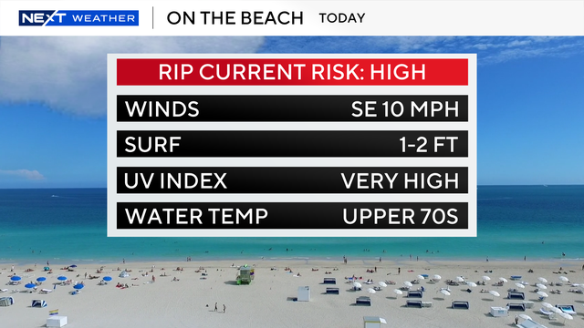
The UV index is at extreme levels in South Florida, and beachgoers are urged to use caution despite a low rip current risk.

It's another hot day in South Florida, with heat index values peaking at or just above 100 degrees Sunday afternoon.

South Florida is heading into its hottest stretch of the year, with temperatures in the 90s and humidity making it feel like the triple digits.

In the afternoon, temperatures will climb to the mid to upper 80s under mostly sunny skies.

Scattered showers will be possible on Tuesday, but the wet weather will not be as widespread.

Storms are expected to develop along the Gulf Coast in the morning and spread east across the region and into the Florida Keys throughout the day.

It will feel like the mid to upper 90s for some areas due to the high humidity.

Smoke from southern Miami-Dade brush fire will push inland due to a southeast wind.

It will feel like the low to mid 90s when you factor in the humidity.

It will feel like the 90s in the afternoon when the humidity is factored in.

Afternoon highs will be in the upper 80s, but it will feel like the 90s when you factor in the humidity.
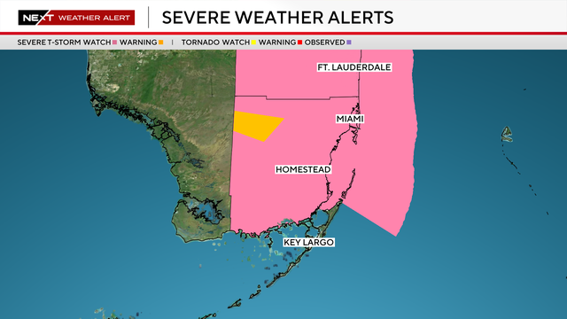
Broward and Miami-Dade counties were under a Severe Thunderstorm Watch until 9 p.m. Monday
A few scattered showers have already bubbled up this morning and our chances for storms will peak in the afternoon.
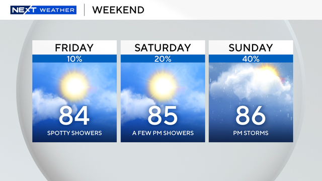
On Friday, a few spotty, light showers will lead to a warm afternoon with temperatures in the mid 80s.