Warm, breezy to start the work week in North Texas before rain and storm chances increase

This week, temperatures in North Texas are back in the 80s, and we are tracking multiple chances for rain and thunderstorms Wednesday through Saturday. Our weather pattern has changed, and several disturbances out in the Pacific will make a run at North Texas in the next couple of days.
Monday night will be mostly clear, breezy and mild, with lows in the 60s. Tuesday will be windy and humid, with lots of clouds in the morning and some breaks of sunshine in the afternoon. Highs will reach the mid-80s.
During the evening hours on Tuesday, weakening storms from West Texas will try to move in and could reach some of our counties west and northwest of the metroplex. The rest of us will stay dry.
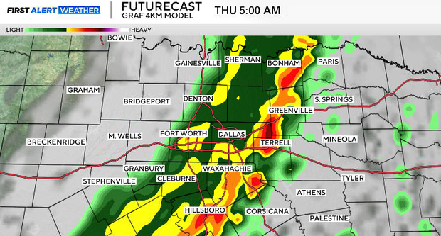
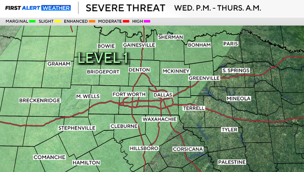
The first round of widespread rain and storms arrives late Wednesday night into Thursday. A line of strong (potentially severe) storms will move in from west to east through North Texas. Most of North Texas is under the Level 1 "marginal" risk (green area). The potential threats would include large hail and strong winds.
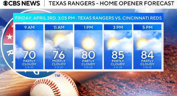
Most of Friday, the Texas Rangers' home opener, looks quiet. Expect intervals of clouds and sunshine with breezy conditions and highs in the 80s. Then we're looking at another round of potentially severe storms Friday night into early Saturday afternoon.
Saturday, we have a cold front bringing a line of storms with threats for heavy rain and the possibility of some stronger storms.
Easter Sunday looks much cooler but dry. Highs on Sunday will top out in the upper 60s to be about 70F with partly sunny skies.