At least 6 dead after tornado rips through Michigan and storms hit central U.S.
Severe storms were sweeping across the central U.S., and forecasters warned tornadoes could turn dangerous across several states.
Watch CBS News
Severe storms were sweeping across the central U.S., and forecasters warned tornadoes could turn dangerous across several states.
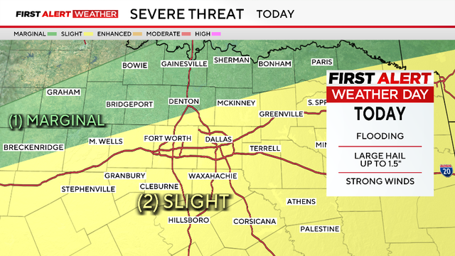
The main risks will be large hail and damaging winds; however, an isolated tornado is still a possibility.

Friday has the biggest expected chance of severe weather, with most of the region under a level two (slight) risk.
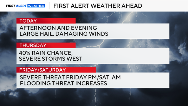
The severe weather threat begins around 5 p.m. Wednesday and continues through midnight.
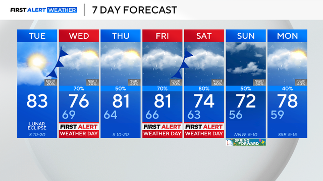
Clouds will decrease throughout the afternoon, and winds will stay breezy coming from the south, gusting up to 20 mph.
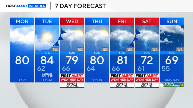
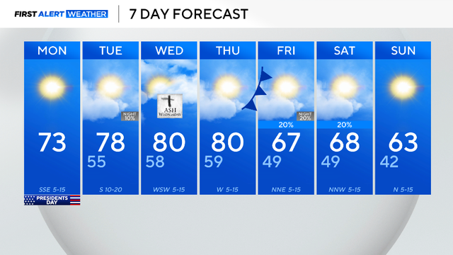
The northern counties may be stuck in the upper 60s and low 70s Monday, while parts of the DFW will push close to the 80°.
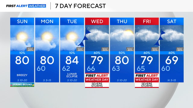
Looking ahead to the upcoming workweek, the weather turns much more active.
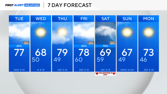
The dry weather pattern isn't expected to last much longer. Starting Tuesday night through the next weekend, rain and storms will be possible.

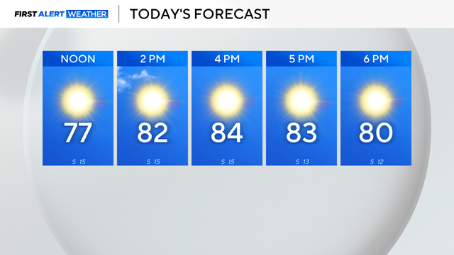
By the afternoon, expect partly cloudy skies and temperatures in the lower 80s.
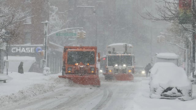
More than 40 million people were under blizzard warnings along 700 miles of the East Coast from Maryland to Maine.
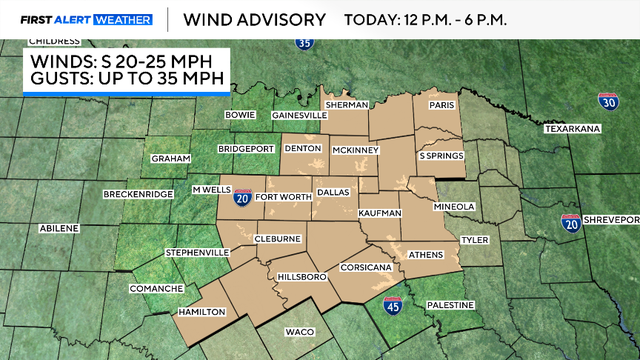
A wind advisory is in place with gusts up to 35 mph. This, in combination with how dry it has been, will increase the fire threat.
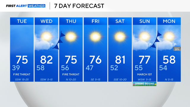
The warming trend is expected throughout this week.
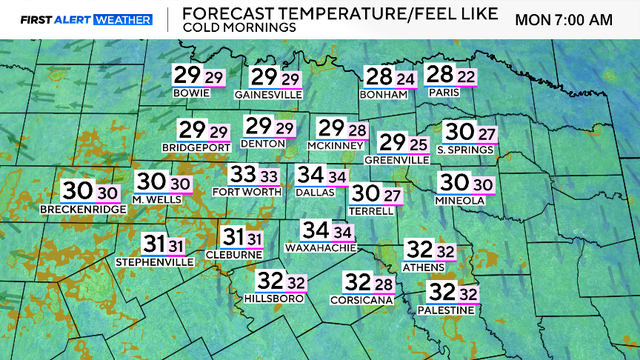
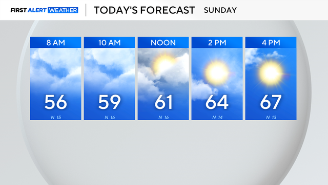
Grab the jacket because it will be chilly. Temperatures will climb into the low 50s by lunch and reach into the upper 50s by the late afternoon.
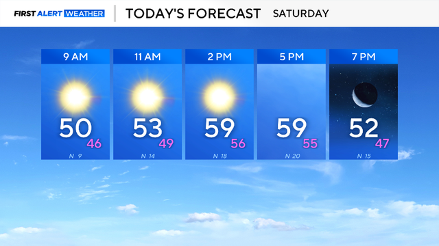
A cold front will be moving through the area, causing wind to gust up to 30 mph at times.

Temperatures on Sunday morning will be close to freezing.

A red flag warning is in place for Young, Jack, Montague and Cooke counties.
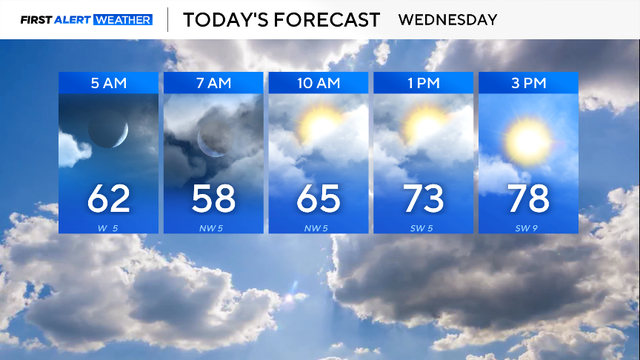
The main weather story over the next couple of days will be the elevated fire danger.

The training is designed for both experienced storm spotters and anyone interested in learning more about severe weather in North and Central Texas.
It will be partly cloudy at times throughout Tuesday, preventing DFW from reaching 80°.
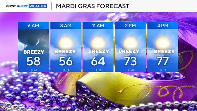
Mardi Gras, Tuesday, will start mild in the 50s and warm into the upper 70s by mid-afternoon.
Even with that record rain, though, the region is still well below normal for rainfall this winter season, with a deficit of 4.3".
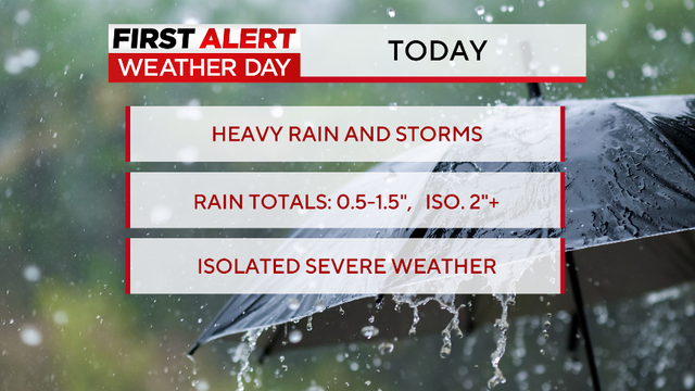
A First Alert Weather Day is in effect for disruptive rain and the chance of some isolated severe storms.
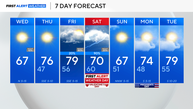
It will be sunny, cooler and less humid Wednesday, with morning temperatures in the 40s and afternoon highs expected in the mid-60s.
Humidity has increased as an upper-level low sits to the west and a cold front approaches from the north.

The high Monday will climb into the 70s by lunchtime and top out around 82 degrees by 4 p.m.