Expect sunny skies, breezy conditions before rounds of rain move into North Texas this week


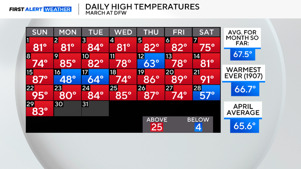
The high on Saturday hit only 57°, the second coldest day of the month. Sunday, we snapped right back to the story of March: warm and dry.
Just a quick glance at the daily highs for the month shows most of the days in our first month of spring landed above normal:25 of them versus a mere four days below normal. This is the hottest March on record. February was the second hottest on record. This month will end warmer than your average April.
Over the last 20 days, DFW has logged a mere .01" of rain. We'll likely close the month with dry and windy weather. But then there will be a significant change in weather patterns.
We get a nearly stationary trough set up across the western half of the United States. This brings in almost daily rain chances starting on April 1. The wettest days ahead look to be Thursday/Thursday night and Saturday on Easter Weekend. Cooler days this coming weekend will also be part of this pattern.

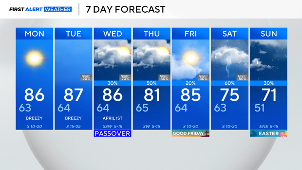
The rain chances stick around over the first week of April. Right now, there isn't a significant severe risk shaping up with this, but strong storms along the dryline to our west could erupt as early as Tuesday. We'll be watching. April and May are the two stormiest months of the season.