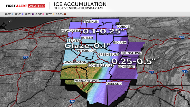
Freezing rain, ice expected to impact parts of western Pa. into Thursday morning
An ice storm is expected to appear in our region Wednesday through Thursday.
Watch CBS News
An ice storm is expected to appear in our region Wednesday through Thursday.
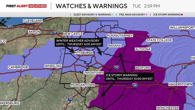
12 counties in the Pittsburgh area are under a winter storm watch.
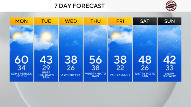
As the Pittsburgh area warms up, don't expect the warmth to mean little winter weather will be in place for the week.
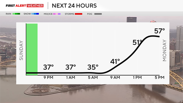
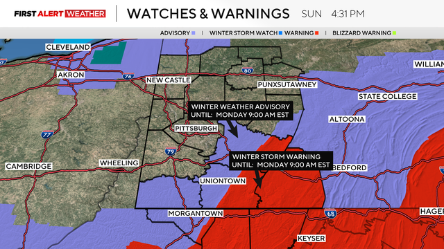
A winter weather advisory is now in place through midnight for areas north and east of Pittsburgh for slick travel conditions.
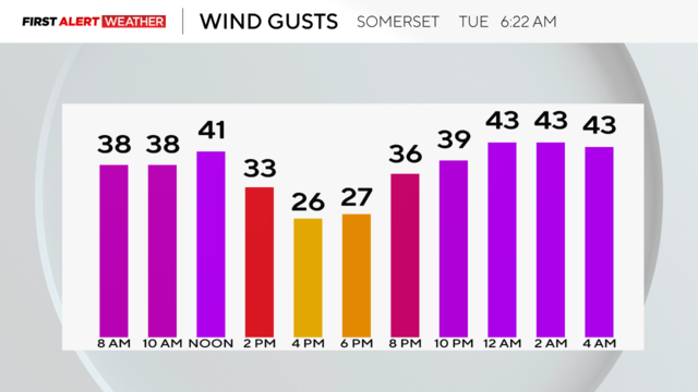
There's a wind advisory in effect for higher elevations through at least 12 p.m.
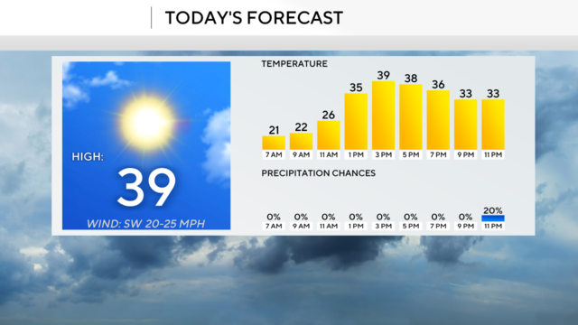
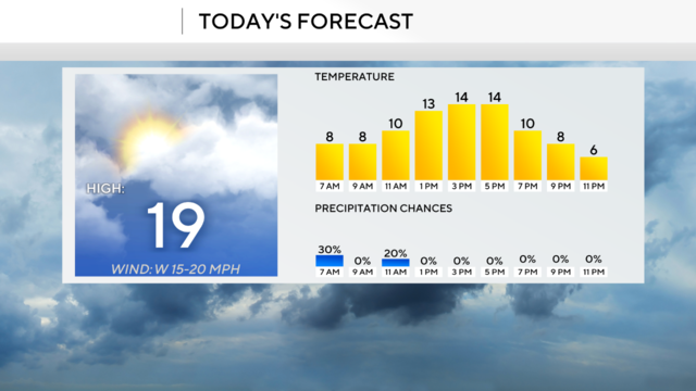
Temperatures are expected to nearly reach 40 degrees today.
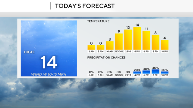
Evening snow showers are expected, as well.
First Alert Weather Days are in place through Thursday due to the cold and snow showers for today too.
The arctic air is on our doorstep and will take hold tonight.
Next week, we could see temperatures fall below 0° on Tuesday and Wednesday mornings.
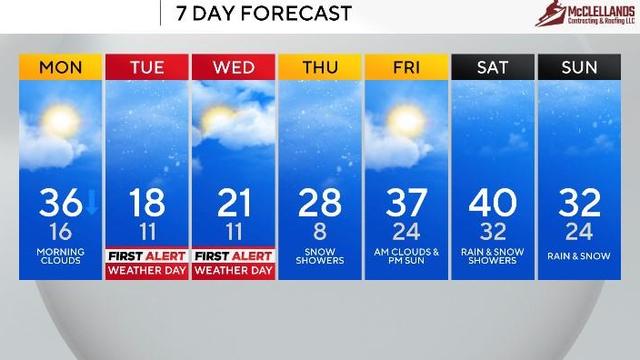
Tuesday and Wednesday are First Alert Weather Days because of the expected morning wind chills.
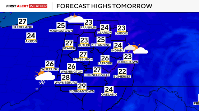
Some snow showers will continue early Thursday morning and temperatures will reach single digits tonight.
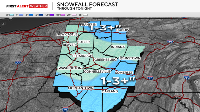
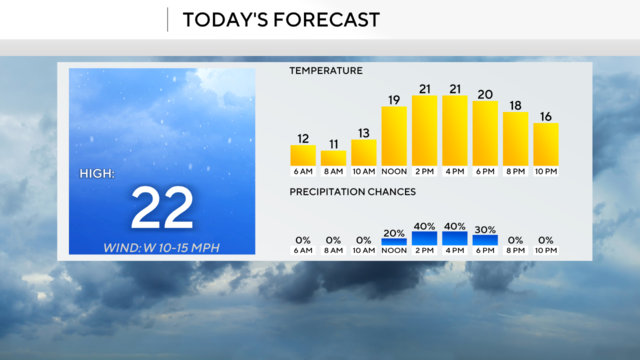
Today we'll see some snow showers before even colder temperatures move in.
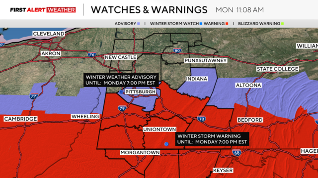
The winter weather advisory and winter storm warnings expire at 7:00 p.m.
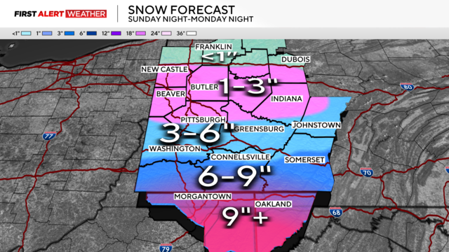
A winter weather advisory is also in effect for Allegheny and Indiana counties.
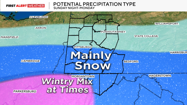
After a day of snow showers, the Pittsburgh area is looking at cold temperatures and some more snow.
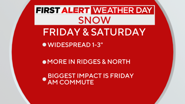
Accumulating snow throughout the day could impact your morning commute, but Friday won't be the only snow we see.
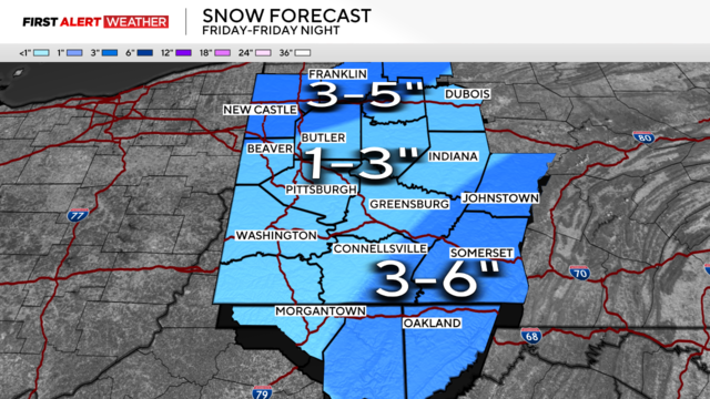
While it will be cold on Thursday, a system bringing snow will move into our area on Friday.
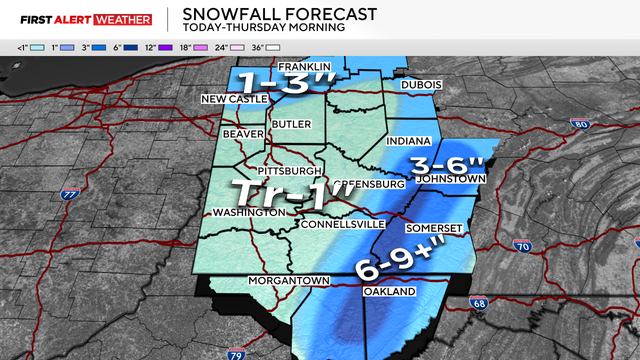
Scattered snow showers are expected to continue areawide through the midday into the afternoon, evening and overnight hours.
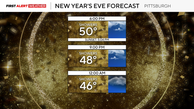
There will be some heavy rounds of rain this evening.
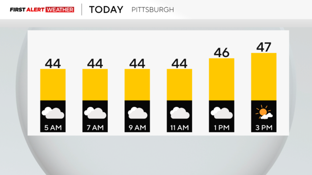
The Wind Advisory is done for the region but it's still breezy with gusts at 20-30mph through the afternoon.
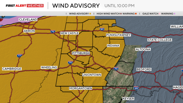
Potential heavy rain and damaging winds have prompted a KDKA First Alert Weather Day.
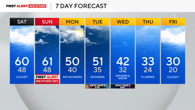
Highs could reach near 60 degrees for the Pittsburgh area, but damaging winds and heavy rain are possible on Sunday.
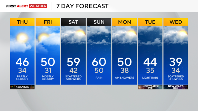
The Pittsburgh area started Thursday with lows near freezing.
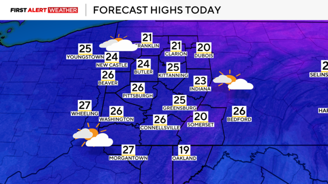
We're in for another cold day on Sunday before we get some relief on Monday.