The flip-flopped seasons | Hey Ray
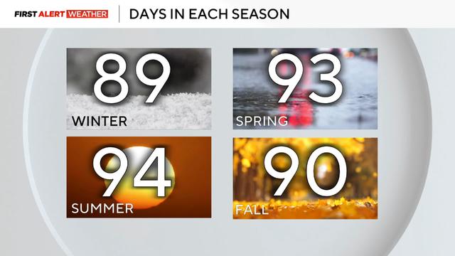
Winter officially began around 4 a.m. on Saturday, but did you know it's not winter everywhere?
Watch CBS News
Winter officially began around 4 a.m. on Saturday, but did you know it's not winter everywhere?
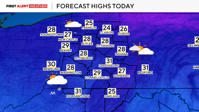
Temperatures will slowly fall throughout the day and we could see lake-effect snow.
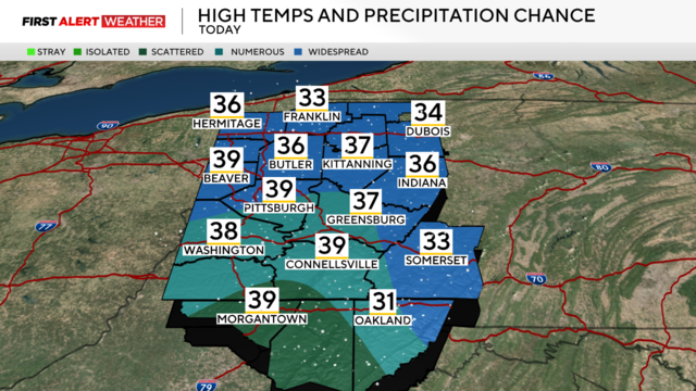
Temperatures begin in the upper-20s on Friday and some areas could see snowfall.
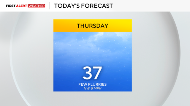
The decline in temperatures continues today before a cold weekend.
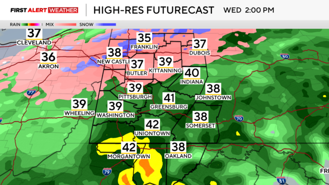
After a couple of days of mild temperatures, the colder air is moving into Pittsburgh on Wednesday.
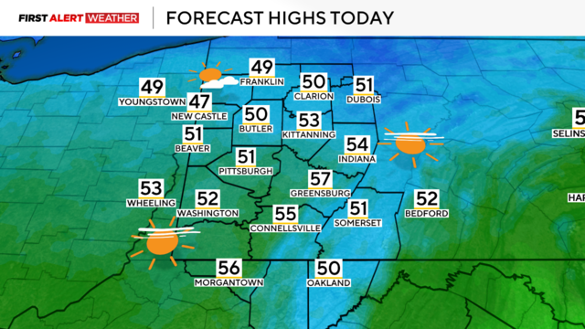
A morning cold front will result in slightly cooler afternoon temperatures.
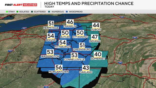
Temperatures are expected to drop later in the week.
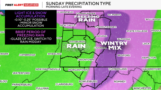
While we'll see some warmer temperatures, our region will see rain, freezing rain, and a wintry mix.
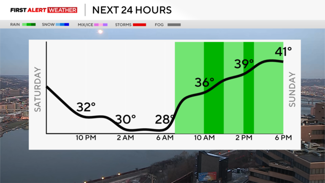
Saturday we'll see cold but sunshine while freezing rain and snow could be moving in on Sunday.
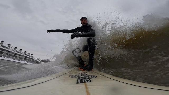
When you think of surfing, you think summer and the ocean, but this time of year, there's surfing in...Lake Erie?
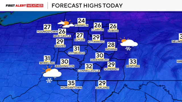
The overnight snow will wrap up later this morning but more precipitation is on the way this weekend.
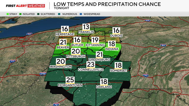
We're in for a cold day after a quick band of snow passed through our region overnight.

We'll see some rain turn to snow this afternoon along with dropping temperatures.
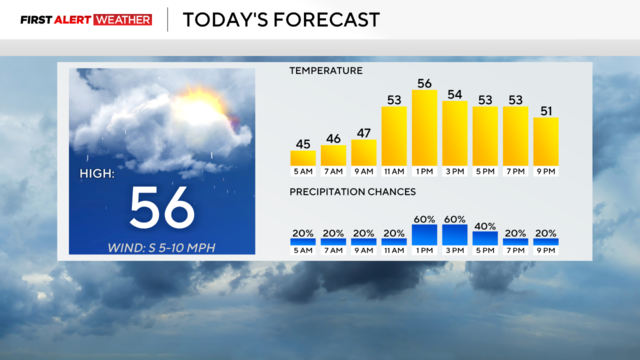
Today will be the final mild weather day this week with cold weather set to return tomorrow.
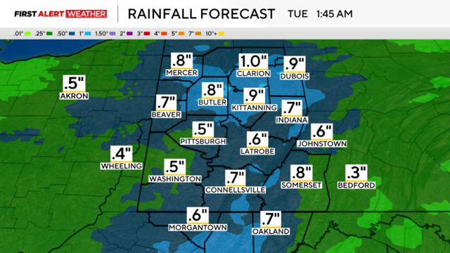
The rain has arrived and will remain through noon in the Western Pennsylvania area.
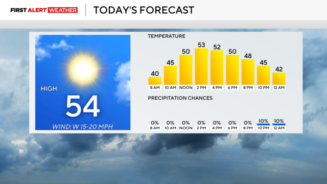
Temperatures will jump into the 50s today but snow and colder temperatures are on the way later this week.
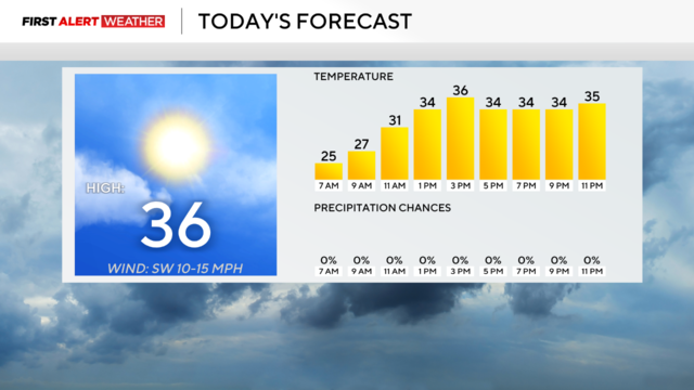
While we'll see an uptick in temperatures on Saturday, it won't be by much.
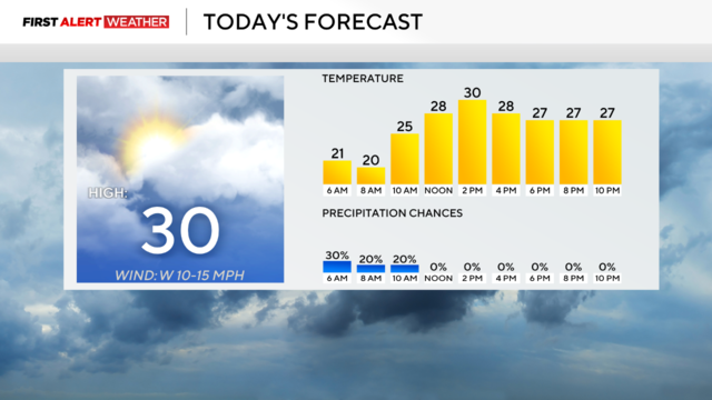
The on-and-off snow will come to an end this afternoon, but the cold temperatures are sticking around.
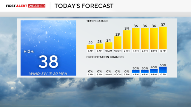
Thursday is a First Alert Weather Day with snow expected to fall overnight into the morning.
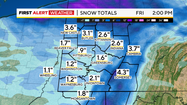
A big chunk of the area could see snow from Wednesday night into Thursday morning.
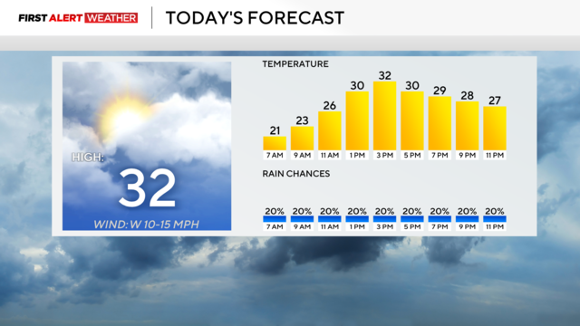
A lake effect snow event continues for places north of I-80.

Meteorological winter is here and so are the cold temperatures.
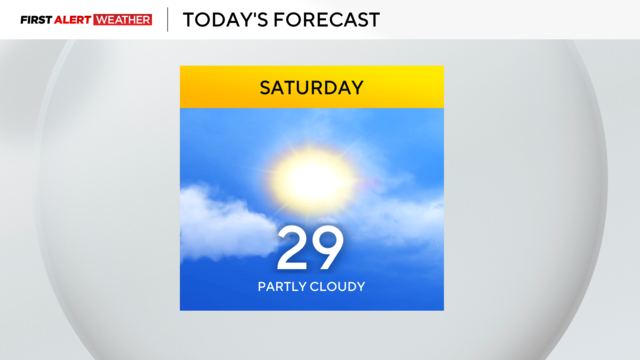
Temperatures will dip into the high-20s to end the month of November.
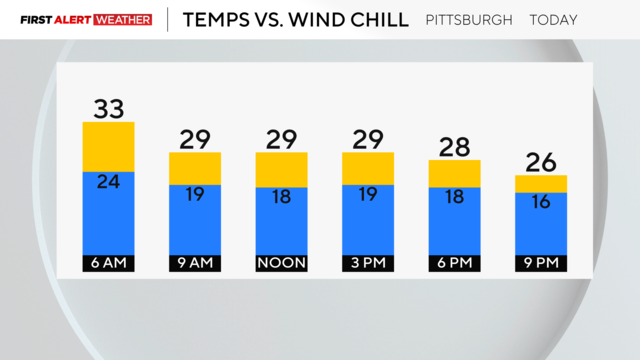
It's going to be a cold weekend with lows only in the 20s and highs in the 30s.
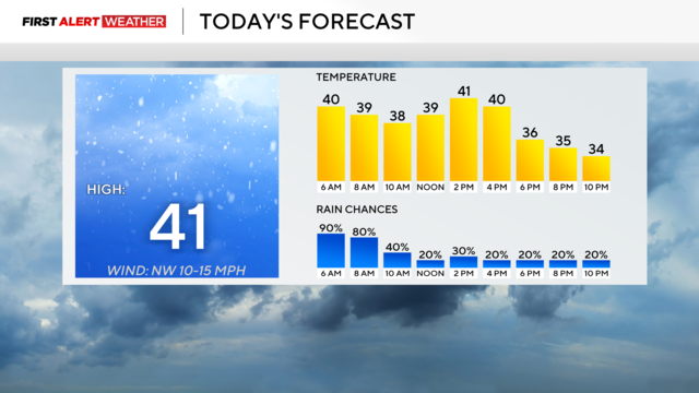
Colder weather will soon be arriving in Pittsburgh.