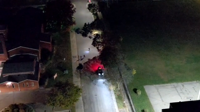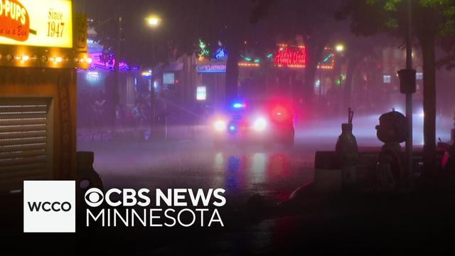
Storms cause flash flooding at Minnesota State Fair on Monday evening
Monday night's dangerous storms swamped the Minnesota State Fair, sent hundreds running for cover and shut down the Grandstand show.
Watch CBS News
Monday night's dangerous storms swamped the Minnesota State Fair, sent hundreds running for cover and shut down the Grandstand show.
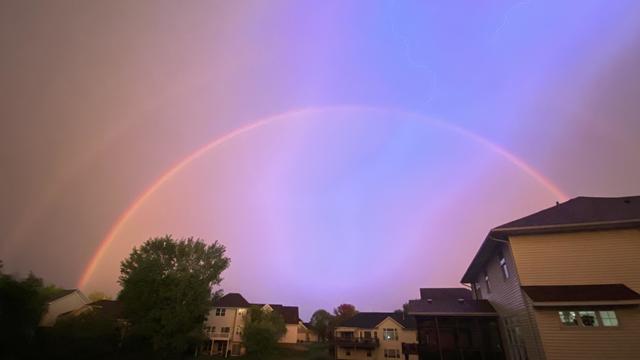
A severe thunderstorm swept through the Twin Cities metro late Monday evening, bringing sights to behold.
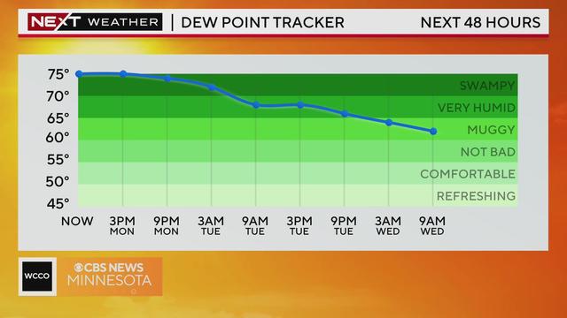
Meteorologist Katie Steiner has the latest forecast on this NEXT Weather Alert day. Excessive heat is expected along with potentially severe weather Monday evening.
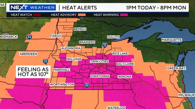
A NEXT Weather Alert is in place Sunday due to excessive heat, and Monday will be even hotter.

With the on coming heat, it's important to stay cool at the fair.
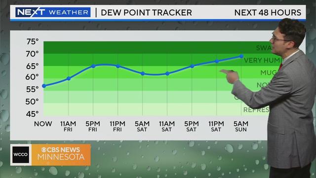
Humidity is on the rise Friday, with things expected to heat up for the first weekend of the Minnesota State Fair.
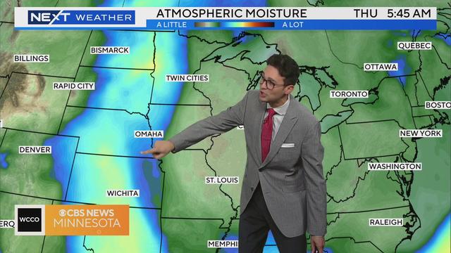
Meteorologist Joseph Dames has the latest forecast.
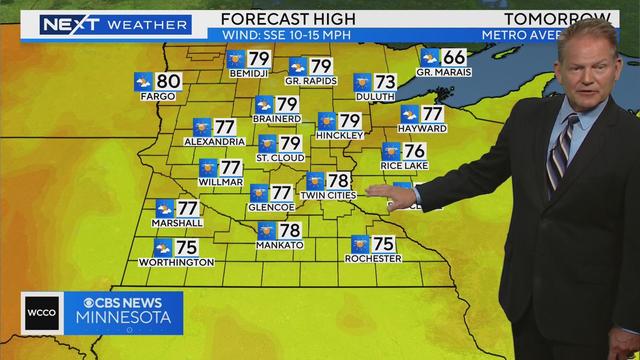
Scattered showers will move out of Minnesota overnight Wednesday, leading to highs in the upper 70s with a partly cloudy sky.
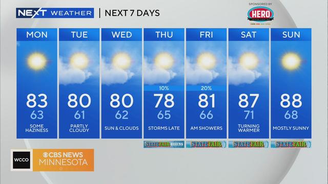
The work week will kick off with a pleasant August day in the Twin Cities.

Everyone wants to know what the weather will be like for the Great Minnesota Get-Together. NEXT Weather meteorologist Lisa Meadows has a look at your Minnesota State Fair forecast.
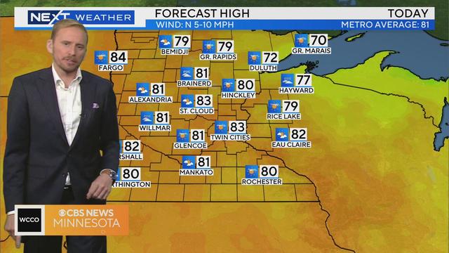
The rain is finally gone and Minnesotans can look forward to a dry day ahead on Sunday.
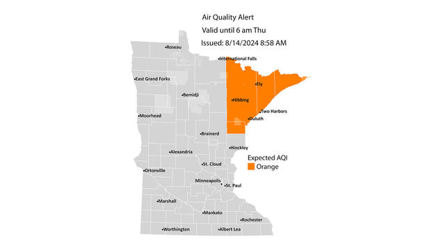
The Minnesota Pollution Control Agency on Wednesday issued an air quality alert for northeastern Minnesota due to wildfire smoke from Canada.
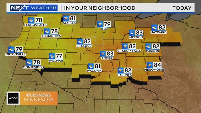
Tuesday will be another pleasant day in Minnesota.
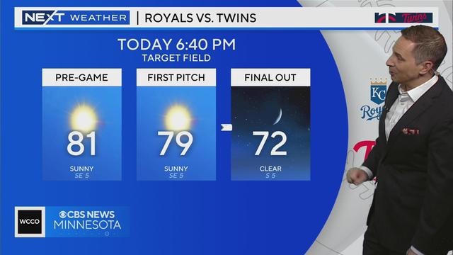
Tuesday will be a carbon copy day of Monday in the Twin Cities, with highs around 80, lots of sunshine and low humidity.
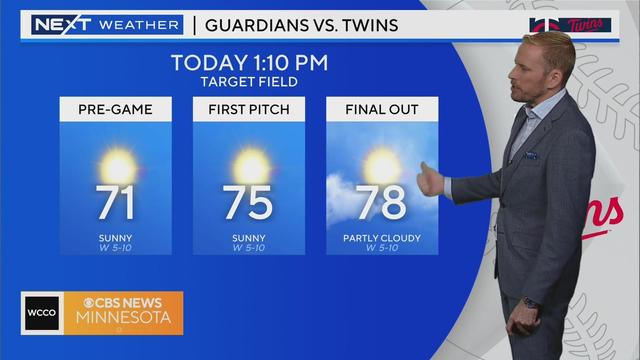
A high-pressure system will bring more sunshine to Minnesota as the weekend wraps up.
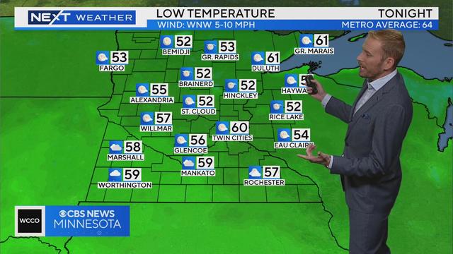
Meteorologist Adam Del Rosso has the latest forecast late Sunday morning.
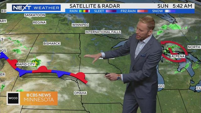
Meteorologist Adam Del Rosso has the latest forecast Sunday morning.
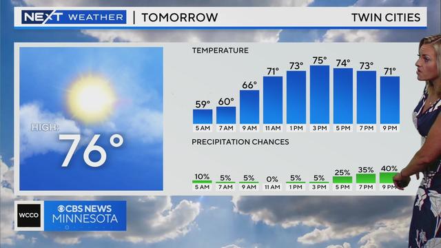
After Monday's severe storms, Tuesday's stable weather will be a welcome change.
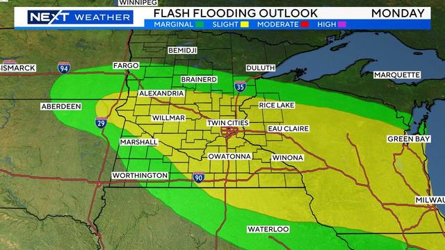
WCCO meteorologist Mike Augustyniak says the strongest part of the storm is moving to the east, quickly exiting Minnesota.
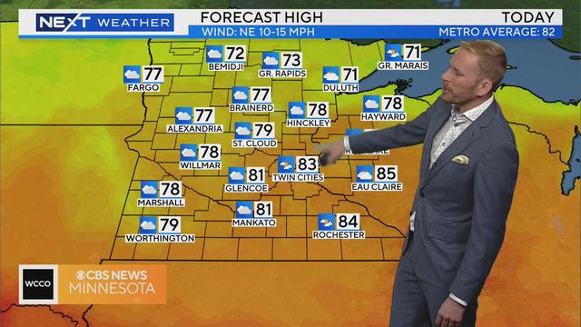
Sunday will be a touch cooler across Minnesota, and mainly dry until late in the evening when more storms could move in.
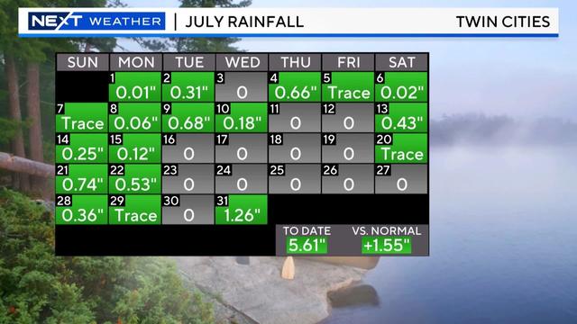
It was definitely a bumpy end to July with severe storms marching across the state, bringing damaging wind and massive hail.
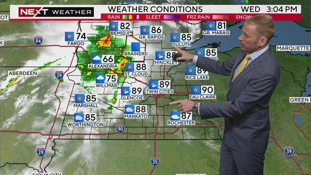
Meteorologist Adam Del Rosso has the latest forecast for Wednesday afternoon with severe weather possible.
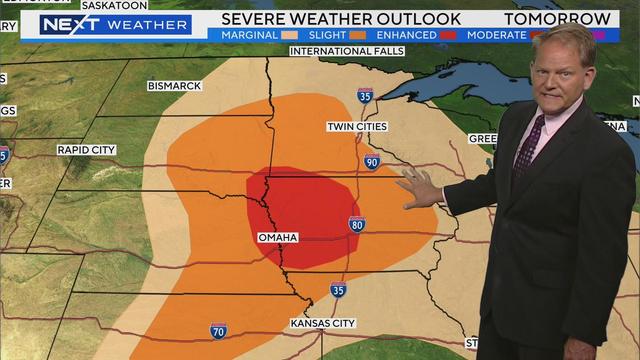
Tuesday continues a now familiar pattern of scattered storms and summer heat in Minnesota.
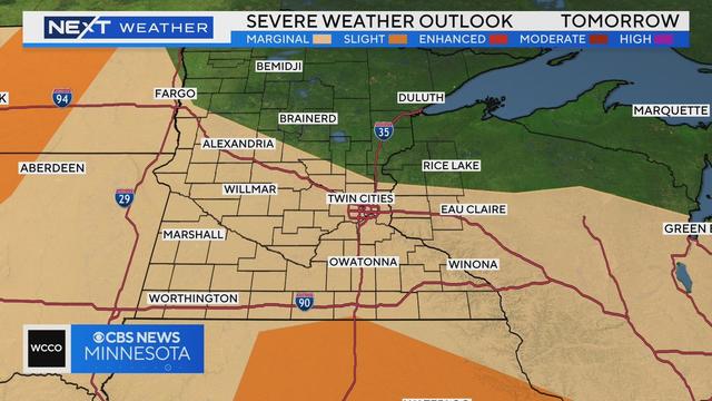
The Twin Cities will stay dry into Monday evening, but there could be another round of rain and storms overnight with a few heavy downpours possible.
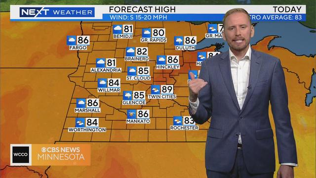
Most of the day will be dry, but storms become likely late in the evening and into the night.