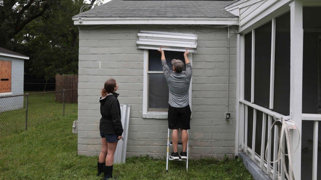
Hurricane Isaias has Florida residents scrambling to prepare, evacuate
Hurricane Isaias strengthened into a major Category 3 hurricane with winds of 120 mph hours ahead of a potential Florida landfall.
Watch CBS News
Hurricane Isaias strengthened into a major Category 3 hurricane with winds of 120 mph hours ahead of a potential Florida landfall.
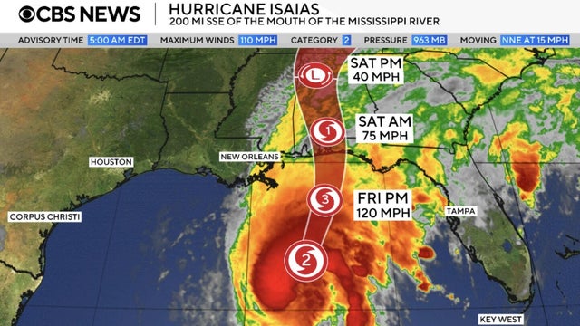
Hurricane Isaias, the first Atlantic hurricane of 2026, is inching closer to the northern Gulf Coast, where it is expected to make landfall on Friday evening.
It's going to be a hot and humid afternoon in South Florida with a forecast high temperature of about 90 degrees.
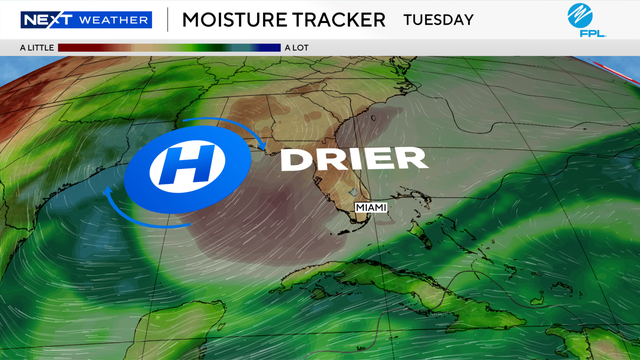
The CBS News Miami NEXT Weather team is also tracking Hurricane Isaias in the Gulf.

Florida is pre-positioning emergency resources as Isaias threatens to bring heavy rain, strong winds and flooding to parts of the state.

Florida Gov. Ron DeSantis declared a state of emergency for 25 counties due to Hurricane Isaias.
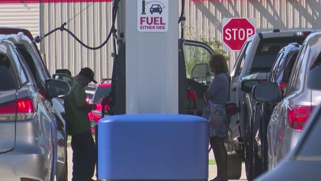
Preparations are underway in communities in the Florida Panhandle and Big Bend region for potential impacts by a strengthening Hurricane Isaias.
The National Hurricane Center said hurricane watches will likely be issued Wednesday due to Tropical Storm Isaias in the Gulf.
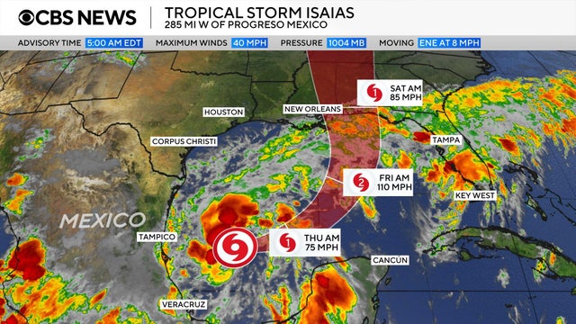
Tropical Storm Isaias has formed in the Gulf and is expected to become a hurricane by Thursday before approaching the U.S. northern Gulf Coast on Friday, according to forecasters.
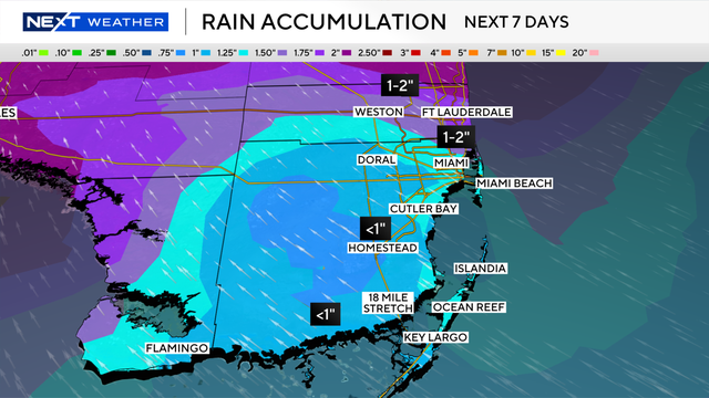
Keep the umbrella handy as the chance of rain is expected to be higher over the next few days here in South Florida.
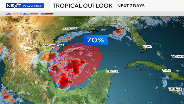
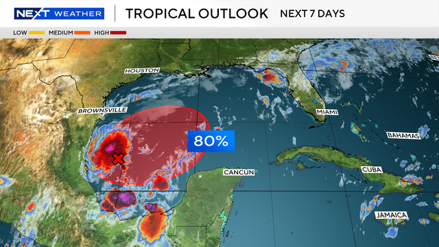
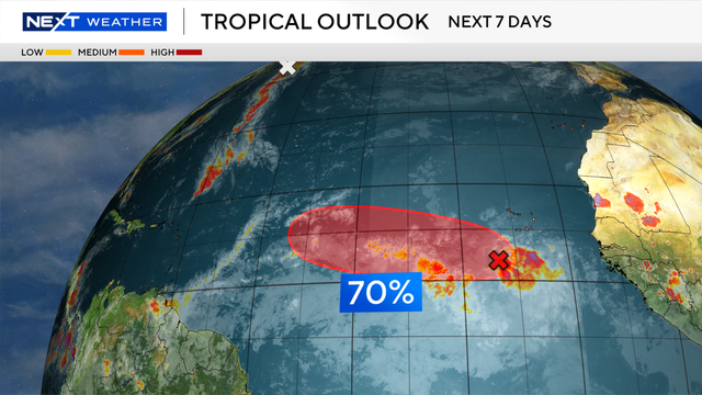
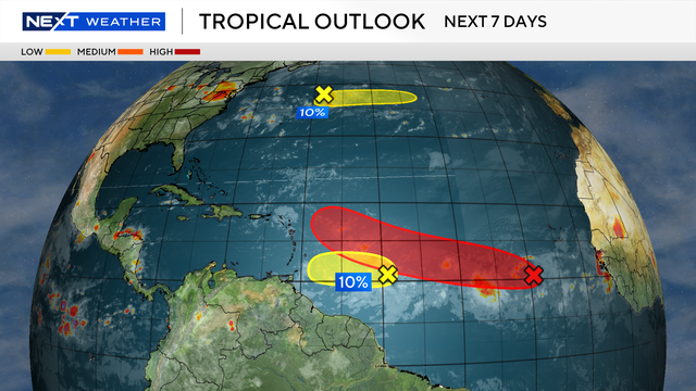
The National Hurricane Center says there is a high chance that a tropical depression will form in the Gulf by the end of the week.
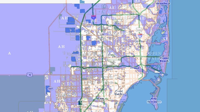
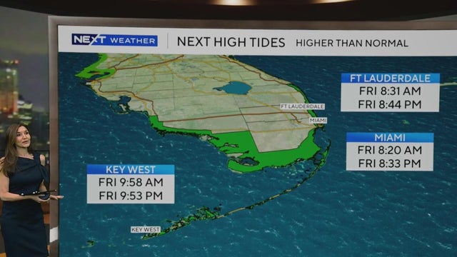
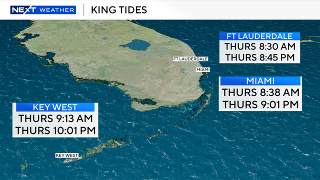
Heavy rain and king tides can bring flooding to South Florida, making it important to know your flood risk and whether your property is in a flood zone.
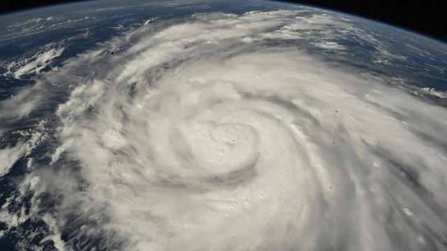
The Saffir-Simpson Hurricane Wind Scale rates hurricanes on a scale from 1 to 5.

The Great Miami Hurricane of 1926 devastated South Florida, killing hundreds and delivering an economic blow whose effects lasted for years.
Thursday also marks the peak of the 2026 Atlantic hurricane season, and tropical development is not expected over the next week.
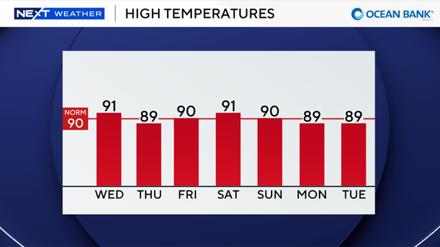
Thunderstorms that develop could produce heavy downpours, localized flooding, lightning and gusty winds.
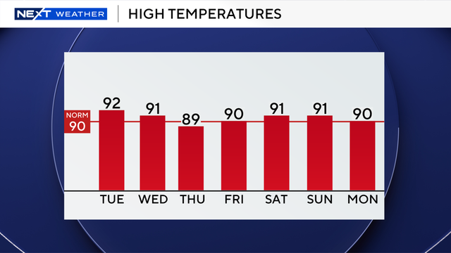
A few showers and storms moved in earlier on Tuesday morning, and more are expected to develop during the day.
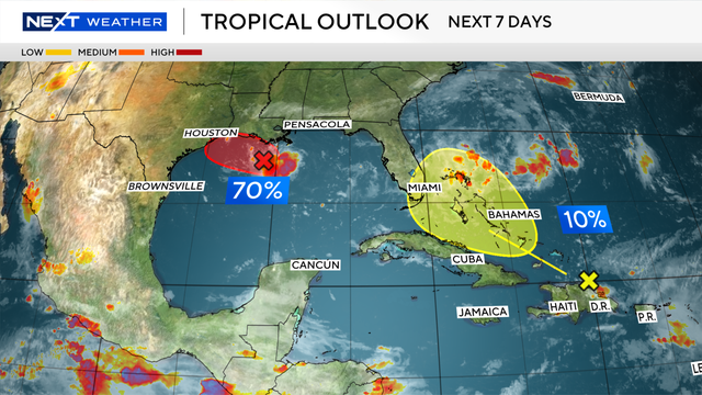
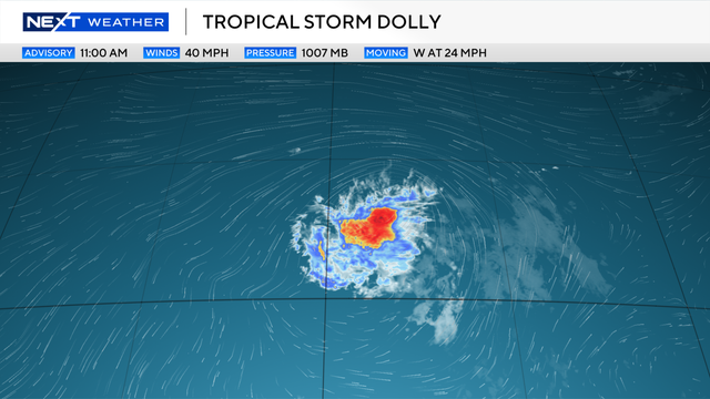
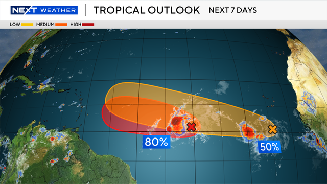
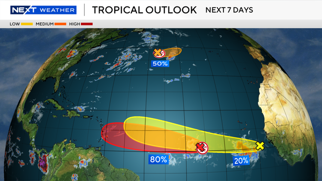
Two areas are being monitored for possible development – the remnants of Tropical Storm Dolly and an area in the Gulf.
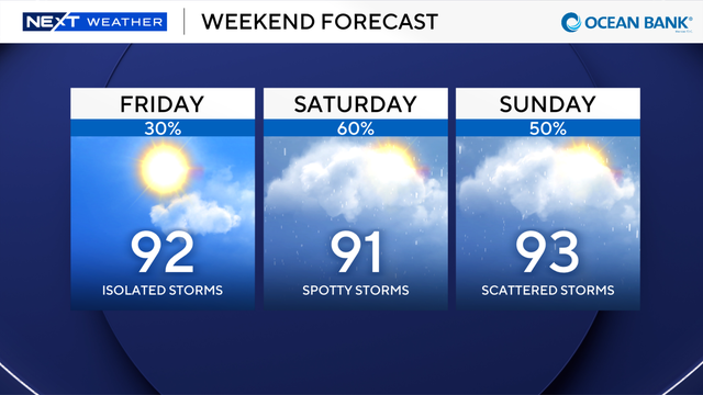
The rain and thunderstorms should come to an end before the start of the game at Hard Rock Stadium in Miami Gardens.
High temperatures are expected to climb into the low 90s on Thursday, but it will feel much hotter when you factor in the humidity.
Thunderstorms that develop in South Florida on Wednesday could produce heavy downpours, lightning and gusty winds.
A heat advisory has been issued once again for Miami-Dade and Broward counties from 12 p.m. until 7 p.m.
Heat advisories have been issued once again for Broward and Miami-Dade counties on Wednesday.
High temperatures Tuesday will soar to the low to mid 90s and it could feel like 105 to 110 degrees when you factor in the humidity.
High wind shear driven by El Niño is the dominant factor holding down storm formation, researchers say.