South Florida faces heavy downpours, localized flooding as king tides return

Keep the umbrellas handy, South Florida. More scattered showers and thunderstorms are expected on Wednesday afternoon.
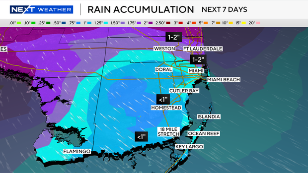
And some heavy downpours and localized flooding will be possible.
In addition, king tides will be returning to South Florida, leading to the potential for minor coastal flooding.
The chance of rain will remain high through Thursday due to passing showers and thunderstorms.
It won't be as wet on Friday, but will then turn breezy on Saturday with the chance of more passing storms.
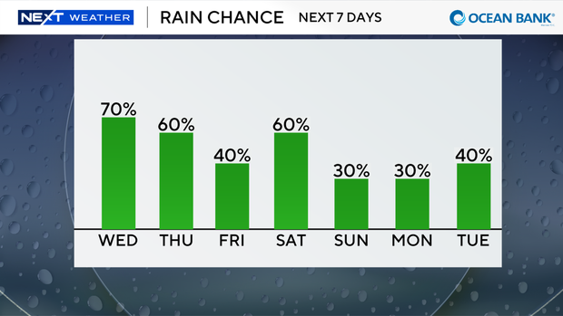
Lower rain chances and more sunshine are expected on Sunday.
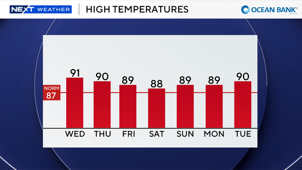
High temperatures will remain near 90 degrees through early next week.
Tropical Storm Isaias expected to strengthen into hurricane in Gulf
The CBS News Miami NEXT Weather team is tracking Tropical Storm Isaias in the Gulf.
It's expected to become the first hurricane of the 2026 Atlantic hurricane season by early Thursday morning.
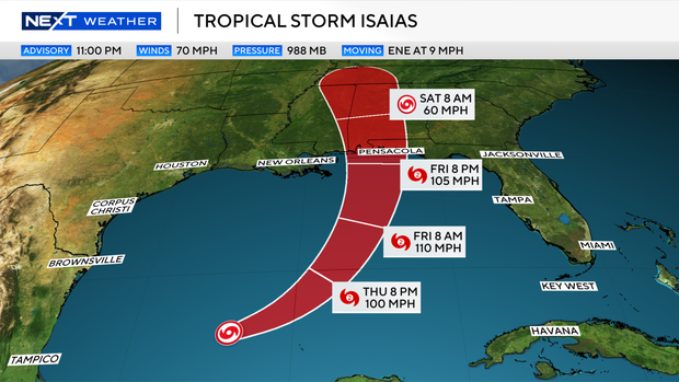
Isaias is moving to the east-northeast but is expected to turn to the northeast and then lift north later this week.Isaias is forecast to make landfall along the northern Gulf Coast by late Friday or early Saturday morning.
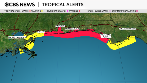
The Hurricane Watch has been upgraded to a Hurricane Warning from Ocean Springs, Mississippi, to the Bay-Gulf county line in Florida.
Tropical Storm Warnings have been issued from west of Ocean Springs to Jefferson Parish, Louisiana. Tropical Storm Warnings also extend east of the Bay-Gulf county line in Florida to the Aucilla River. The remainder of the coast previously under a Hurricane Watch is now under a Tropical Storm Warning.
Additionally, the Storm Surge Watch has been upgraded to a Storm Surge Warning from the mouth of the Mississippi River to the Steinhatchee River, Florida.