South Florida stays dry Thursday morning before more storms pop up for evening commute

We're enjoying a dry start to the day in South Florida but keep the umbrellas handy because the CBS News Miami NEXT Weather team is expecting scattered showers and storms to develop on Thursday afternoon and evening due to a frontal boundary stalled to the north.
With plenty of moisture in place, some storms could produce heavy downpours and localized flooding in spots.
High temperatures should climb to about 90 degrees on Thursday afternoon.
Dry air will start to move into the area on Friday and that will help to lower our rain chances.
The breeze will build on Saturday and there will be a chance of some showers and storms. Sunday will be the drier day of the weekend with more sunshine and just a few showers and isolated storms possible.
The chance of rain will say low through Monday for Columbus Day.
Hurricane Isaias approaches Florida Panhandle, Gulf Coast
The CBS News Miami NEXT Weather team is also keeping an eye on Hurricane Isaias in the Gulf.
As of Thursday morning, Hurricane Isaias is a Category 1 hurricane with maximum sustained winds of 80 mph and is moving to the east-northeast at 9 mph.
NOAA Hurricane Hunters have found Isaias to be getting stronger and is expected to strengthen into a Category 2 hurricane.
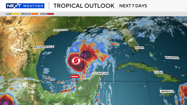
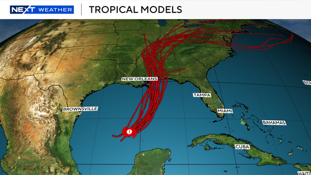
Isaias is expected to make a turn to the northeast later on Thursday and then move northward on Friday.
Isaias is expected to make landfall along the northern Gulf Coast on Friday night or early Saturday morning.
A hurricane warning is in effect from Ocean Springs, Mississippi to the Bay/Gulf County line in Florida.
A tropical storm warning is in effect for the Jefferson/Plaquemines Parish in Louisiana, to west of Ocean Springs, Mississippi and east of the Bay/Gulf County line to Aucilla River, Florida.
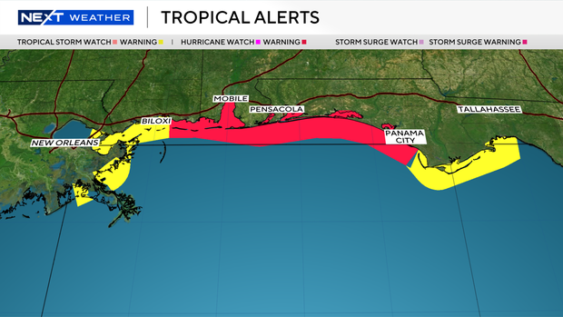
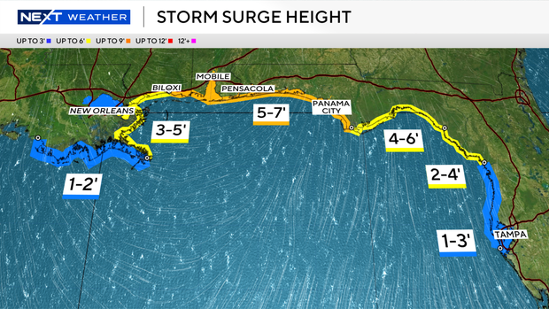
A storm surge warning is in effect from the mouth of the Mississippi River to the Steinhatchee River, Florida, due to the potential of a 3-to-5-foot storm surge with some areas possibly seeing a storm surge of up to 7 feet.
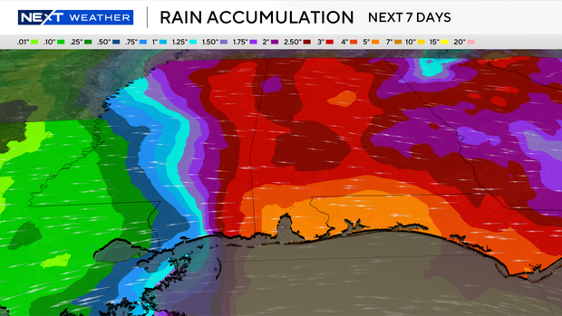
From Friday through the weekend, Isaias is expected to produce rainfall amounts of 3 to 7 inches, with localized totals up to 10 inches, across the central U.S. Gulf Coast extending from far southeastern Louisiana to the Florida Panhandle.
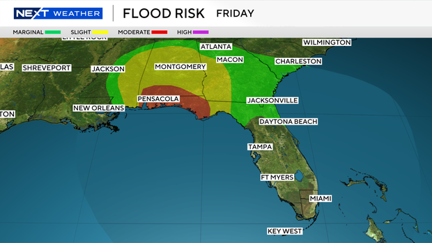
There is a moderate risk of excessive rainfall for southern Alabama and the western Florida Panhandle.
Rainfall amounts of 1 to 3 inches, with localized amounts of up to 5 inches, are possible across much of the Southeast as far north as the Tennessee Valley and the Carolinas.
Flash and urban flooding, along with isolated river flooding, will be possible.