South Florida stays steamy Thursday as NEXT Weather team monitors Atlantic for tropical development

Miami-Dade students are heading back to school on Thursday, and it's going to be another hot and humid day across South Florida.
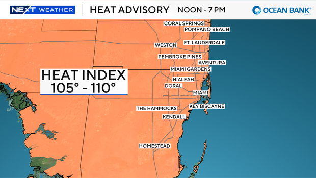
A heat advisory has been issued once again for Miami-Dade and Broward counties from 12 p.m. until 7 p.m. as high temperatures rise to the low 90s. It will feel like 105 to 110 degrees when you factor in the humidity.
It's been mainly dry and it was a warm start to the day for school drop-off and the drive to work.
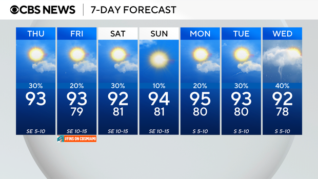
Be sure to pack the ponchos in the backpacks and take your umbrella as some showers and thunderstorms are expected to develop on Thursday afternoon around the time kids get out of school.
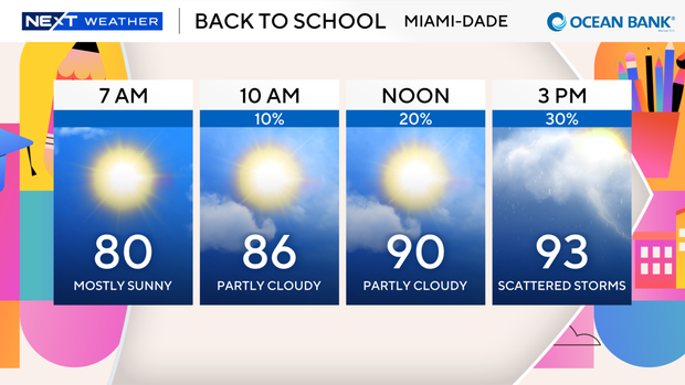
On Thursday evening we may have some passing thunderstorms during the drive home from work.
The summer sizzle will stick around through Friday with high temperatures in the low 90s and heat indices in the triple digits again with the potential for spotty storms.
Saharan dust and drier air will move in this weekend and lead to hazy skies and lower our rain chances.
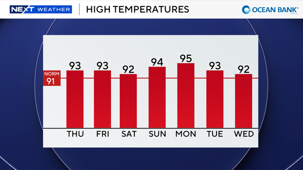
Mother Nature turns up the heat as highs climb to the low to mid 90s Sunday into early next week.
The CBS News Miami NEXT Weather team is tracking three areas in the tropics.
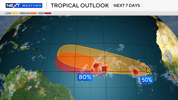
Tropical Depression Cristobal is located about 600 miles west of the Azores and is expected to dissipate later today in the cooler waters of the subtropical Atlantic.
A tropical wave located about 1,000 miles east of the Lesser Antilles is showing signs of organization and has a high potential of becoming a short-lived tropical depression during the next day or two as it moves westward across the Atlantic.
By late Friday, this system is expected to move into a region of strong wind shear and dry air associated with Saharan dust.
Regardless of development, heavy rain and gusty winds are expected to impact the Lesser Antilles Friday night into Saturday.
Another tropical wave located in the eastern Atlantic a few hundred miles south-southwest of the Cabo Verde Islands has a medium potential of developing into a tropical depression late this week or this weekend while the wave moves westward or west-northwestward across the eastern and central tropical Atlantic.