Tropical development in Gulf looking more likely as rain, storm chances return to South Florida

Rain will return to South Florida on Tuesday as a frontal boundary sags southward and provides plenty of moisture.
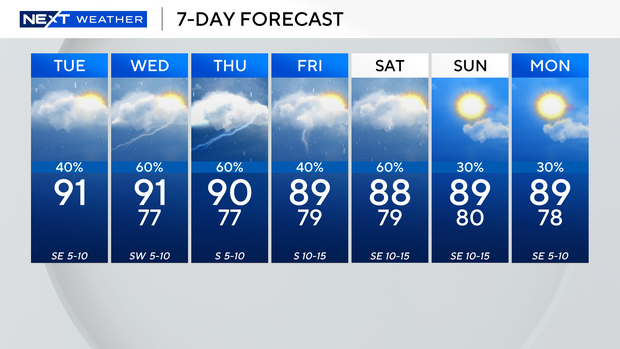
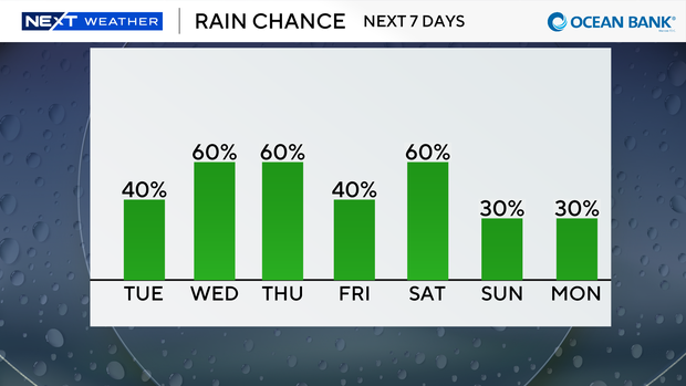
It was mainly dry on Tuesday morning across South Florida, but later in the afternoon and evening, thunderstorms are expected to develop, bringing the potential for some heavy downpours.
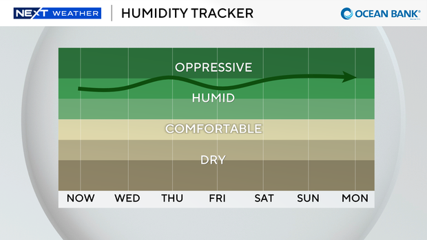
Another hot and steamy day is expected on Tuesday with high temperatures in the 90s and feels-like temperatures in the upper 90s when you factor in the humidity.
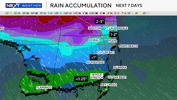
Be sure to keep the umbrella handy as the chance of rain is expected to be higher over the next few days.
In addition, higher-than-normal king tides will lead to some minor coastal saltwater flooding mid- to late-week.
Another round of wet weather is expected on Wednesday with more storms expected.
Scattered to numerous thunderstorms are likely on Thursday.
It won't be as soggy this weekend, but some passing storms are also possible.
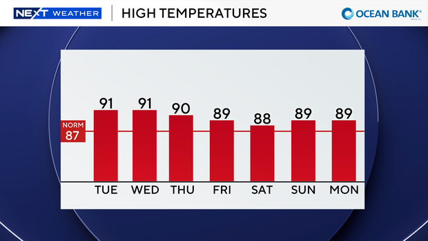
Highs are expected to remain near 90 degrees.
Is a new tropical storm going to form in the Gulf this week?
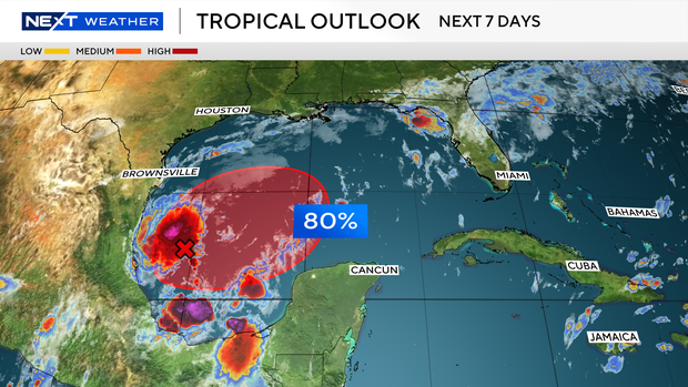
The CBS News Miami NEXT Weather team is also tracking a disturbance in the southwestern Gulf.
The broad area of low pressure is starting to show signs of organization.
The National Hurricane Center (NHC) in Miami is giving the system a high potential of becoming our next tropical depression over the next day or two as it drifts eastward.
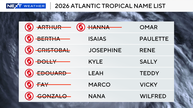
The next name on the 2026 Atlantic hurricane season list is "Isaias."
Regardless of development, the system could bring gusty winds and heavy rain to the western portions of the Yucatan Peninsula of Mexico in a few days.
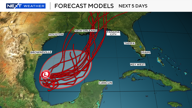
The disturbance is expected to turn north or northeast toward the northern Gulf by the end of the week.
It's too soon to determine specific impacts to the Gulf states, but residents who live in the Florida Panhandle should monitor the system closely.
Many forecast models indicate the system could move in the general direction of the Gulf coast states or near the Florida Panhandle.
The disturbance doesn't pose a threat to South Florida currently.
The CBS News Miami NEXT Weather team will continue to monitor the forecast and keep you updated on-air and online.