Tropical development possible in Atlantic as South Florida braces for wetter Wednesday

It's going to be a wetter Wednesday in South Florida as rounds of rain and thunderstorms push through the area during the morning hours.
That trend is expected to continue, but the highest rain chance on Wednesday will be around midday and through the afternoon and evening hours.
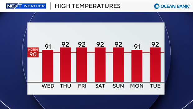
As high temperatures climb to the low 90s this afternoon, the heating of the day and moisture will fuel scattered storms later today that could produce heavy downpours, lightning and gusty winds.
There is a low risk of rip currents, and the UV index is high to extreme. There are no alerts or advisories for boaters over the Atlantic or Keys waters.
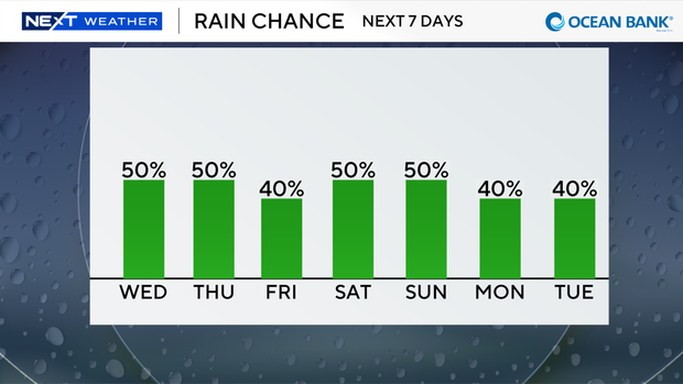
We remain unsettled with higher rain chances and daily scattered storms late week into the weekend. Highs will stay seasonably hot in the low 90s with feels-like temperatures in the upper 90s and 100s.
The CBS News Miami NEXT Weather team is also monitoring the Atlantic for possible tropical development.
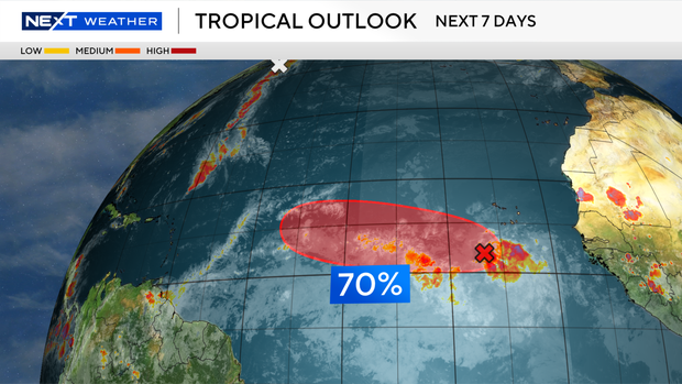
An area of low pressure associated with a tropical wave located a few hundred miles south-southwest of the Cabo Verde Islands is producing showers and thunderstorms.
This disturbance has a 70% chance, a high potential, of development.
Environmental conditions remain somewhat favorable for development over the next couple of days, and the National Hurricane Center says a tropical depression is likely to form over the next day or two.
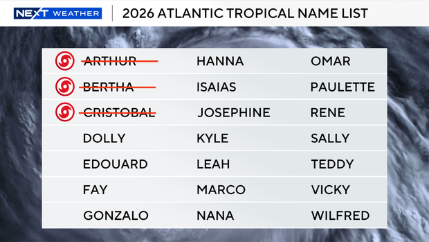
If this wave strengthens into a tropical storm, the next name on the list is Dolly.
Forecast models are in agreement this system will generally move westward to west-northwestward across the eastern and central tropical Atlantic over the next few days.
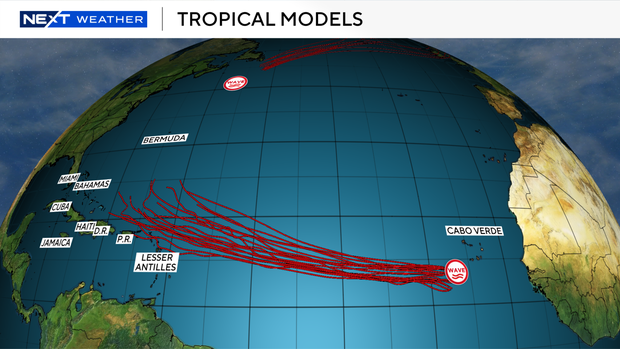
But late weekend into early next week, there is some uncertainty regarding the track and intensity.