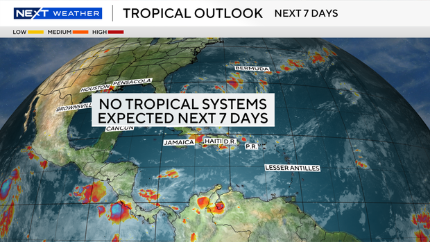
Rounds of rain, thunderstorms to soak South Florida heading into start of September

It's a soggy start to September across South Florida, so keep those umbrellas close by because more rounds of rain and thunderstorms will be rolling across the region on Tuesday.
A few showers and storms moved in earlier on Tuesday morning, and more are expected to develop during the day.
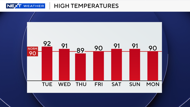
High temperatures are expected to climb into the low 90s on Tuesday.
The chance of rain and thunderstorms will be even higher on Wednesday and Thursday, with more widespread storms expected due to the moisture associated with the remnants of what was once Tropical Storm Dolly.
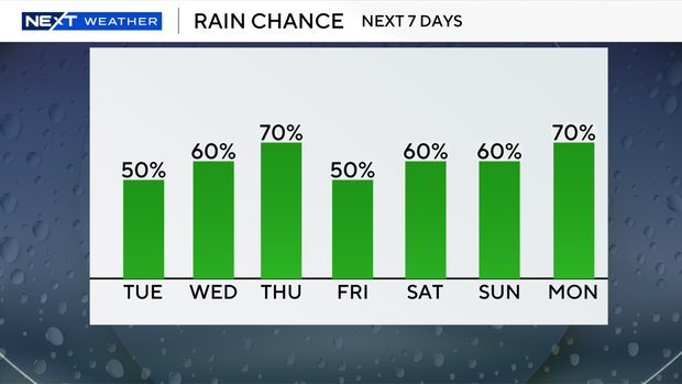
Heavy downpours and localized flooding will be possible. It won't be quite as hot due to the cloud cover and wet weather.
The CBS News Miami NEXT Weather team is also keeping its eyes on Tropical Storm Edouard.
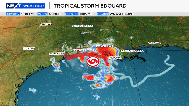
As of Tuesday morning, Edouard is located about 65 miles south-southeast of Cameron, Louisiana, and was moving west-northwest at 8 mph with maximum sustained winds of 40 mph.
The National Hurricane Center says Edouard could strengthen significantly to near hurricane strength before making landfall later Tuesday along the northwestern Gulf coast.
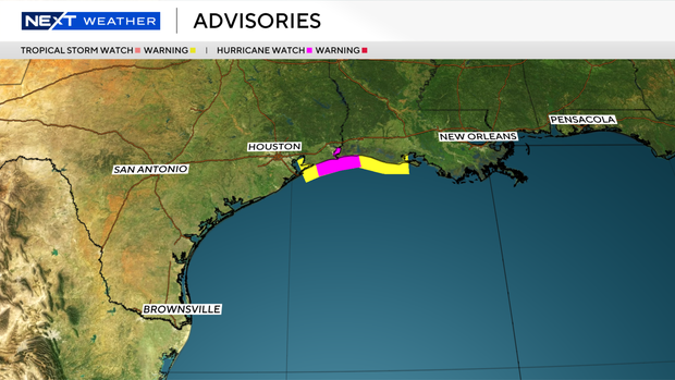
A hurricane watch and storm surge warning have been issued in addition to a tropical storm warning.
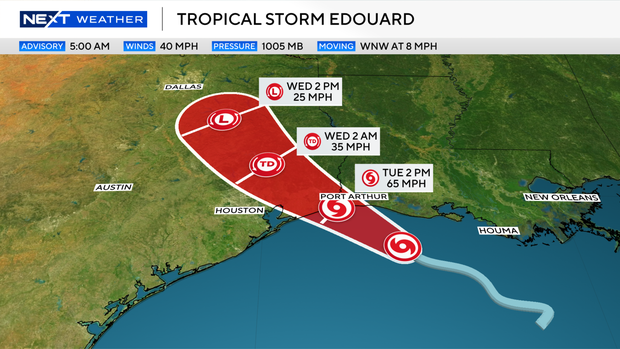
Edouard is expected to produce rainfall totals of 3-6 inches with maximum totals of 9 inches for parts of the Upper Texas Coast inland through east-central Texas, with the potential for 2-4 inches in far southwestern Louisiana.
This rainfall is likely to produce flash flooding, especially in low-lying and urban areas. River flooding may also be possible.