Odds of tropical development grow in Gulf as higher rain chances return to South Florida this week

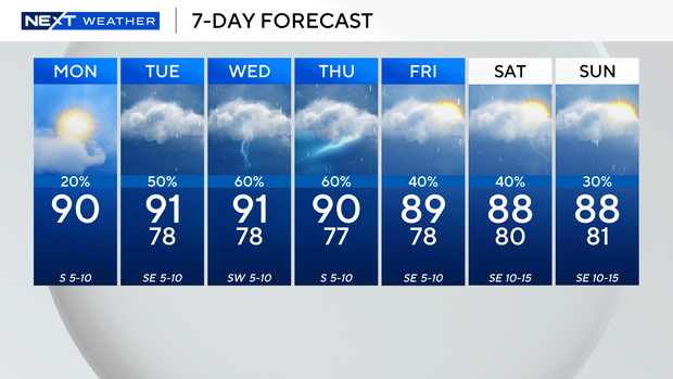
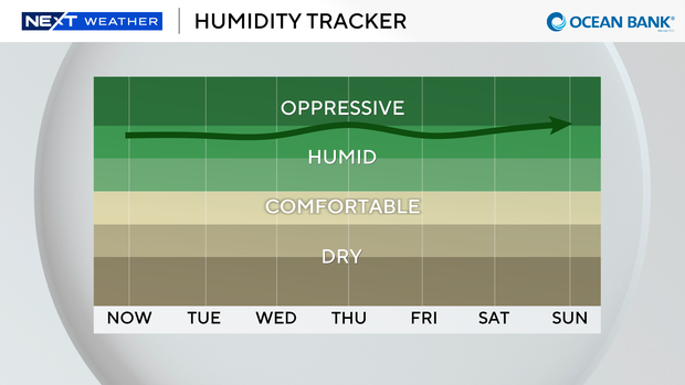
It's going to be a hot and humid start to the week with high temperatures around 90 degrees and feels-like temperatures in the upper 90s and triple-digits.
A few showers rolled through the region on Monday morning, but the chances of rain during the day remain low.
Thunderstorms that develop in the afternoon will mostly be inland and off to our west over the Everglades.
There is a low risk of rip currents along our Atlantic beaches. There are no alerts or advisories for boaters along the Atlantic waters or Keys waters.
The chances of rain and thunderstorms will rise across South Florida over the next few days due to plenty of moisture around that's associated with a frontal boundary and an area of low pressure draped across North Florida.
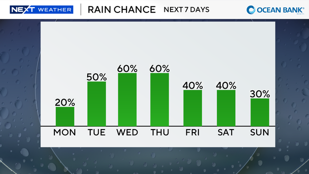
Scattered to numerous thunderstorms are expected Tuesday, Wednesday, and Thursday with some heavy downpours possible in some spots.
High temperatures will remain near 90 degrees.
Later in the week the chance of rain will begin to decrease gradually. This weekend won't be a washout as only some spotty storms are expected on Saturday and Sunday.
CBS News Miami NEXT Weather team monitoring Gulf for possible development
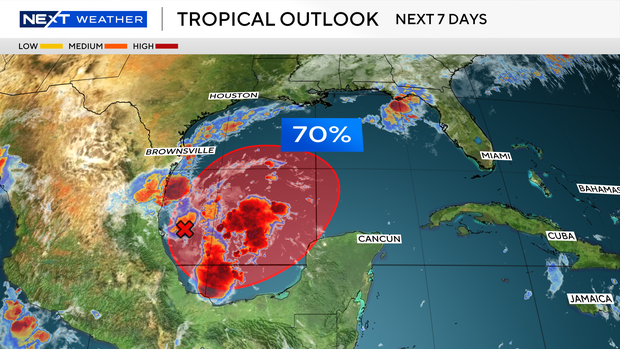
The CBS News Miami NEXT Weather team is tracking a trough of low pressure in the southwestern Gulf.
The National Hurricane Center said that the system has a high potential of becoming a tropical depression over the middle to end of the week.
This system is not expected to pose a threat to South Florida, but some forecast models are hinting that the system could possibly lift northward and potentially move near the Gulf Coast states later this week.