South Florida continues to swelter as NEXT Weather team monitors likely tropical development in Atlantic

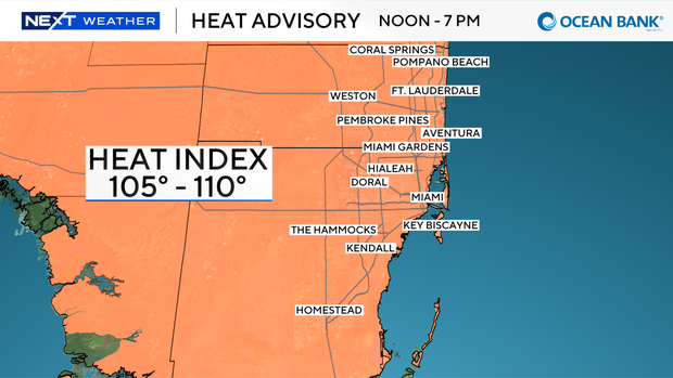
Another heat advisory has been issued in Broward and Miami-Dade counties from 12 p.m. until 7 p.m. due to heat indices of 105 degrees to 110 degrees.
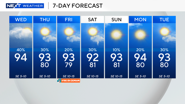
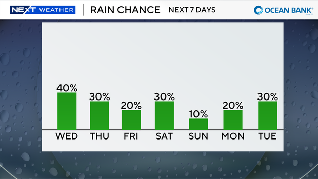
The difference today, however, is that the chance of rain is higher with the potential for some wet weather to bring some relief later Wednesday.
It was mainly dry in South Florida on Wednesday morning, but scattered showers and thunderstorms will develop as the breeze will be lighter and we will have more moisture around.
There is a low risk of rip currents along our Atlantic beaches. There are no alerts or advisories for boaters over the Atlantic waters or the Keys waters.
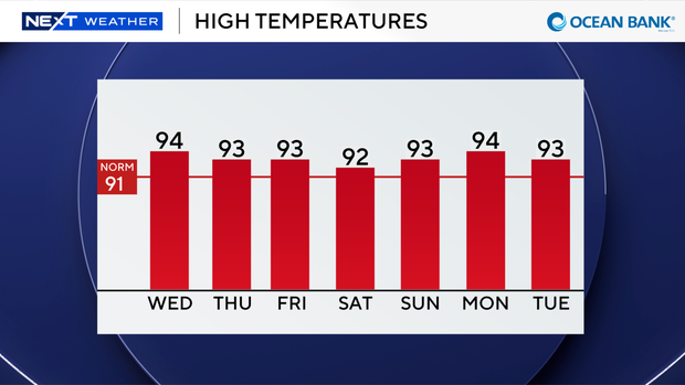
On Thursday we will see spotty showers and a few storms with high temperatures soaring into the low to mid-90s. It will feel like the 100s when you factor in the humidity.
Later this week and into the weekend, Saharan dust and drier air moves in the lower the rain chances. The summer heat continues with highs in the low 90s.
The CBS News Miami NEXT Weather team is tracking three areas in the tropics.
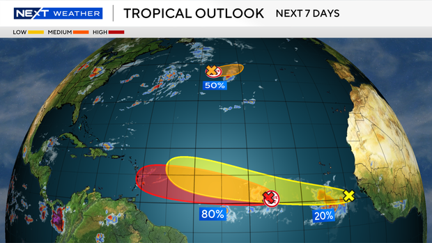
The area we will be monitoring most closely is tropical wave in the central Atlantic located about 800 miles southwest of the Cabo Verde islands.
This system has a high potential of becoming a tropical depression within a couple of days while this system moves westward to west-northwestward across the central tropical Atlantic.
This weekend and early next week this area will encounter some strong wind shear and drier Saharan dust.
Another wave in the central subtropical Atlantic has a medium potential of development over the next seven days, but this system is expected to move eastward to east-northeastward away from the U.S.
The system is forecast to reach cooler waters by Thursday, ending its chances of formation.
And in the eastern Atlantic, a tropical wave just offshore of the coast of west Africa is producing disorganized showers and thunderstorms.
Environmental conditions are forecast to be generally conducive for some development of this system during the next several days while it moves westward or west-northwestward across the eastern and central tropical Atlantic.
This system has a low potential of development over the next seven days.