NEXT Weather team monitors potential tropical activity in Atlantic as South Florida stays steamy

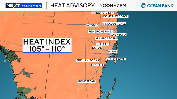
A toasty Tuesday ahead in South Florida with another heat advisory issued for Broward and Miami-Dade counties from noon until 7 p.m.
High temperatures will soar to the low to mid 90s this afternoon, and it could feel like 105 to 110 degrees when you factor in the humidity.
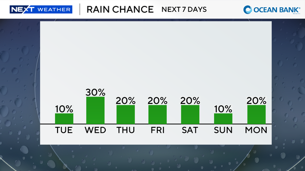
The chance of rain is low on Tuesday as only stray showers will be possible. The onshore breeze will steer storms to the west later on Tuesday.
There is a low risk of rip currents along our Atlantic beaches and there are no alerts or advisories for boaters over the Atlantic waters or the Keys waters.
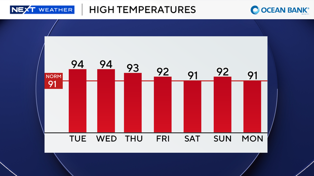
Wednesday will be another scorcher with highs near the mid 90s and heat indices in the triple-digits. The chance of rain increases a bit with the potential for spotty showers.
Late-week drier air moves in and Saharan dust will keep our rain chances low. A few showers will be possible every day with more seasonable highs in the low 90s through the weekend.
The CBS News Miami NEXT Weather team is tracking three areas in the tropics.
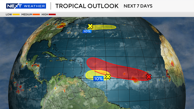
An area of low pressure in the Central Atlantic located about 500 miles southwest of the Cabo Verde Islands has a high potential of developing into a tropical depression during the latter half of this week while this system moves westward to west-northwestward across the Atlantic Ocean.
This system is expected to encounter some wind shear and Saharan dust. It will be closely monitored over the next week or so.
The second area is a tropical wave located about 600 miles east of the Windward Islands.
The National Hurricane Center says this system is expected to encounter dry air as it approaches the Windward Islands and development is not expected.
Locally heavy rain and gusty winds will be possible over the Lesser Antilles during the next couple of days.
And the third area is a trough of low pressure in the sub-tropical Atlantic located several hundred miles northeast of Bermuda.
Some development of this system is possible during the next day or so while it moves eastward at around 20 mph across the central subtropical Atlantic.
This system has only has a 10% chance of development as it is expected to reach cooler waters later this week.