King tides could lead to some saltwater flooding in South Florida as region braces for more rounds of showers, storms

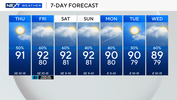
Scattered showers and thunderstorms are expected in South Florida once again on Thursday, with some wet weather pushing through earlier in the day.
A few storms that develop could turn stronger later in the afternoon with the potential for some heavy downpours and localized flooding.
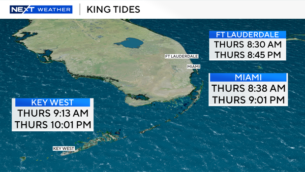
In addition, King tide saltwater flooding is possible along low-lying, vulnerable areas along the coast during times of high tide.
The high tide occurred in Miami and Fort Lauderdale around 8:30 a.m., and the high tide in Key West was at 9 a.m.
King tides will continue over the next few months through December.
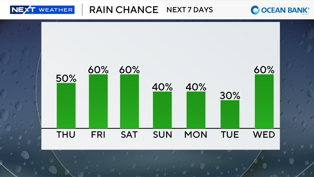
The chance of rain will remain high through the weekend with scattered showers and thunderstorms expected every day.
High temperatures will stay in the low 90s with feels-like temperatures in the upper 90s and low 100s.
It won't be until early next week that the rain chances decrease a bit due to Saharan dust moving into the region around Tuesday.
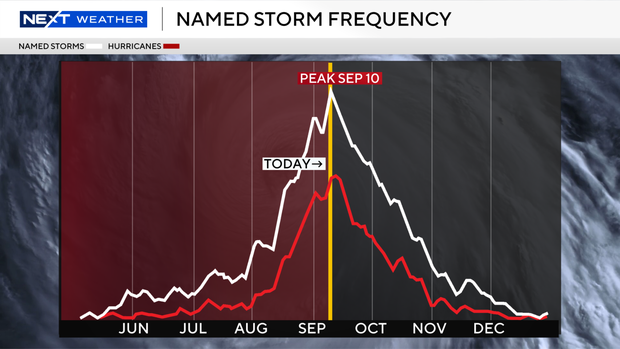
We've also reached the peak of the 2026 Atlantic hurricane season, and tropical development isn't expected over the next seven days.
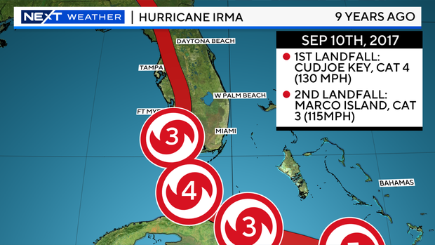
Thursday marks nine years since Hurricane Irma made landfall on Cudjoe Key as a Category 4 hurricane with winds of 130 mph on Sept. 10, 2017.
Since we have not had a hurricane develop so far this season, this marks the first time in the satellite era with no hurricanes by the peak of the Atlantic season.
The last time we saw a hurricane form this late was back in 1941.
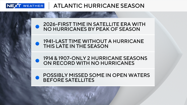
It's possible that we missed some of them in the open water of the Atlantic without satellites.
The years of 1907 and 1914 were the only two hurricane seasons on record with no hurricanes, although we may have missed some of them in the open waters before satellites.