South Florida to see more rounds of rain, storms as Tropical Storm Dolly forms in Atlantic

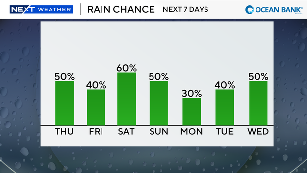
Keep the rain gear handy on Thursday as South Florida will once again face threats of seeing passing showers and thunderstorms during the day.
High temperatures are expected to climb into the low 90s on Thursday, and it will feel like the upper 90s and 100s when you factor in the humidity.
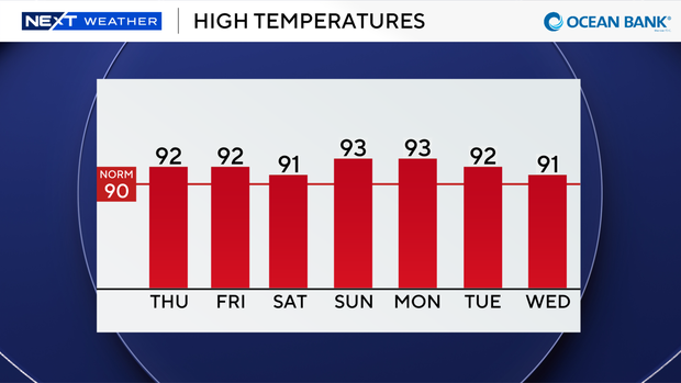
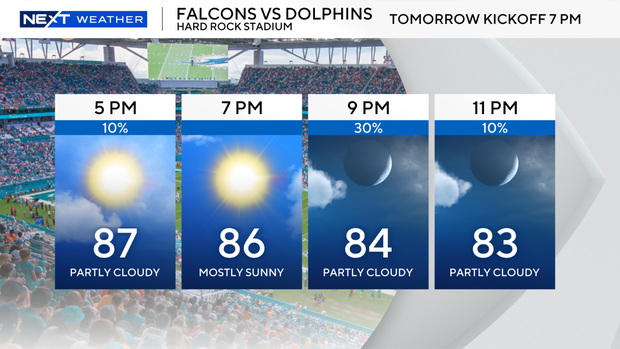
Conditions were mainly quiet on Thursday morning, but that's expected to change when wetter weather moves in around midday and then becomes more widespread during the afternoon hours with some storms possible through the evening.
Don't forget to look up into the sky on Thursday night to enjoy the deep partial lunar eclipse. During a lunar eclipse, the Earth slides between the Sun and the Moon, casting a giant shadow over the lunar surface.
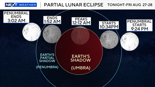
At its peak tonight, the Earth's shadow will cast its shadow on more than 96% of the lunar surface.
The moon will catch some filtered sunlight from Earth's atmosphere and will glow a coppery orange and red, which is why it's often called the "Blood Moon."
Lunar eclipses start with a subtle kind of eclipse called a penumbral eclipse. That's when the Moon is in the lighter part of Earth's shadow, called the penumbra, which starts at 9:24 p.m.
You probably won't notice it at first. But, as the eclipse progresses, you should see a subtle shading on the moon.
When the partial eclipse begins at 10:33 p.m., it'll appear as if a tiny, but dark, bite is taken from one edge of the moon. At maximum eclipse at 12:12 a.m., about 96% of the moon's disk will lie inside Earth's dark umbral shadow. But there might be a few showers and some clouds around midnight and overnight.
The partial eclipse will end at 1:51 a.m.
You don't need any special equipment to view a lunar eclipse. Lunar eclipses are safe to view with the eye alone. But binoculars and telescopes do enhance the view.
As we head into Friday and the weekend, we remain unsettled with daily scattered storms and highs in the low 90s.
This pattern persists into early next week as we kick off the month of September.
Will Tropical Storm Dolly impact South Florida?
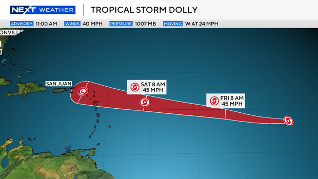
Tropical Storm Dolly has formed in the Central Atlantic and is moving to the west at 24 mph with maximum sustained winds of 40 mph.
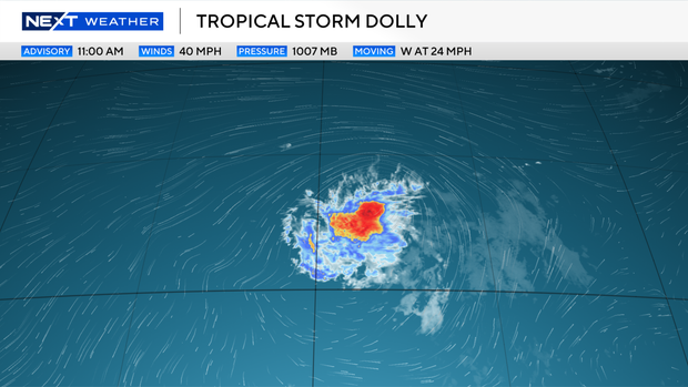
Dolly is expected to continue moving generally westward and maintain tropical storm strength through Saturday.
Dolly is forecast to weaked due to wind shear and become an area of low pressure (an open tropical wave) by late weekend as it moves near or over the Leeward Islands.
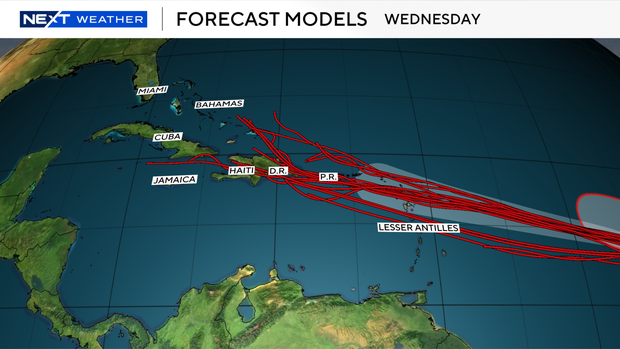
The forecast models diverge and spread out during that time frame as there is some uncertainty regarding Dolly's track.
The CBS News Miami NEXT Weather team will continue to monitor Dolly closely.
The timing of the use of the name Dolly from the 2026 Atlantic hurricane season storm name list is purely coincidental. Tropical storm and hurricane names for the North Atlantic Basin originate from six pre-determined rotating lists established by the World Meteorological Region IV Hurricane Committee.
The name Dolly replaced Diana after the 1990 hurricane season and it was first used in 1996.