Chicago First Alert Weather: Chance of showers
For the middle of the week, a ridge of high pressure parks overhead clearing the sky. It's short-lived though as another sluggish rain maker parks over our region for the upcoming weekend.
Watch CBS News
For the middle of the week, a ridge of high pressure parks overhead clearing the sky. It's short-lived though as another sluggish rain maker parks over our region for the upcoming weekend.
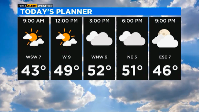
Monday's highs will be in the mid 50s with a mix of sunshine and clouds.
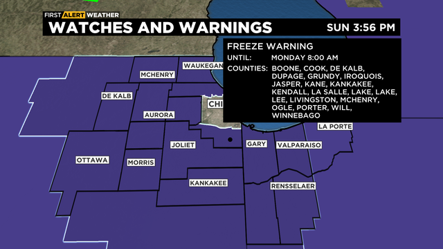
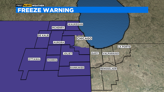
Expect chilly conditions overnight, but slightly warmer days are ahead.
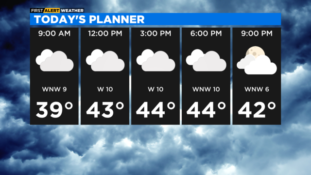
Clouds and chilly temperatures continue for Sunday, but a subtle warm-up is expected into next week
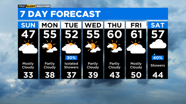
More clouds than sun are in store for the Chicago area for a few days.
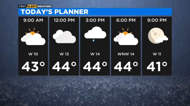
Cool for a few days, then slow to warm up.
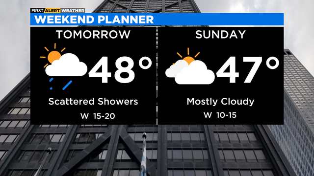
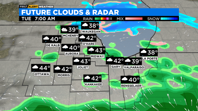
Better organized chance for passing showers tomorrow, with areas near Wisconsin seeing a few snowflakes mixed into the picture.
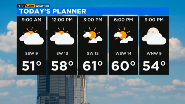
Friday's high temperatures will be in the low 60s with winds gusting 15 to 30 miles per hour.

The threat of severe weather increased Thursday afternoon, and a tornado watch was issued.
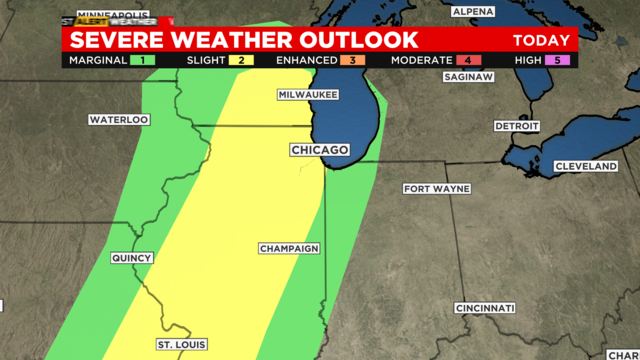
The timing for severe weather heightens from 2 p.m. to 9 p.m.
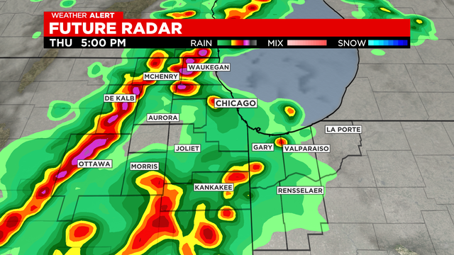
Severe threat is increasing this afternoon. Any storms that form today have the potential for damaging winds and large hail.
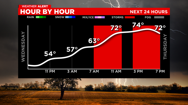
Damaging winds and large hail may accompany the strongest storms.
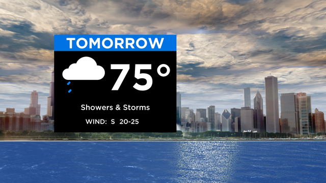
Large hail and damaging winds will accompany the strongest storms on Thursday, according to CBS 2 Meteorologist Mary Kay Kleist.
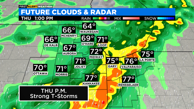
The best chance for storms will be near the Wisconsin state line. Storms that do develop could produce strong winds and hail.
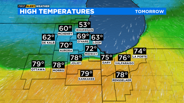
According to CBS 2 meteorologist Mary Kay Kleist, there are uncertainties with how far north the warm front will lift Wednesday, so we expect a huge spread in temperatures.
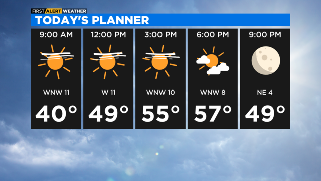
Temperatures start off in the 20s and 30s and end up in the uppermost 50s today.
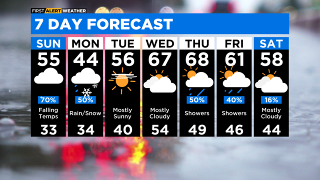
Sunny skies, breezy and milder for Tuesday with highs in the upper 50s.
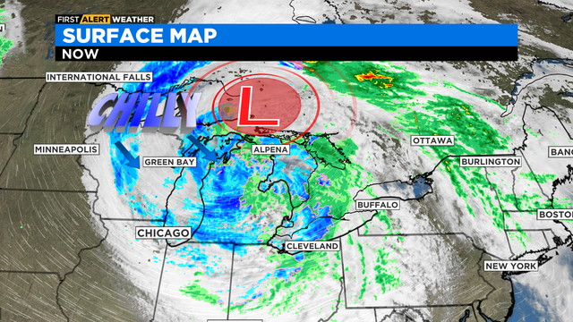
Next storm chance arrives mid-week, with a storm chance Wednesday and increasing rain and thunder for Thursday.
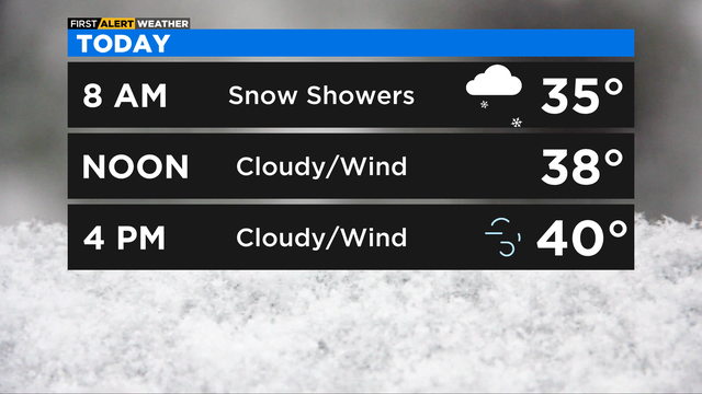
Highs in the 40s but winds will make it feel more like the teens and 20s. It gets better the rest of the week.
Sunday night brings snow showers and a low temperature of 33 degrees.
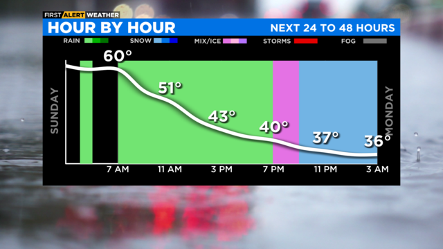
Temperatures will drop throughout the day, with showers likely.
A threat of severe weather will remain mostly southwest of the Chicago area.
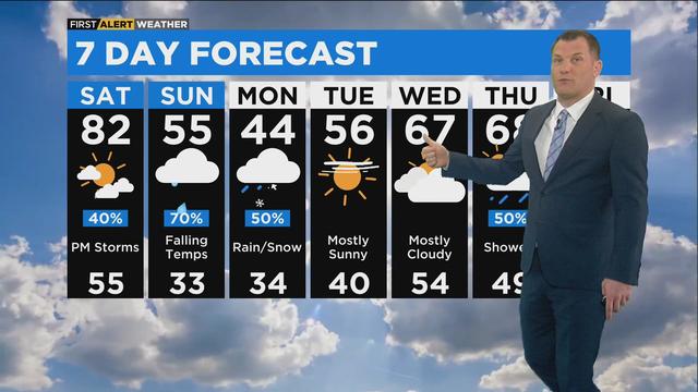
Our warm temperatures are about to come to an end, so enjoy Saturday's 80s while you can.
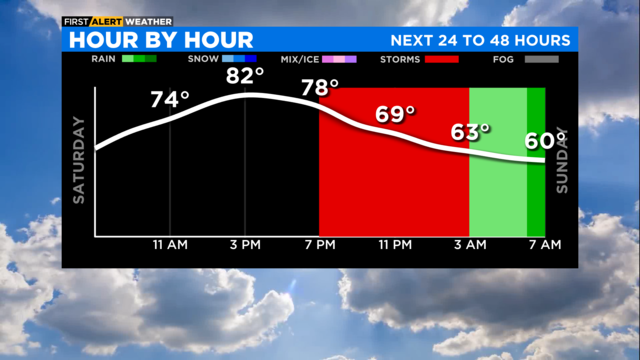
Our warm temperatures are about to come to an end, so enjoy Saturday's 80s while you can.

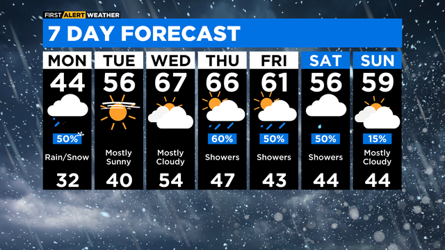
Monday will start out with temperatures in the mid 30s and a chance for wet snow and rain. Highs will be in the low 40s.