Threat of downpours Friday before coldest air of season arrives for weekend
There's a risk of downpours and thunderstorms in the Boston area Friday before the coldest air of the season arrives this weekend.
Watch CBS News
There's a risk of downpours and thunderstorms in the Boston area Friday before the coldest air of the season arrives this weekend.
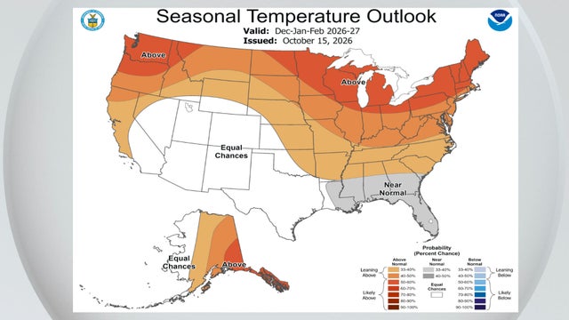
NOAA's National Weather Service announced its winter outlook Thursday and there were no big surprises for Massachusetts.
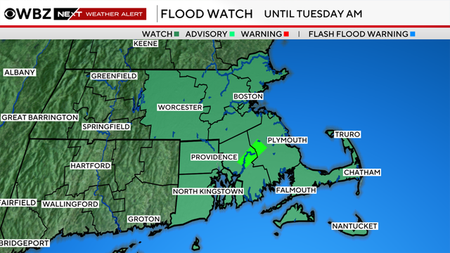
Despite the storm gradually winding down, some minor impacts are still expected from flooding to coastal concerns.
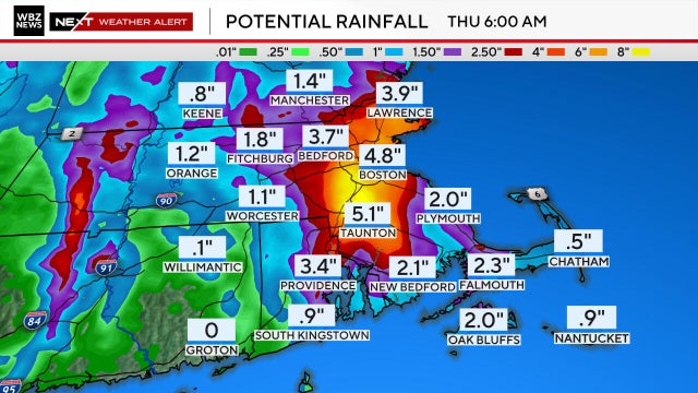
Periods of torrential downpours are expected in the Boston area with rainfall rates capable of overwhelming storm drains causing flooding.
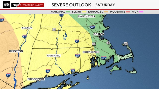
The WBZ-TV Weather Team has issued a Next Weather Alert for storms for the Boston area through 11 p.m. Saturday
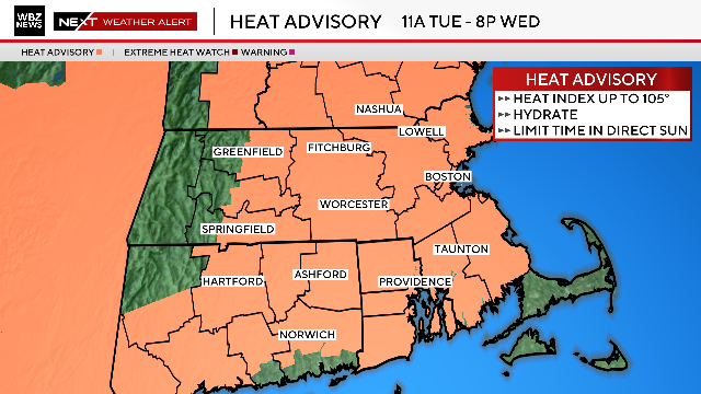
The National Weather Service has issued a Heat Advisory for most of Massachusetts until 8 p.m. Wednesday.
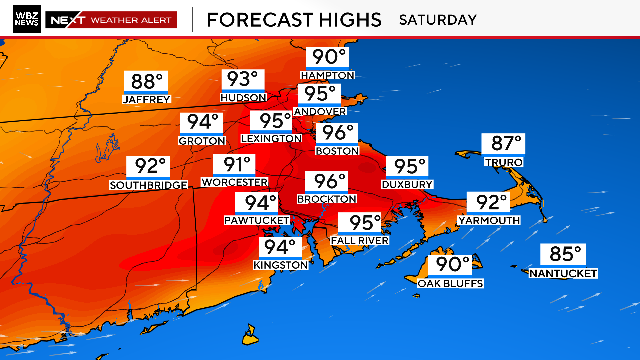
Boston made it back-to-back days hitting 100 degrees. Thunderstorms could be on the horizon for July 4th, threatening fireworks displays across Massachusetts.
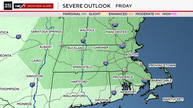
A few isolated thunderstorms Friday afternoon could present frequent lightning and strong winds.
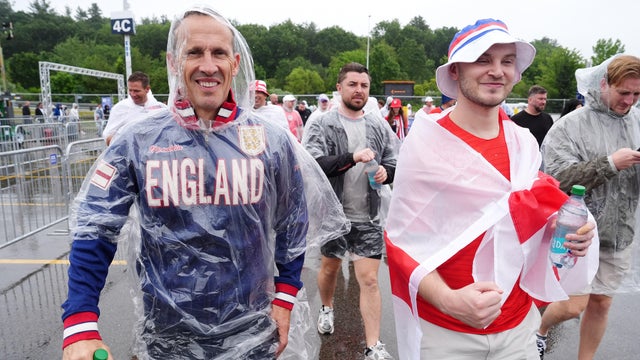
More scattered rain is expected through Tuesday evening into the first half of the night and it could impact the World Cup match in Foxboro.
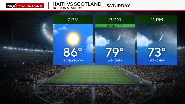
There's good news in the weather forecast for Scotland vs. Haiti, the first World Cup match scheduled at Boston Stadium.
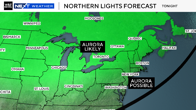
The northern lights could be visible in parts of Massachusetts tonight due to several huge solar flares.
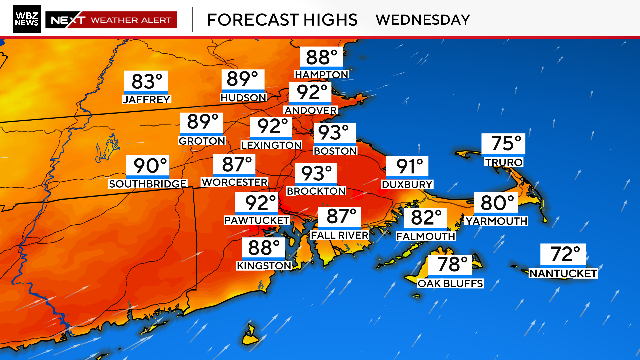
Boston set a new high temperature record on Tuesday, and Wednesday will be another scorcher.
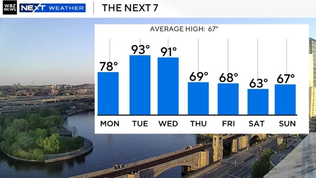
Temperatures are warming up in Boston this week with the city's first 80 and 90-degree days in over 200 days.
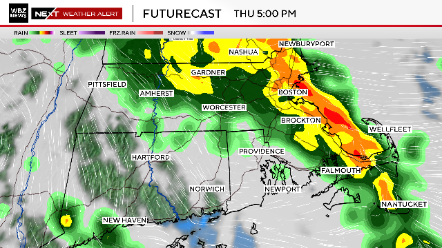
Periods of heavy rain are expected throughout the day on Thursday in southern New England.
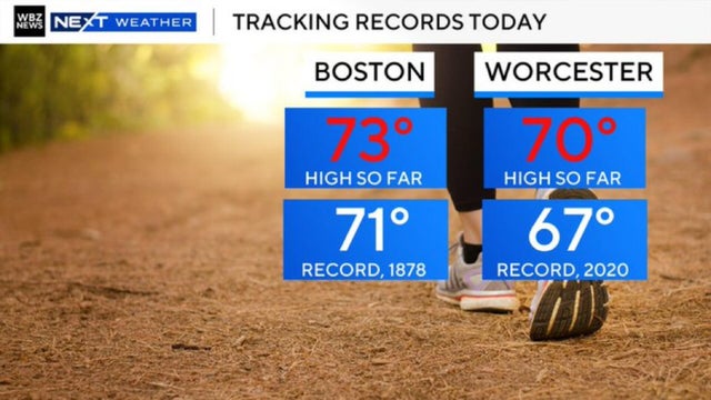
There will be numerous towns topping 70 on Tuesday, and a new record was set in Boston.
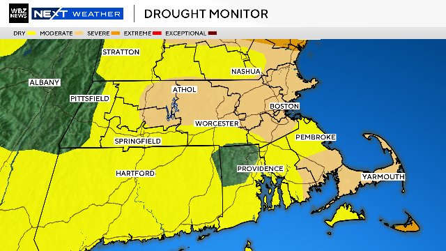
After all the snow that fell in Massachusetts this winter, how could the state possibly still be in a drought to start spring?
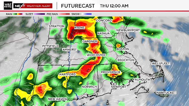
The WBZ Weather Team is issuing a NEXT Weather Alert for the likelihood of some thunderstorms Wednesday night into Thursday morning.
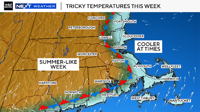
Many people in Massachusetts will be getting their first real taste of summer this week.
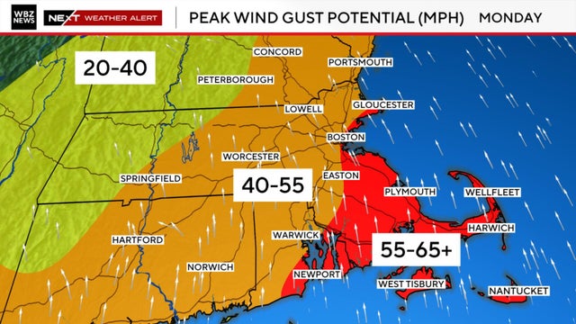
The Boston area and much of southern New England is heading into an active stretch of weather to start the week.
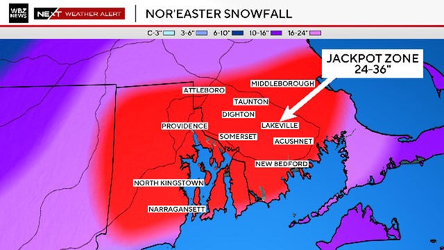
The Blizzard of 2026 left more than three feet of snow in southeastern Massachusetts.
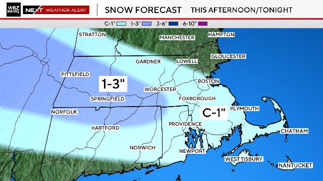
There are three different winter storms that could drop snow in Massachusetts in the next week. The first one is Wednesday evening.
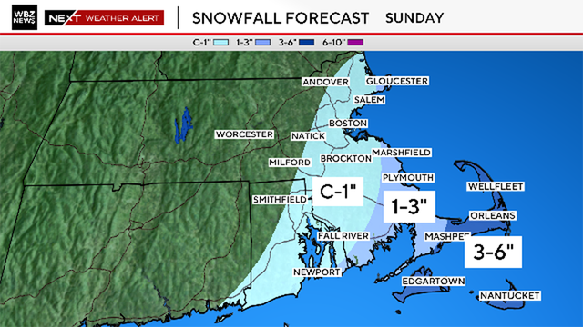
The greats impacts from the bomb cyclone weekend storm in Massachusetts will be felt on the Cape and Islands Sunday.
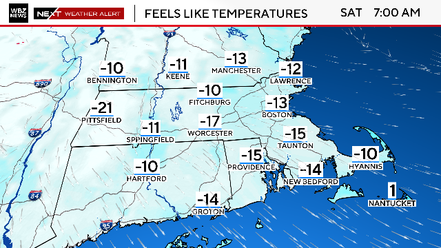
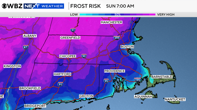
Temperatures bottom out Friday night into early Saturday, dipping well below zero in most area north and west of Boston.
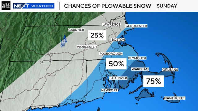
At this point, there are still several possible tracks and scenarios for a weekend nor'easter in Massachusetts.
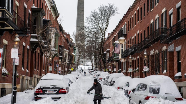
This storm finished in eighth place among the biggest snow storms in Boston's history.