Boston hits 100 degrees for 2nd day in a row as thunderstorms threaten July 4th fireworks forecast
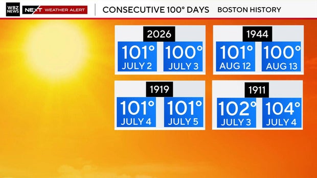
Boston hit 100 degrees again on Friday, one day after a record-setting 101 degree temperature was observed at Logan Airport.
It's the first time Boston has seen back-to-back 100s in 82 years.
July 4th weather forecast
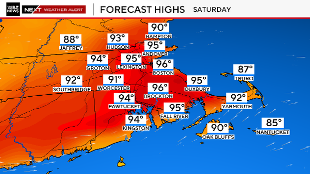
The heat eases just a bit on Saturday with highs generally in the mid 90s. There is a chance of some afternoon relief along the coastline in the form of a sea breeze.
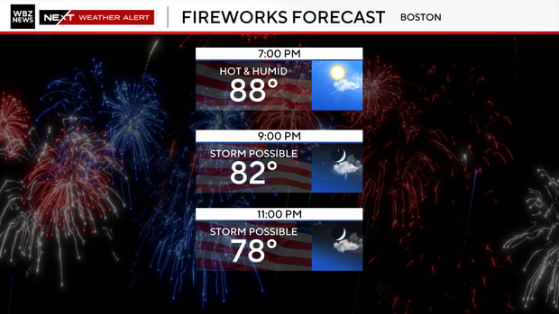
As a cold front slowly drifts south into southern New England, there will be some isolated to scattered storms around this evening, especially from the Boston area and points south.
Many will stay rain-free; however, we can't rule out a gusty thunderstorm with strong winds, heavy rain, and frequent lightning. Timing looks to be from about 8 p.m. to midnight, then lingering a bit later across the Cape and Islands.
You should stay tuned to updated forecasts for more precise timing and track of the storms.
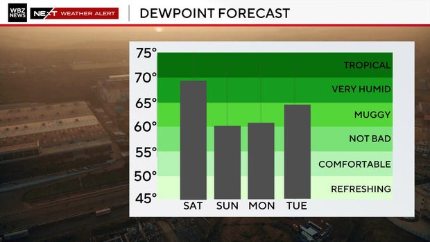
It will turn drier and cooler overnight, with temperatures falling into the 80s this evening before settling into the 60s by morning. You will notice a major change in air mass when you step outside on Sunday morning. Time to re-open the windows.
Sunday will be warm and skies will be partly to mostly cloudy. But showers may start to creep into areas south and west of Boston later in the day.