Heat advisory for Boston area into late Wednesday as temperatures soar into 90s
Another heat wave is arriving in the Boston area this week, with temperatures set to reach near 100 degrees across parts of Massachusetts.
So far, this has been the warmest meteorological summer in Boston's recorded history. This week will only help solidify that status.
The National Weather Service has issued a Heat Advisory for most of southern New England until 8 p.m. Wednesday. The WBZ Weather Team is declaring a NEXT Weather Alert for the combination of high heat and, at times, high humidity Tuesday and Wednesday.
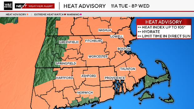
This will be Boston's second heat wave of 2026. An official heat wave requires at least three consecutive days with temperatures of 90 degrees or higher.
Also, with 90+ in the forecast Tuesday through Thursday, that would make 15 days of 90+ this year, the most of any year on record in Boston through July 16.
Why is the sky yellow in Boston?
Curious about that milky sky today? There are some clouds rotating down from Canada, but perhaps even more noticeable is a layer of wildfire smoke.
This is coming from several out of control fires across eastern Canada, and the trajectory Tuesday is perfect to send the smoke right down into New England.
The majority of the smoke is high up in the atmosphere and therefore no threat to our lungs. However, the smoke may work in our advantage, allowing less sun to reach ground level and therefore, keeping our temperatures a few degrees lower than expected.
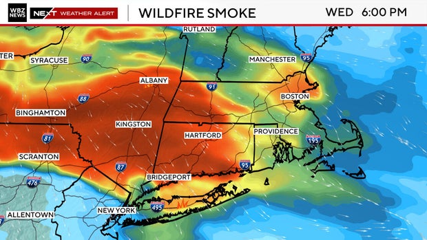
The latest model predictions are for even thicker smoke on Wednesday. This would mean a lowering of high temperatures again tomorrow.
High temperatures on Tuesday
Tuesday will likely be the hottest day of the stretch, temperature-wise as well as heat indices. Highs are expected to reach the mid to upper 90s Tuesday afternoon, just shy of the record high of 100 in Boston.
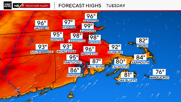
Add in dew points approaching 70 degrees, and it will feel like 100-to-105 degrees.
There will be very little relief Tuesday night. In fact, low temperatures by early Wednesday morning are likely to remain in the 70s, potentially setting a new record for the highest minimum, which is currently 74 degrees.
Wednesday heat
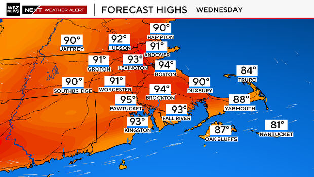
While it will still be hot, temperatures will be a few degrees lower in most of Massachusetts on Wednesday. Highs are expected to top out in the low- to mid-90s.
Even better news: the air will start to feel much drier as dew points drop throughout the day.
Heat wave ends Thursday
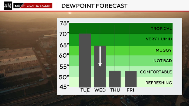
Thursday will be the third and final day of the heat wave. Highs will top out in the low- to mid-90s, but the humidity will be very low, making it feel a bit more comfortable outdoors.


