Enjoy the cooler weather! Triple digits return for Labor Day weekend
As we move through your Tuesday, expect a hot but pleasant day due to the low humidity.
Watch CBS News
As we move through your Tuesday, expect a hot but pleasant day due to the low humidity.
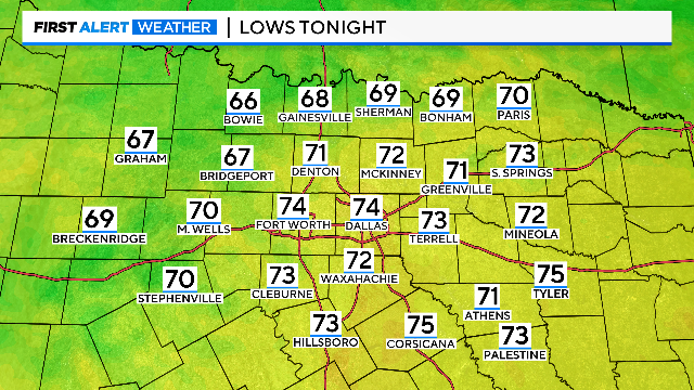
A few spots drop into the 60s overnight with highs in the mid-to-upper 90s Tuesday afternoon.

We're tracking highs in the 90s for much of the work week, but don't get used to it. The triple digit heat returns for your holiday weekend.
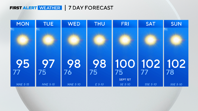
Temperatures stay under 100° for most of the work week ahead.
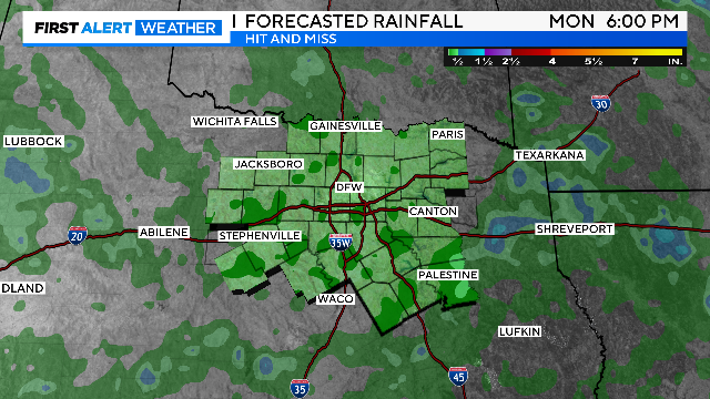
It's the third hottest summer on record with five days left in the month.

An excessive heat warning is in effect for North Texas until 9:00 p.m. Friday night, with feels-like temperatures up to 113 degrees.
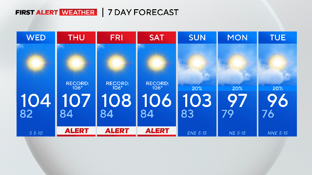
Weather Alerts for excessive heat warnings are expected Thursday through Saturday.
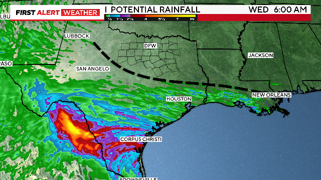
North Texas doesn't get the rain from Harold, just some clouds, higher humidity and gusty winds.
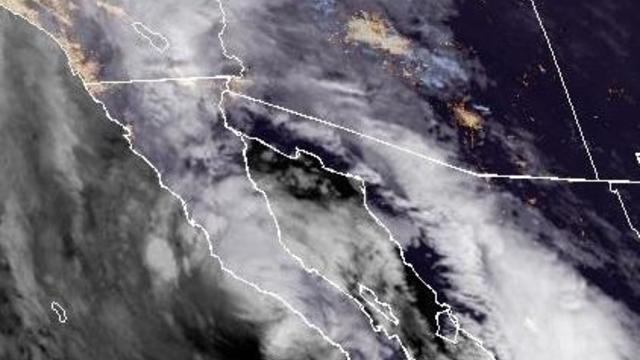
Hilary was downgraded a few hours before landfall to a tropical storm as rain from the storm started spreading in Southern California, the National Weather Service said.
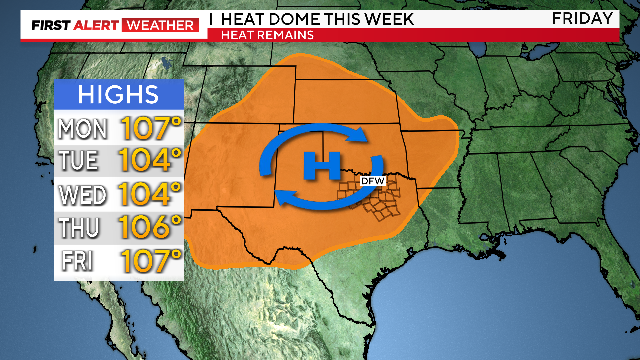
Don't look for relief this week. The heat dome sits over us all week.

People are bracing for what could be a once-in-a-lifetime event, now a double whammy with a confirmed quake.
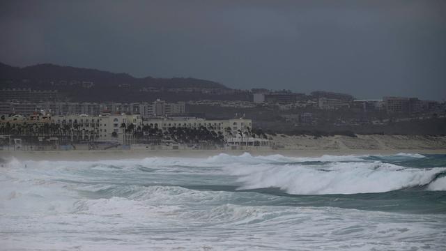
Tropical Storm Hilary has made landfall along Mexico's Baja California coast.

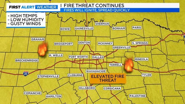
With no rain in sight, we will see more record-breaking temperatures and a high fire risk in North Texas.
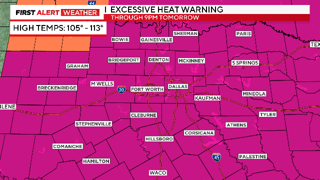
Record and near-record highs ahead this week. No rain in the forecast.
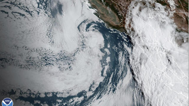
Hilary is expected to plow into the Mexican peninsula on Saturday night and then surge northward and enter the history books as the first tropical storm to hit Southern California in 84 years.
Get ready for more dangerous heat and near-record high temperatures in North Texas through your weekend.
Here we go again! The extreme heat has returned to North Texas.
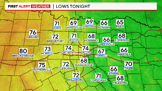
If you missed the gorgeous weather Wednesday morning, you have one more chance Thursday morning to enjoy the cool temperatures.
We're tracking another hot but pleasant day in North Texas. However, the dangerous heat returns tomorrow.
Wednesday is an Ozone Action Day.
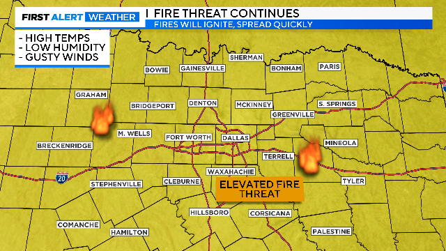
There is still no rain in the forecast for the week ahead and the elevated fire risk continues.

Collin, Dallas, Denton and Tarrant Counties are not under heat alerts, as a cold front pushes through North Texas.
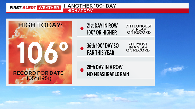
No Excessive Heat Warning for the Metroplex for the first time this month and no Red Flag Warning.
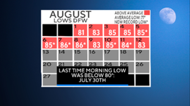
So far this August we are breaking lots of records. Not daytime highs. Nighttime lows.

Highs are expected in the 90s for North Texas as opposed to the 100s.