Cold front brings brief break from extreme heat in North Texas
NORTH TEXAS (CBSNewsTexas.com) - Your CBS News Texas First Alert Weather Team is tracking a brief break from the extreme heat.
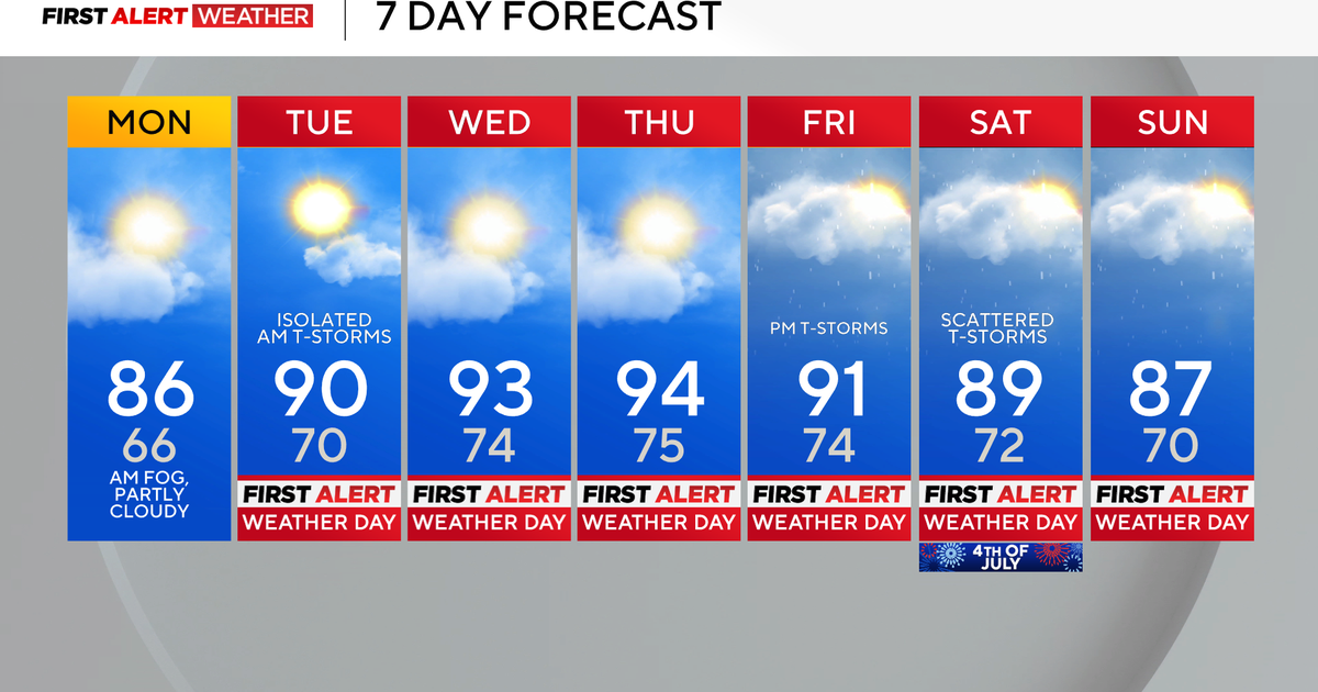
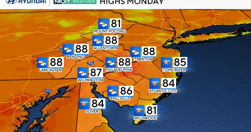
As we move through your Monday, a cold front will push southward through North Texas, giving way to some heat relief and drier air. High temperatures will be in the upper 90s for much of the area, but it will still feel like the triple digits. In fact, some heat alerts are in place for parts of North Texas.

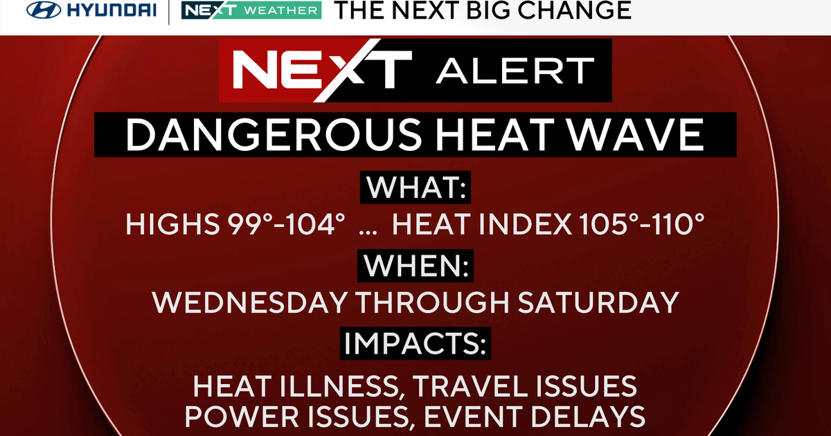
A heat advisory and an excessive heat warning are both in place for counties south of I-20. The heat alerts expire at 9:00 p.m. Monday night. Feels-like temperatures could get as high as 110 degrees, especially for areas under the excessive heat warning. Collin, Dallas, Denton and Tarrant Counties are not under heat alerts at this time.

As the front passes through the area, an isolated shower or storm could develop south of I-20 this afternoon and evening. The chance for rain is around 10-20%.

There is still an elevated fire threat for our area Monday due to hot temperatures, gusty winds and low relative humidity values. Avoid outdoor burning.
Monday evening, there will be mostly clear to partly cloudy skies with overnight lows in the mid 70s. On Tuesday and Wednesday, highs will be in the mid to upper 90s. It will feel like the triple digits.
By Thursday and Friday, weather alerts will likely be posted for much of our area. High temperatures will be around 107-108 degrees each day. More hot weather is expected for your weekend.