Record-breaking heat, worsening drought conditions and fire threat continue
NORTH TEXAS (CBSNewsTexas.com) - Good Sunday morning! Yesterday was doubly record-breaking. A new record-warm morning of 85 degrees and a record-breaking 108 degrees in the afternoon
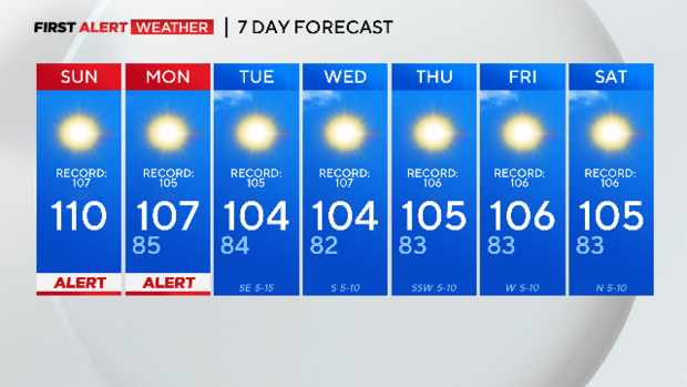
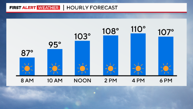
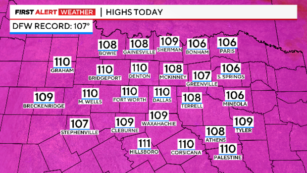
Today we are expecting to add another degree or two to our afternoon temperatures, going for 110 in DFW.
It will likely be another record-breaking day, as the current record in DFW is 107.
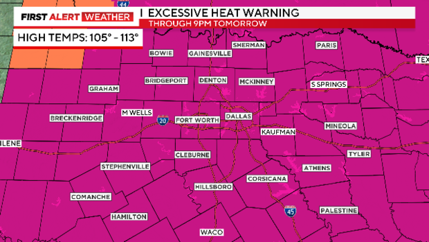
Our weather alerts and the Excessive Heat Warning continue through Monday due to the dangerous heat. Temperatures across North Texas will range from 105 to 113 over the next two days.
The reason for the dangerous heat is the ridge of high pressure controlling our weather. It is also the reason why we will remain dry through the upcoming week.
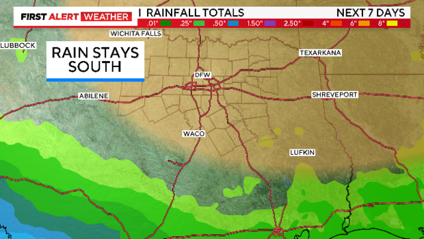
We are watching for the development of a disturbance as it moves into the warm Gulf waters this week. But the ridge of high pressure will sit over North Texas and keep any beneficial rain to the south.
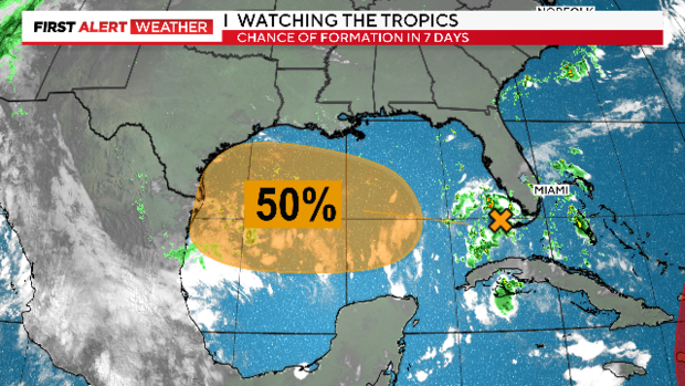
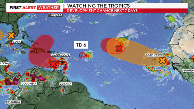
The tropics are definitely heating up in the Atlantic, as we now have Tropical Depression 6, and two other areas in red are likely to become tropical depressions this week.
Another wave coming off the coast of Africa in orange also has the potential for development over the next 7 days.
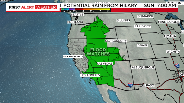
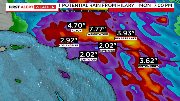
Southwestern states are already seeing rain from Hurricane Hilary, and it will continue to pick up throughout the day as the system tracks north into southern California.
Wind gusts of 50–60 mph are possible, but the bigger concern is the heavy rain and the potential for catastrophic flooding, mudslides, and debris flows.
Flood watches are in place from California all the way up to Idaho.
The elevated fire threat will continue all week in North Texas, with no rain chances in the forecast.