Drought, fire risk worsen during one of the driest summers on record

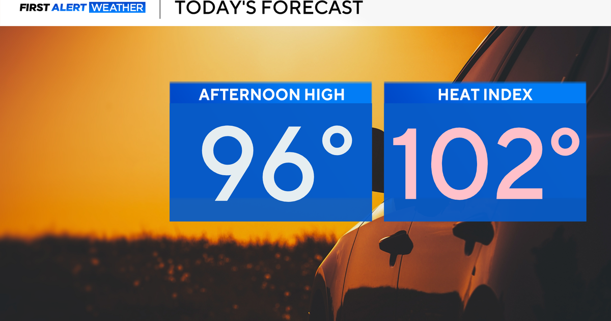
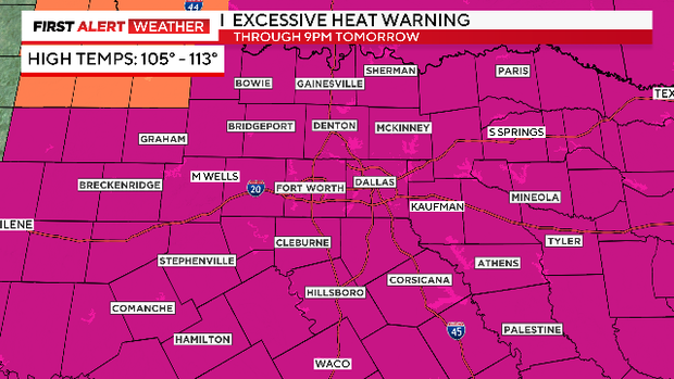
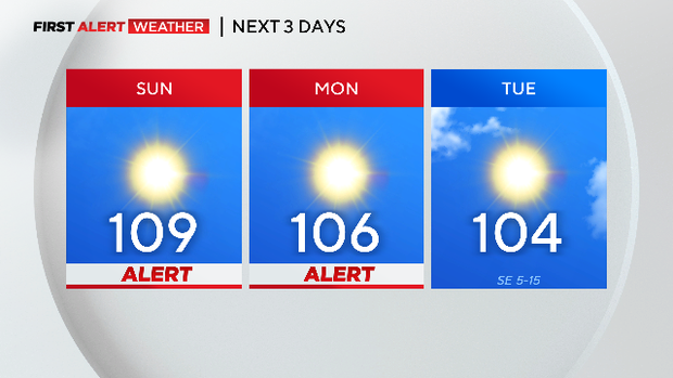
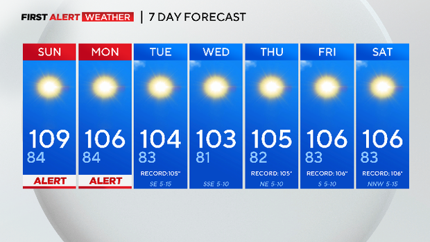
NORTH TEXAS (CBSNewsTexas.com) - There is a Weather Alert for Excessive Heat Sunday and Monday with highs over 105° and dangerous heat. The Elevated Fire Risk also continues.
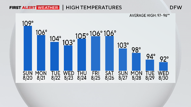
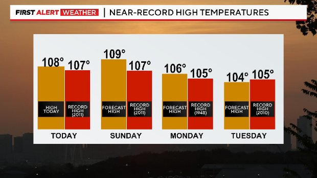
For the third time this summer, we hit a new record high Saturday.
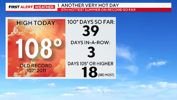
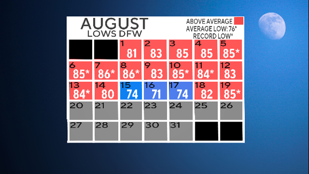
We broke another record Saturday morning as well with a low of 85°, the warmest low for the date. Nights this warm or warmer were unheard of at DFW until this century (there had been one in 1939). Since 2011 there have been 21 warm low records of 85° or 86° (DFW has never had any warmer than that). Eight of those 21 happened this month. Again, DFW just had one in all the records from 1899 to 2010.
We'll likely have another record high on Sunday and a good chance of yet another on Monday.
The Weather Alerts continue for this heat. The Excessive Heat Warning right now continues through Sunday evening.
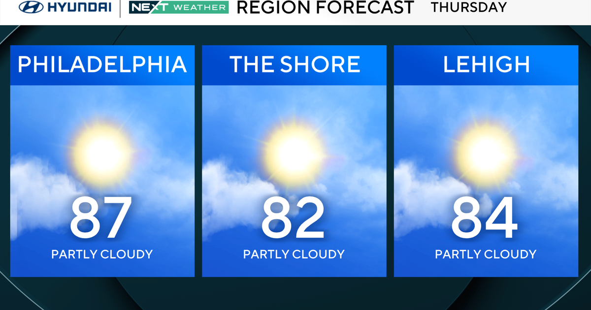
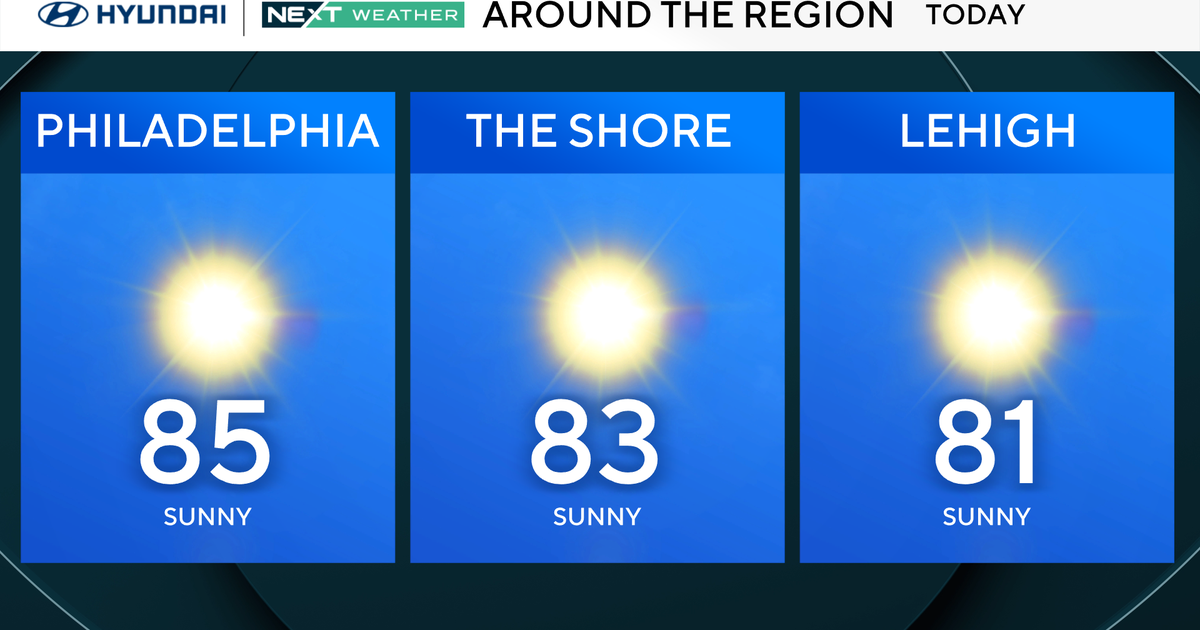
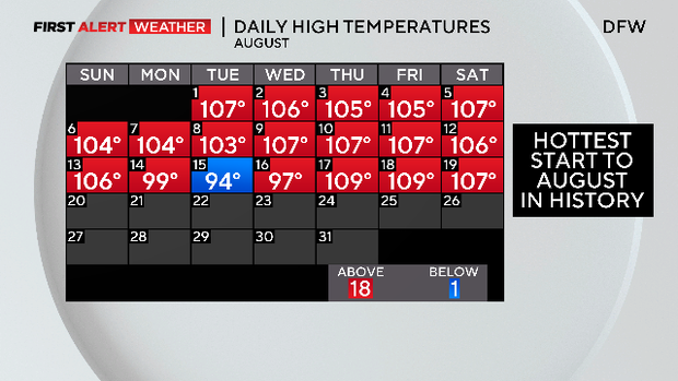
What a month it has been, the hottest August on record so far. That's saying something- August is our hottest month. We have 12 days left in Meteorological summer, right now it is the 5th hottest summer on record.
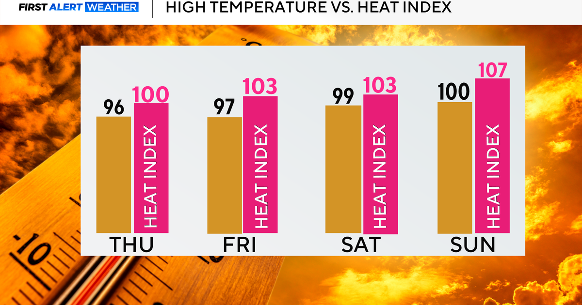
Not much difference found in the 3-day outlook.
There is a good chance that we spend the first half of the upcoming work week talking about a tropical system in the Gulf. Right now it is the Bahamas and headed into the historically warm waters of the Gulf.
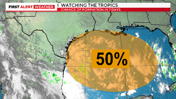
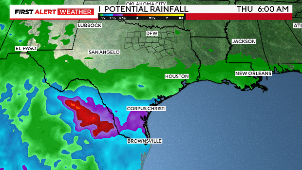
All forecast models keep the rain from this system to our south, so not much relief this week in the current drought.
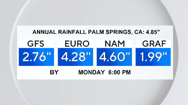
Southern California is going to get hit Sunday by (then) Tropical Storm Hilary. This will produce a record rain event and bring the risk of catastrophic flooding. The heavy rain arrives in the LA basin Sunday by mid-day.
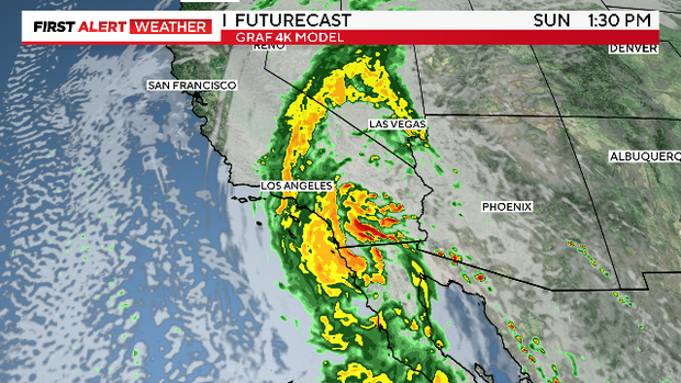
The flooding risk is over an extensive area but consider the desert valley to the east of LA. The city of Palm Springs gets under 5" of rain every year. It could get close to that amount over tomorrow and Monday.
Meanwhile, the current dry streak at DFW is now at day 34. No rain in the 7-day forecast.
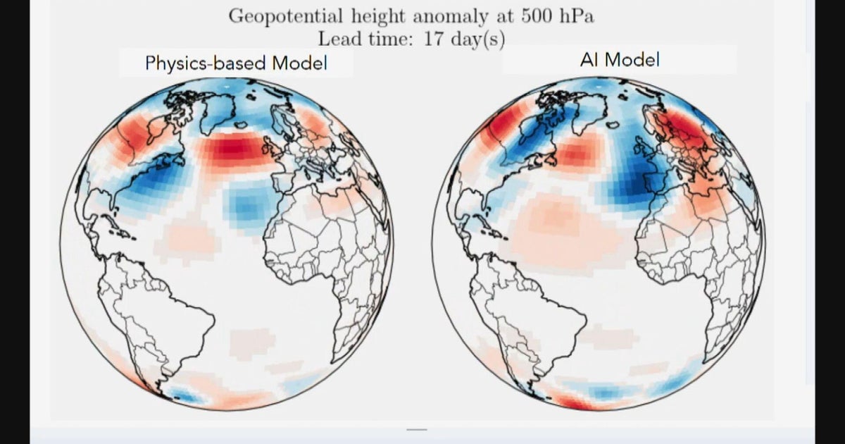
There is some agreement in the current long-range models that at the end of this month, the current heat dome of the Midwest will start weakening as it moves west of us.
The high pressure is still over us by next Friday, we are forecasting tying a record high on that day.
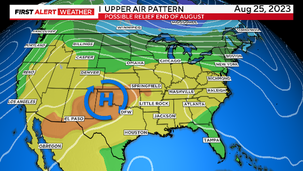
But look where the EURO puts it by the 29th, to the west and weaker.
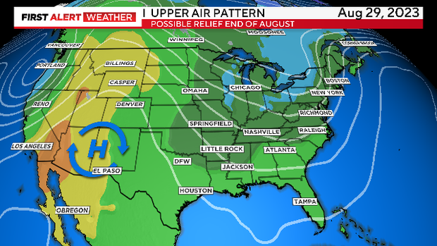
This would be the significant weather pattern shift we would hope to see to get some relief from the hot/dry weather. It is always a long shot to look this far out in the forecast. Given the current heat wave, excuse me for grasping onto a little hope.