
Below average temperatures in store for North Texas ahead of the weekend
Spotty showers can't be ruled out Thursday.
Watch CBS News
Spotty showers can't be ruled out Thursday.

A few showers are possible Thursday along with cooler weather.

Wednesday will be hot and humid across Dallas-Fort Worth despite more cloud cover on the way.

The incoming cold front will bring cooler weather and rain chances, a rare statement for mid-July.

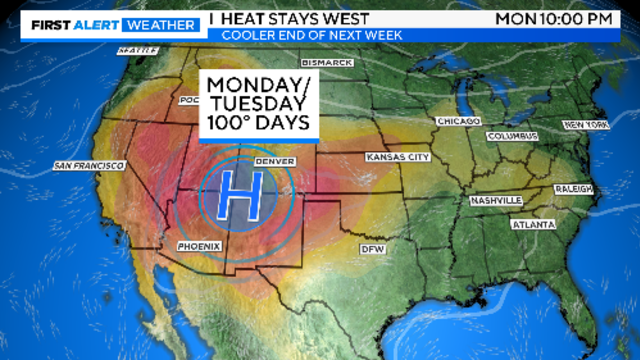
Tuesday is forecast to be the hottest day of the week, and if Dallas-Fort Worth reaches 102 degrees, it will be the hottest day of the year.

The heat advisory continues before a significant weather pattern change puts us into a stretch of mild weather.

High temperatures top out in the low 100s and could feel slightly warmer.
A heat advisory will be in place for North Texas through 8 p.m. Monday.
Humidity in the area will make it feel a few degrees warmer – around 100 degrees to 104 degrees during peak heating this afternoon.
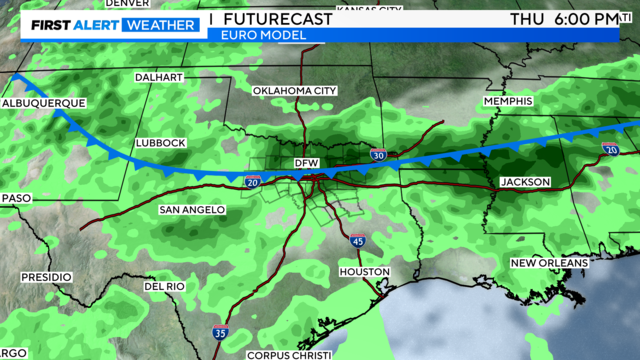
Rain chances will increase as the week continues.
Temperatures will be in the upper 90s, with slim afternoon storm chances.

Sunshine is out in full force Friday and high temperatures will climb back to the upper 90s across Dallas-Fort Worth.

It will be another hot day across North Texas with abundant sunshine and high temperatures into the upper 90s.
Another hot afternoon is forecast for Thursday, with highs topping out in the mid/upper 90s.

Plan for the summer heat to settle in – high temperatures next week will climb back into the triple digits.

Humidity will gradually increase as we get closer to the weekend, and very slim rain chances are in the forecast for the weekend, 10% or less.

Full sunshine is in the forecast with temperatures back in the 90s.

Beryl weakened to winds of 45 mph and is a Tropical Depression. It should exit Texas Monday night.

These crews have specialty training to handle swift water rescues and other types of related disaster response.

Rain is on the way for parts of Dallas-Fort Worth after Beryl made landfall around 4 a.m. this morning near Matagorda as a Category 1 hurricane.

The latest on Beryl's track and heavy rainfall through Monday, isolated storms to our northwest, and building heat to follow for the long term.
The latest high-resolution models show Beryl approaching east of the metroplex Monday morning and lasting through the early afternoon.
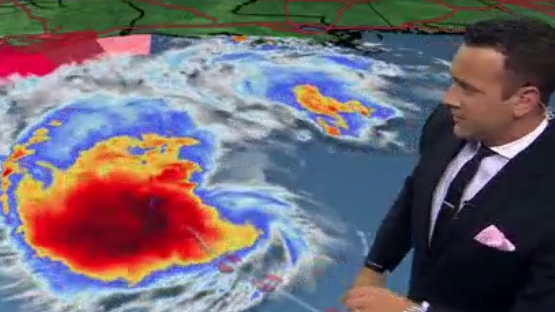
Hurricane hunters are on their way again into the storm. More information will be available soon.

The National Weather Service said record-breaking temperatures can be expected throughout the weekend.
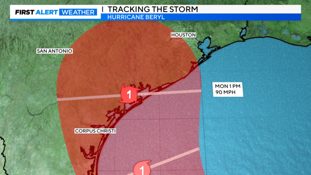
There is no heat advisory for North Texas today, but it could be possible for Sunday. The threat of Beryl hitting South Texas looms over the mid-week, bringing rain and lower temperatures to North Texas.