Cozy, cold Super Bowl Sunday ahead for North Texas
Temperatures will stay in the 40s this afternoon, making it the perfect day for indoor Super Bowl watch parties before rain and more unsettled weather move in on Monday.
Watch CBS News
Temperatures will stay in the 40s this afternoon, making it the perfect day for indoor Super Bowl watch parties before rain and more unsettled weather move in on Monday.
Indoors will be the place to be on Sunday for your Super Bowl watch party.

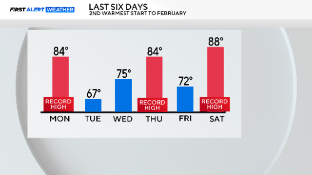
DFW is set for a rollercoaster of temperatures this weekend, with a record high of 85 degrees giving way to a cold front by Sunday.
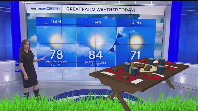
Expect warm highs in the 80s before a cold front sweeps through North Texas, plummeting temps into the 50s by Saturday evening.

A First Alert Weather Day is in place for Sunday as temperatures in North Texas are set to drop by nearly 30 degrees.

North Texas is seeing muggy conditions this morning, with a stalled front causing varied temperatures.

Thursday will be another tricky day with the temperature forecast.

Patchy fog Wednesday morning, then warm temperatures return in the afternoon through Saturday.

Expect more clouds tomorrow with highs in the upper 70s, but 80s are expected to close the week.

Near-record heat is in the forecast through mid-week, then a cold front arrives Saturday into Sunday, bringing back average temperatures.

Sunday is bringing milder temperatures in the mid to upper 70s to North Texas, with a sunny outlook for the week.
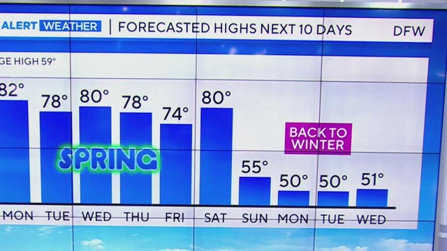
Temperatures will climb into the 70s and 80s across the Metroplex this week, bringing a taste of spring before another cold front pushes in.
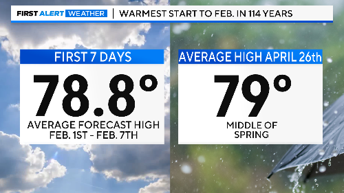
Nothing but sunshine and way-above-normal temperatures to start the new month.

With temperatures reaching nearly 80 degrees, this weekend promises perfect weather for outdoor activities.
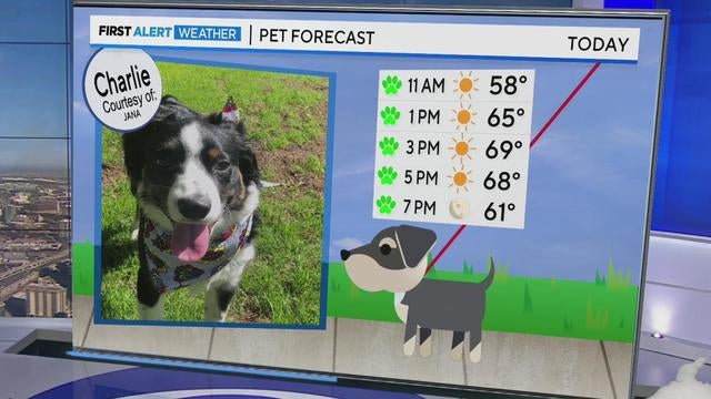
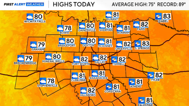
The first week of February is shaping up to be unseasonably warm in North Texas, with highs reaching into the 70s and 80s.
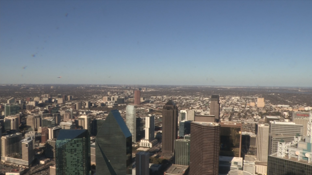
Highs continue to warm for Sunday and into the start of next week.

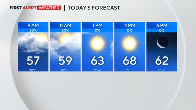
After a chilly start, North Texas will warm up significantly, reaching mid-60s this afternoon and near 70 on Saturday.
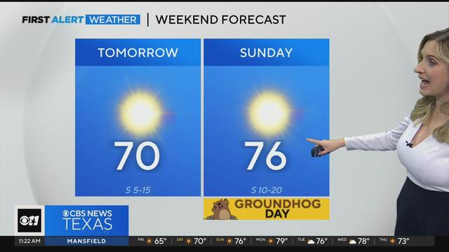
North Texas is enjoying a stretch of calm and sunny weather with current temperatures climbing into the high-70s over the weekend.

We couldn't ask for nicer weather to start the month of February.
Thunderstorms produced heavy rain across North Texas Wednesday night and into Thursday.
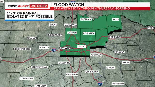
First Alert Weather Days are in effect for Wednesday and Thursday for heavy rain and possible flooding.

First Alert Weather Days were issued for Wednesday and Thursday due to widespread rain on the way and some stronger storms.

First Alert Weather days have been issued as North Texas' first soaking rains of 2025 arrive Tuesday night, ramping up through Wednesday and Thursday.
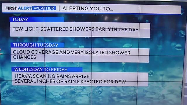
With Sunday's highs in the upper 40s and low 50s, North Texas will see its first major soaking of the year later this week, bringing heavy rain and possible flooding from Wednesday to Friday.

A mild start to the weekend with southerly winds will give way to cooler temperatures and scattered showers Sunday.