Second-warmest Christmas on record attracts big crowds to Klyde Warren Park in Dallas
The weather may not have been perfect for everyone, but Mother Nature still knew how to put a bow on this Christmas Day.
Watch CBS News
The weather may not have been perfect for everyone, but Mother Nature still knew how to put a bow on this Christmas Day.

Christmas Day will likely be the second-warmest Christmas on record, with highs in the lower 80s, and a new record is likely for Friday.

A ridge of high pressure is dominating in the upper levels of the atmosphere, resulting in above-average highs.

Maybe grab a light jacket as you head out the door Monday morning, but you won't need it by the afternoon.
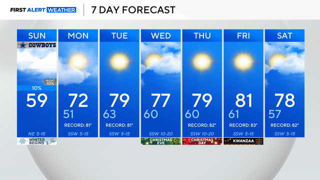
Sunday is the shortest day and longest night of the year.
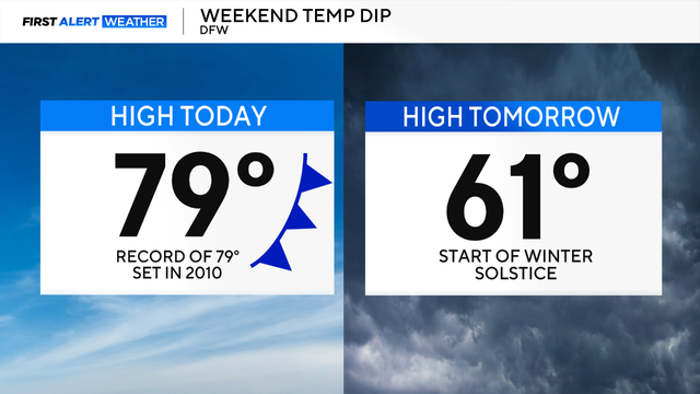
Highs are expected to flirt near 80 degrees across North Texas Saturday, which will potentially break the record for the daily high temperatures on this date.
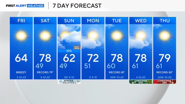
Jackets will be needed to start the day but by this afternoon, it will warm into the mid-60s with breezy winds.

Thursday morning in North Texas is mild and humid ahead of a cold front that will move through, increasing winds.
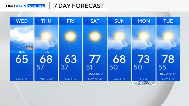
Expect plenty of clouds throughout the day today with highs rising up into the mid-60s.
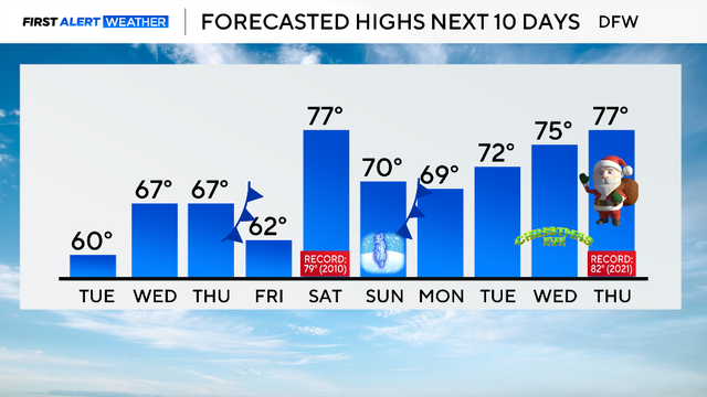
North Texas temperatures Tuesday morning are above freezing with the help of cloud cover and southerly winds.

Temperatures stay cool and below average into Monday afternoon with highs in the lower 50s.

Coats, gloves and hats are needed if you head out to support your family or friends in the BMW Dallas Marathon on Sunday morning.

By Saturday night, a strong cold front will pass through, dropping temperatures and increasing wind speeds.
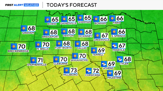
Highs Saturday will be in the mid-60s, but drop to the mid-40s on Sunday.
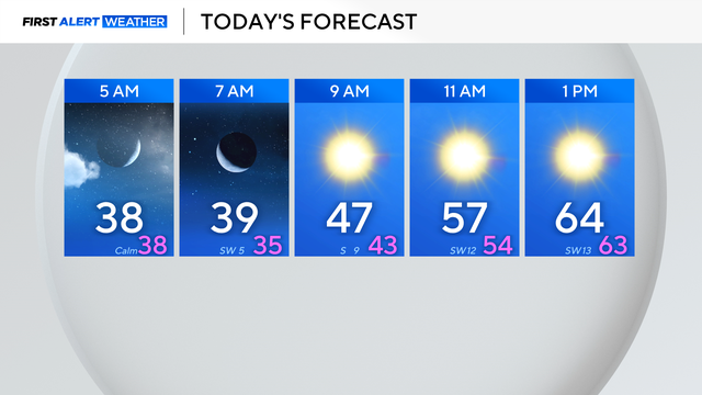
Winter weather in North Texas stays on the warmer side for a few more days until a strong cold front brings a winter punch on Sunday.
Wednesday in North Texas is starting out more mild compared to yesterday morning as most wake up to temperatures in the 40s.
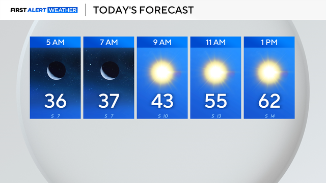
Tuesday morning started off chilly in North Texas with temperatures in the 30s.
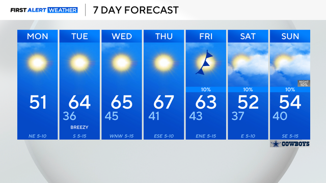
Monday's temperatures will reach the low to mid-50s, a few degrees below the average high of 59 degrees.
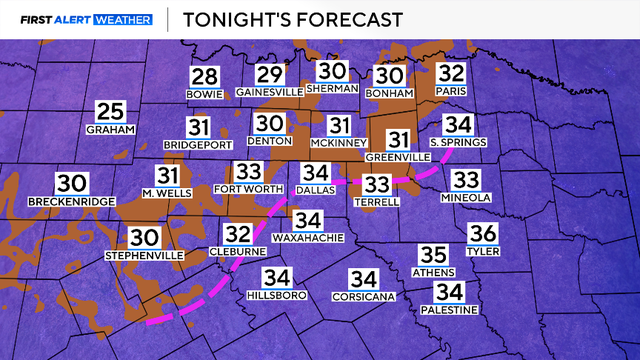
A cold front is moving across the area Sunday morning, bringing a cool and gusty northerly wind.

Winter storms are forecast to bring heavy snows and bitter winds across the regions.
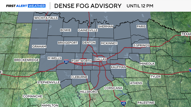
The fog will begin to lift once the sun rises and mixing occurs in the atmosphere.
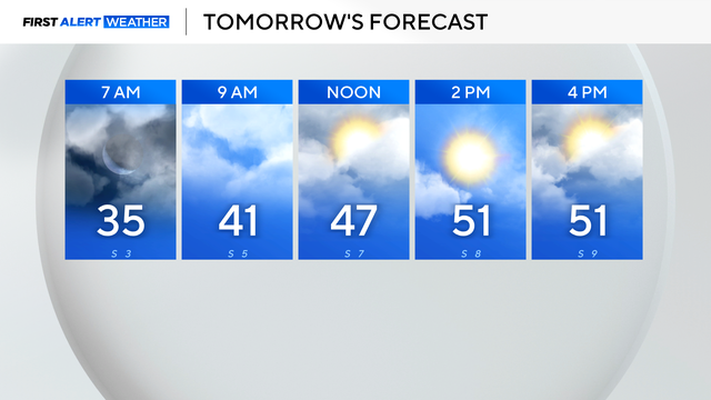
Expect clouds to gradually break as we get through the day on Friday, with highs warming to the lower 50s in the metroplex by afternoon.

Hit-or-miss showers, along with drizzle at times, are in the forecast for North Texas on Thursday.

It was another cold start to the day, Wednesday and with breezy winds, "feels-like" temperatures early were in the 30s.
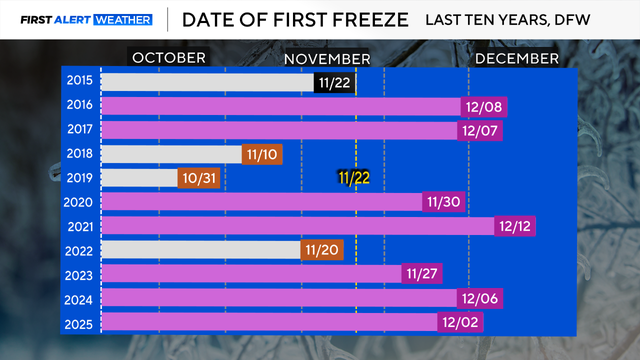
North Texas had the first freeze of the season this morning, making it the coldest start since February.