Rounds of rain, isolated severe storms expected throughout Valentine's Day for North Texas

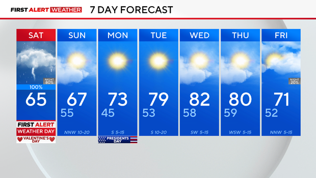
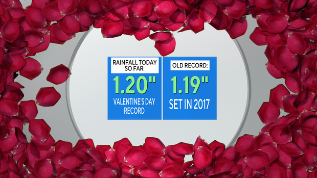
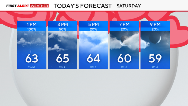
It's officially the wettest Valentine's Day on record for DFW. The day will remain cloudy with breezy winds around 20 mph as rounds of rain continue to move through. Temperatures will stay around the mid-60s.
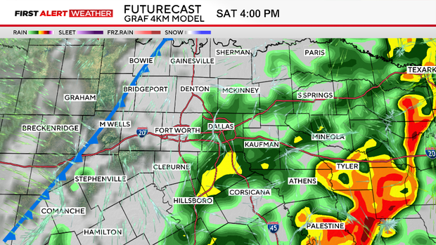
A First Alert Weather Day is in effect for disruptive rain and the chance of some isolated severe storms. The Storm Prediction Center has issued a marginal risk, level 1 out of 5, for the threat of severe weather. A few storms may reach severe criteria, meaning winds of 60 mph or stronger, and small hail will be a possibility, not a guarantee.
Regardless, lightning is dangerous. Remember, when thunder roars, head indoors.
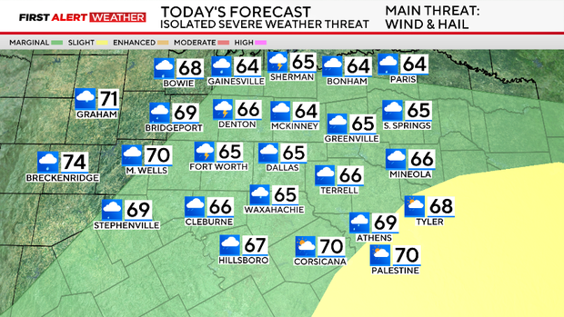
The timing of the storms will depend on the location. Those to the west of the Dallas-Fort Worth Metroplex will see more activity in the morning. DFW has the highest chance of rain and storms until 5 p.m.
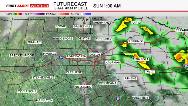
East of DFW has the potential for activity as late as 9 p.m. As of now, reinitiation of storms is looking likely later Saturday night as moisture gets wrapped around a low-pressure system. Storms will be possible late Saturday to the east of I-35.
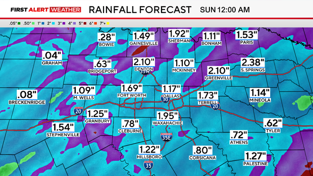
The cold front will bring a decent amount of rainfall to North Texas. Anywhere from 0.5 to 2 inches of rain is expected.
Heavy rain dumping quickly could lead to some isolated instances of flooding. East of the DFW, there is a scattered potential of flooding. In fact, the Weather Prediction Center has issued an excessive rainfall outlook to indicate the higher flooding potential.
After the front moves through, clearing will take place. A gorgeous rest of Valentine's and Presidents Day weekend is on tap.
As for the rest of the week, a few clouds build, and temperatures will rebound into the 80s once again. The next chance of rain isn't until next weekend.