PG&E prepares for upcoming winter storm
PG&E is stockpiling power equipment at its yards around Northern California in advance of a cold front that is expected to bring rain and wind to the region late Wednesday and into Thursday.
Watch CBS News
PG&E is stockpiling power equipment at its yards around Northern California in advance of a cold front that is expected to bring rain and wind to the region late Wednesday and into Thursday.

The National Weather Service advises the public to expect an increased risk of sneaker waves and rip currents from 10 a.m. Thursday to 1 a.m. Friday for beaches that face west and northwest.
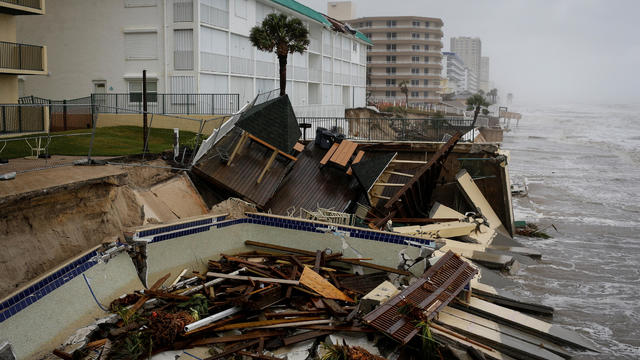
Two people died after being electrocuted by a downed power line at an intersection, a sheriff's office said.

Above-normal temperature reaching into the triple digits are expected over the next several days across the country.

The NWS has updated and clarified more detailed "zones" for this year's fire season. In years past, Red Flag warnings were issued generically for all "North Bay Mountains" as one region. KPIX 5's First Alert Meteorologist Darren Peck on this week's "Weather Extra."

Rip currents and sneaker waves will increase danger along the coastline Thursday.

A new cold front coming to California motivated weather services to issue storm warnings Wednesday, with significant rain forecast along with the possibility of cloud-to-ground lightning and hail.

Meteorologists predicted on Monday that more late-season snow and rain was coming to California.

An approaching cold front came to the Bay Area early Monday morning along with the first drops of rain, starting in the North Bay and moving southward and inland.

The National Weather Service issued a beach hazard statement for the Bay Area and Northern California coast Wednesday because of an incoming northwest swell.

Two children were injured when high winds knocked over a tree in a San Jose park Tuesday afternoon, the fire department said.

Tide-poolers and beachgoers should keep an eye out for King Tides, the highest tides of the year, which are expected to cause minor flooding in some low-lying areas through Monday, according to the National Weather Service.

Cold coastal flooding could occur throughout the Bay Area on Saturday through Monday as the region's highest tides of the year will hit the coastline, according to the National Weather Service.

The National Weather Service issued a fog advisory for several parts of the region until noon Sunday.

The California coast, including parts of the Bay Area, will experience unusually high tides and possible minor flooding in some areas through Sunday morning, the National Weather Service said Friday.

Rain came once again to Northern California Thursday, and more was possible into the weekend, but chances of another atmospheric river event coming next week were dwindling, the National Weather Service said.

More rain is expected to come to the Bay Area next week, but Halloween on Sunday should stay dry and the weather system will not be as disruptive as the "atmospheric river" that hit the region last weekend, according to the National Weather Service.
A powerful weather event that combined a "bomb cyclone" and an "atmospheric river" swept through California earlier this week set rainfall records doused wildfires, yet its impact on the state's drought conditions was yet to be seen Wednesday.

The National Weather Service has expanded its Fire Weather Watch for parts of the North Bay and East Bay to go into effect Sunday night because of dry and windy weather expected in the region.

The National Weather Service issued a Fire Weather Watch for most of the Bay Area ahead of dry and windy weather forecast in the next few days.
The Bay Area office of the National Weather Service has issued a fire weather watch for parts of the North and East Bay starting early Thursday evening.
The National Weather Service is warning motorists to be careful driving on Bay Area roads Sunday morning due to dense fog in some areas.

The National Weather Service is closely monitoring current monsoon conditions over the Southwest that are expected to drift north into California's Central Coast and the Bay Area early next week and could lead to a slight chance of dangerous dry lightning storms.

Thunderstorms with chances of dry lightning might make their way to the Bay Area on Sunday and Monday, according to the National Weather Service.

While the National Weather Service stopped short of issuing a heat advisory this week, there's concern the Bay Area may see another heatwave this weekend.