Tornado warning issued for parts of Armstrong, Clarion counties
Scattered storms with brief downpours are likely to lead to some flash flooding and flooding today in the western Pennsylvania area.
Watch CBS News
Scattered storms with brief downpours are likely to lead to some flash flooding and flooding today in the western Pennsylvania area.

KDKA First Alert Meteorologist Ron Smiley stopped by to talk about this weekend's storms that brought flooding to parts of Washington County and West Virginia leaving behind a trail of damage.
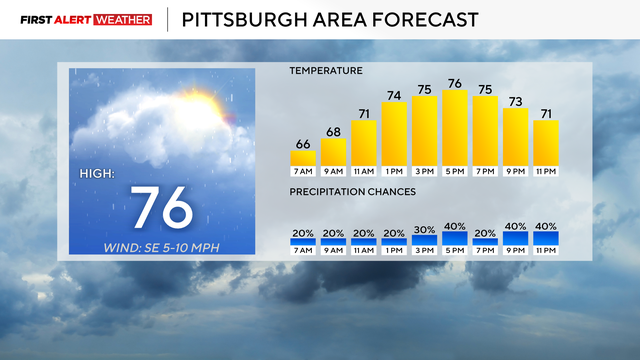
Plenty of rain is expected this week for the Pittsburgh area.

More rain will be scattered throughout the region to close out the weekend.

Have you ever run your finger around the edge of the glass to make a sound? It's energy and science!
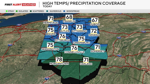
More rain is on the way this weekend, and flooding remains a concern for some.
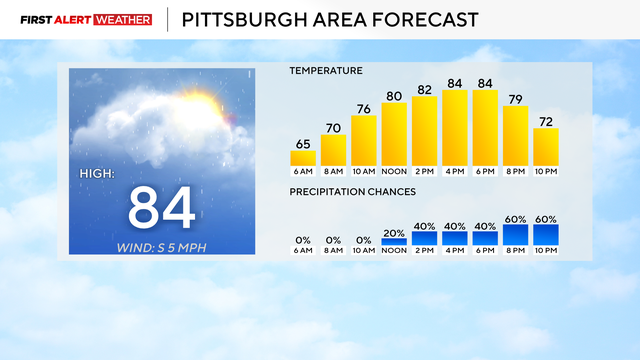
Rain chances are back in Western Pennsylvania, and overnight flooding is the main concern.
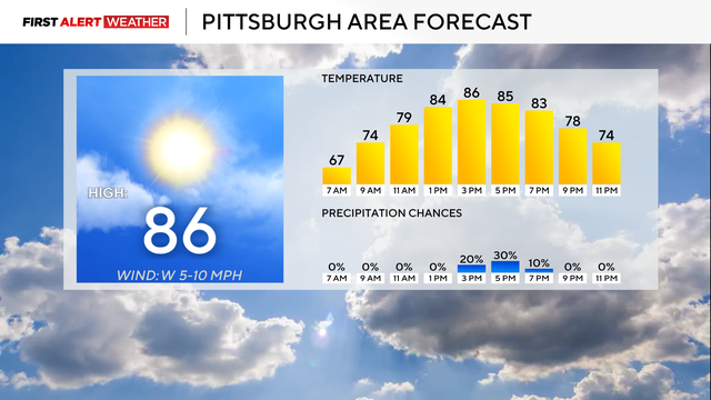
As we go through the day on Thursday, a combination of factors could lessen the air quality.
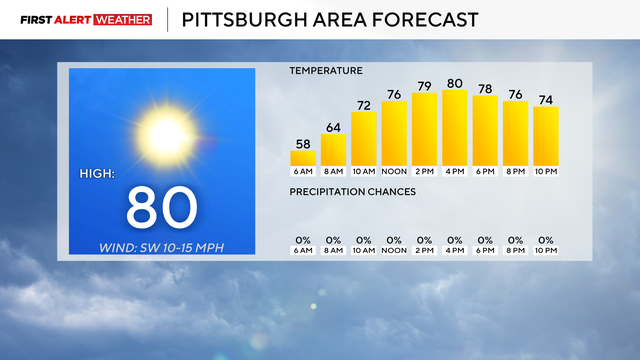
Temperatures today won't be too hot nor will they be too cold, they'll be just right.

Storm crews will be out Tuesday morning surveying what could be the area's 11th tornado of the year so far in Clarion Township.
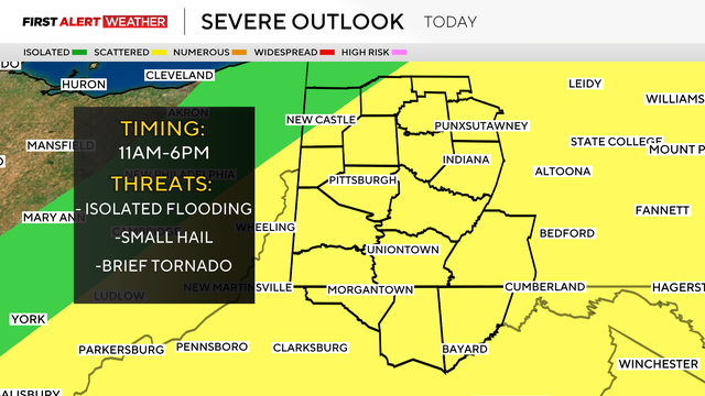
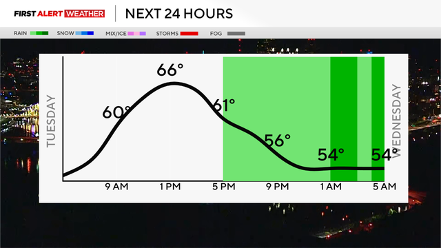
Another round of stormy weather is moving into the Pittsburgh area late Monday afternoon.
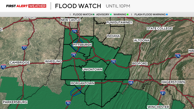
Sunday's bout of severe weather prompted tornado warnings across parts of Allegheny, Washington and Westmoreland counties.
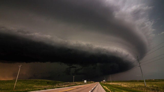
Some cloud formations can look scary, and they can be a sign of a storm. Here's how they form and what they are.
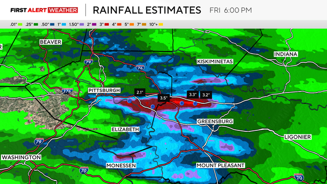
After an afternoon of heavy rains and flash flooding, more heavy rain will continue into the weekend.

Friday starts off foggy, and the humidity and storms move in this afternoon.
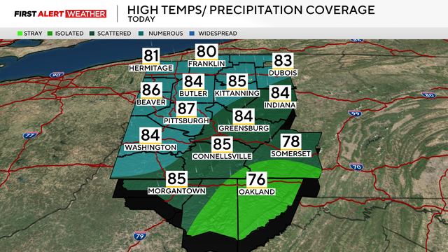
Thursday starts off warm and smoky, and we could see evening storms.
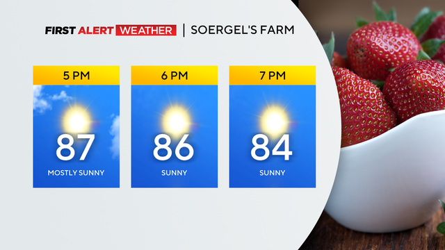
Wednesday is the last day for more than a week that we'll see completely dry weather.
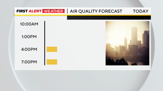
Overall, the most noticeable impact from the smoke is expected to be gorgeous sunrises and sunsets.
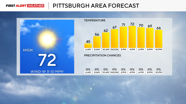
Warmer weather is set to arrive Monday, putting an end to one of the coolest end-of-May stretches Pittsburgh has seen.
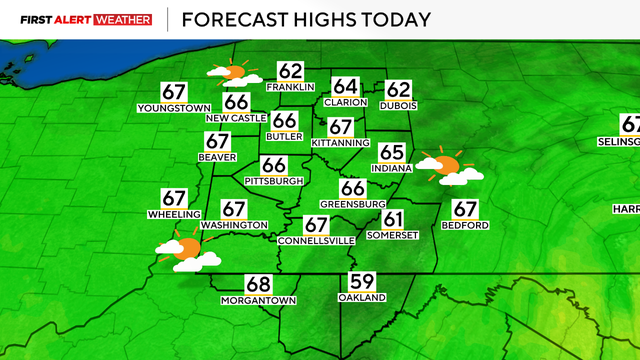
The temperatures will rise this week, but wildfire smoke could impact those temperatures.
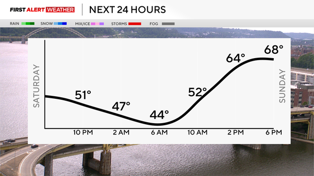
Temperatures Saturday night will dip 10-15 degrees cooler than normal.
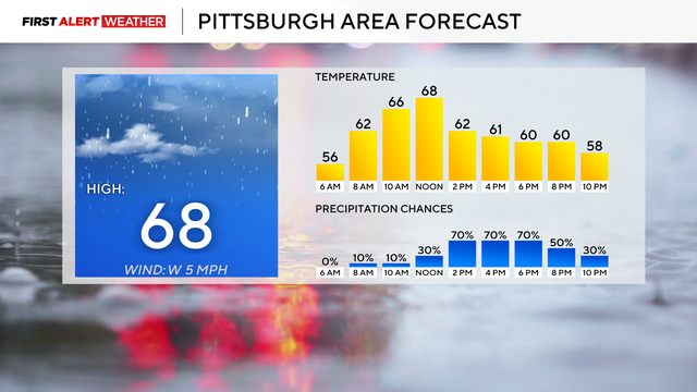
As the weekend approaches, we'll continue seeing cooler temperatures and rain chances.
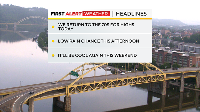
While today will be another day with temperatures below average, it will still be a warmer day.
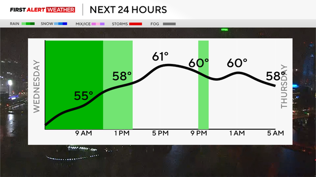
There will be widespread rain with some heavy downpours at time lingering through the morning.
High temperatures today are expected to be below normal in the low 60s.