Next Weather Alert: Flash flood threat up north with potential for heavy rain overnight
MINNEAPOLIS – It's a Next Weather Alert day, as the northern half of Minnesota is under a slight flash flood threat following heavy rain overnight and the possibility for more heavy rain going into Saturday.
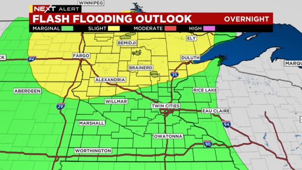
WCCO meteorologist Mike Augustyniak says that a slight threat in the flash flooding outlook indicates at least a 15% chance for flash flooding to develop. That area encompasses Alexandria, Moorhead, Brainerd, Duluth, Bemidji and Ely.
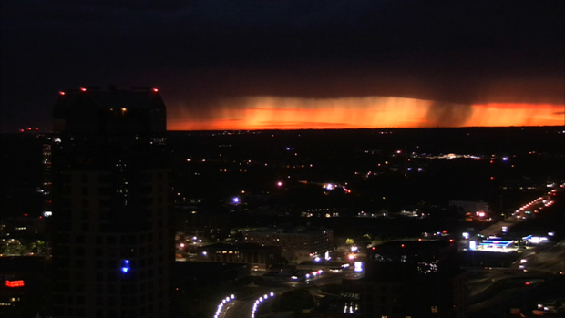
Severe thunderstorms over parts of Minnesota diminished Friday morning, but another round is expected to push in Friday night into Saturday.
It stays hot Friday, with a high of 90 degrees, and it will also be humid. The storm threat comes after midnight from west to east. Hail and wind are the main concerns once again.
Earlier Thursday evening, residents near Brainerd posted images to social media, showing hailstones the size of ping-pong balls. Traffic cameras in the city also captured heavy rainfall.
It gets notably cooler and less humid as the weekend progresses. Saturday's high will be 80, and Sunday's 75. Temperatures will be running slightly below average for a few days.


