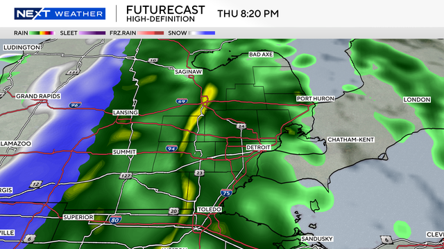
Friday morning could see icy roads following Thursday's rain
You may have heard talk about a flash freeze possible on Friday morning. But what does that mean?
Watch CBS News
You may have heard talk about a flash freeze possible on Friday morning. But what does that mean?
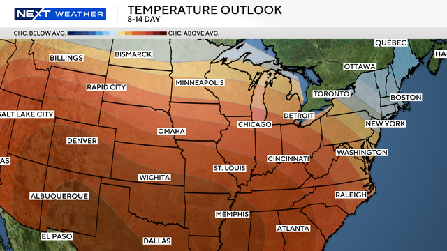
While we've been in a deep freeze throughout December, a warmup is finally headed our way.
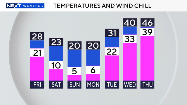
Temperatures in Southeast Michigan have been well below normal since Nov. 27.
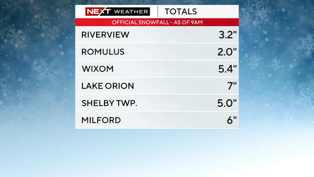
Rain and snow will eventually end, but wind and cold will still impact travel.
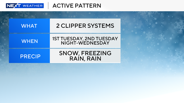
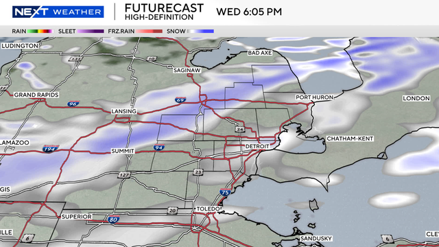
This week is an active one for Southeast Michigan weather with multiple rounds of snow and even rain on the way.
Bitterly cold wind chills will get even colder as morning lows over the next seven days will feel like the single digits.
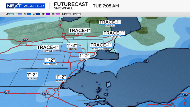
Dry conditions will continue on Monday, but snow showers will begin to move into Southeast Michigan around 7 p.m. Monday.

This week brings quite a few changes to the forecast right as everyone hits the road for Thanksgiving.

Rain, snow, and a wintry mix are in Tuesday's forecast for southeast Michigan.
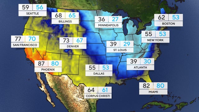
A harsh drop in temperatures is being delivered to the eastern two thirds of the U.S. thanks to a polar vortex dipping down from the Arctic.

It's the biggest question our weather gets asked these days: What will our winter be like?
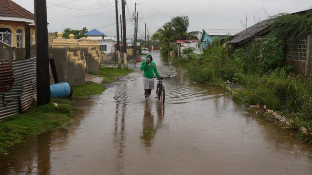
Hurricane Melissa strengthened into a Category 5 storm on Monday, unleashing torrential rain and threatening to bring catastrophic flooding to the northern Caribbean.
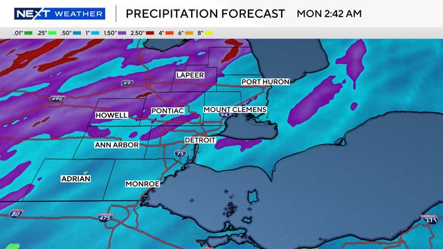
Heat, storms and wind are expected in Southeast Michigan this weekend.
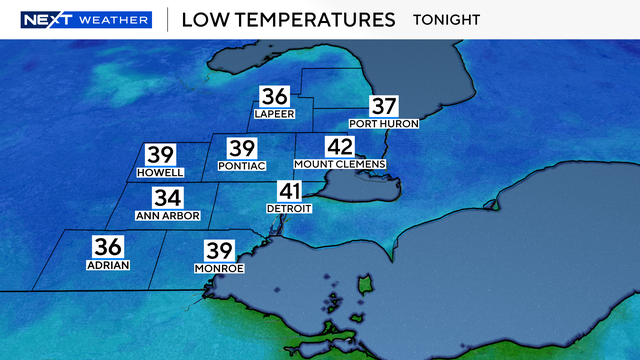
Wayne and Monroe counties are not included in the advisory; however, some areas will see low temperatures in the upper 30s.
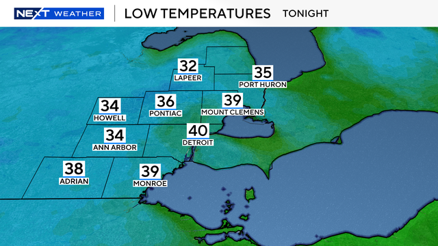
Temperatures are expected to drop into the 30s overnight Wednesday into Thursday morning.

Heavy rainfall that moved through Southeast Michigan Thursday triggered flood watches and alerts in Metro Detroit.

Maps show the best weeks in 2025 for leaf peeping across the U.S., with peak colors arriving as early as late September in some states.
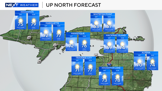
There will be plenty of sun and mild temperatures for cities in Northern Michigan for the Labor Day weekend.
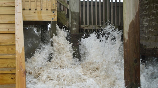
Hurricane Erin battered North Carolina's Outer Banks with strong winds and waves that flooded part of the main highway and surged under beachfront homes before slowly moving away.
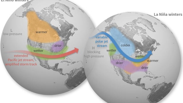
Southeast Michigan is entering a La Niña watch, which means La Niña looks possible going into the winter months.
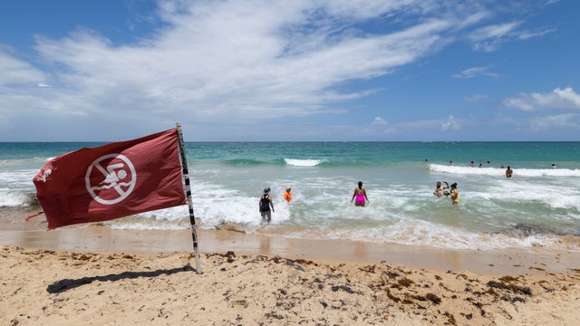
Hurricane Erin underwent rapid intensification to become a Category 5 storm in just hours. It has since weakened to a Category 4 status.
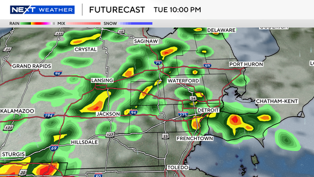
Some strong storms are possible for the afternoon and evening drive in Southeast Michigan.

An air quality advisory is in effect for the entire state through Tuesday, according to the Michigan Department of Environment, Great Lakes and Energy.
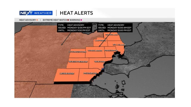
Heat advisories have been issued for all of Southeast Michigan for much of the day Monday.
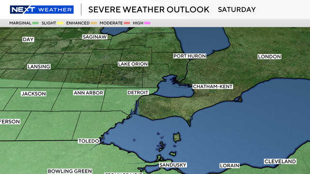
Storms move through on Saturday, bringing another threat of severe weather to Southeast Michigan.